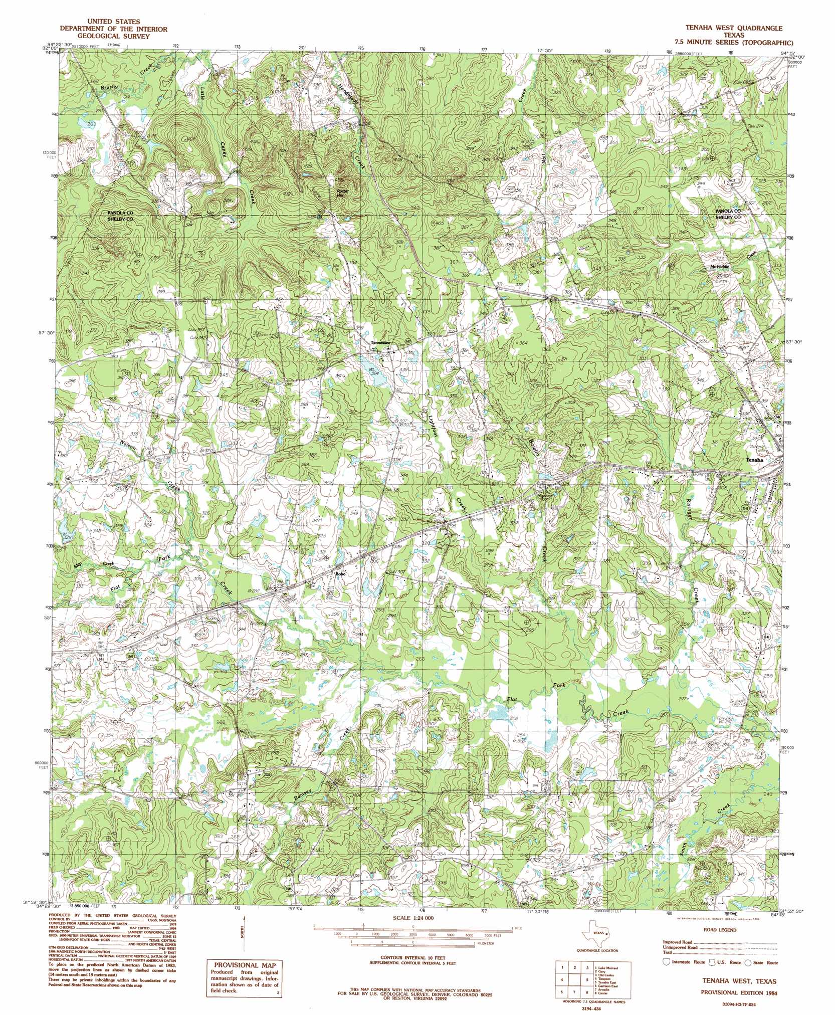
Tenaha West Topo Map Texas
To zoom in, hover over the map of Tenaha West
USGS Topo Quad 31094h3 - 1:24,000 scale
| Topo Map Name: | Tenaha West |
| USGS Topo Quad ID: | 31094h3 |
| Print Size: | ca. 21 1/4" wide x 27" high |
| Southeast Coordinates: | 31.875° N latitude / 94.25° W longitude |
| Map Center Coordinates: | 31.9375° N latitude / 94.3125° W longitude |
| U.S. State: | TX |
| Filename: | o31094h3.jpg |
| Download Map JPG Image: | Tenaha West topo map 1:24,000 scale |
| Map Type: | Topographic |
| Topo Series: | 7.5´ |
| Map Scale: | 1:24,000 |
| Source of Map Images: | United States Geological Survey (USGS) |
| Alternate Map Versions: |
Tenaha West TX 1984, updated 1985 Download PDF Buy paper map Tenaha West TX 2010 Download PDF Buy paper map Tenaha West TX 2013 Download PDF Buy paper map Tenaha West TX 2016 Download PDF Buy paper map |
1:24,000 Topo Quads surrounding Tenaha West
Fair Play |
Beckville |
Carthage |
River Hill |
Old Panola |
Long Branch |
Lake Murvaul |
Gary |
Old Center |
Galloway |
Caledonia |
Timpson |
Tenaha West |
Tenaha East |
Logansport West |
Garrison West |
Garrison East |
Arcadia |
Center |
Shelbyville |
Appleby |
Martinsville |
Mount Herman |
Neuville |
Hurstown |
> Back to 31094e1 at 1:100,000 scale
> Back to 31094a1 at 1:250,000 scale
> Back to U.S. Topo Maps home
Tenaha West topo map: Gazetteer
Tenaha West: Dams
Neel Lake Dam elevation 103m 337′Tenaha West: Populated Places
Bobo elevation 94m 308′Meldrum elevation 88m 288′
Saxet elevation 112m 367′
Tennessee elevation 110m 360′
Tenaha West: Reservoirs
Neel Lake elevation 103m 337′Tenaha West: Streams
Bowlin Creek elevation 75m 246′Lightfoot Creek elevation 82m 269′
Little Caney Creek elevation 74m 242′
Ramsey Creek elevation 81m 265′
Risinger Creek elevation 75m 246′
Smith Creek elevation 81m 265′
Tenaha West: Summits
Porter Hill elevation 144m 472′Tenaha West digital topo map on disk
Buy this Tenaha West topo map showing relief, roads, GPS coordinates and other geographical features, as a high-resolution digital map file on DVD: