Timpson Topo Map Texas
To zoom in, hover over the map of Timpson
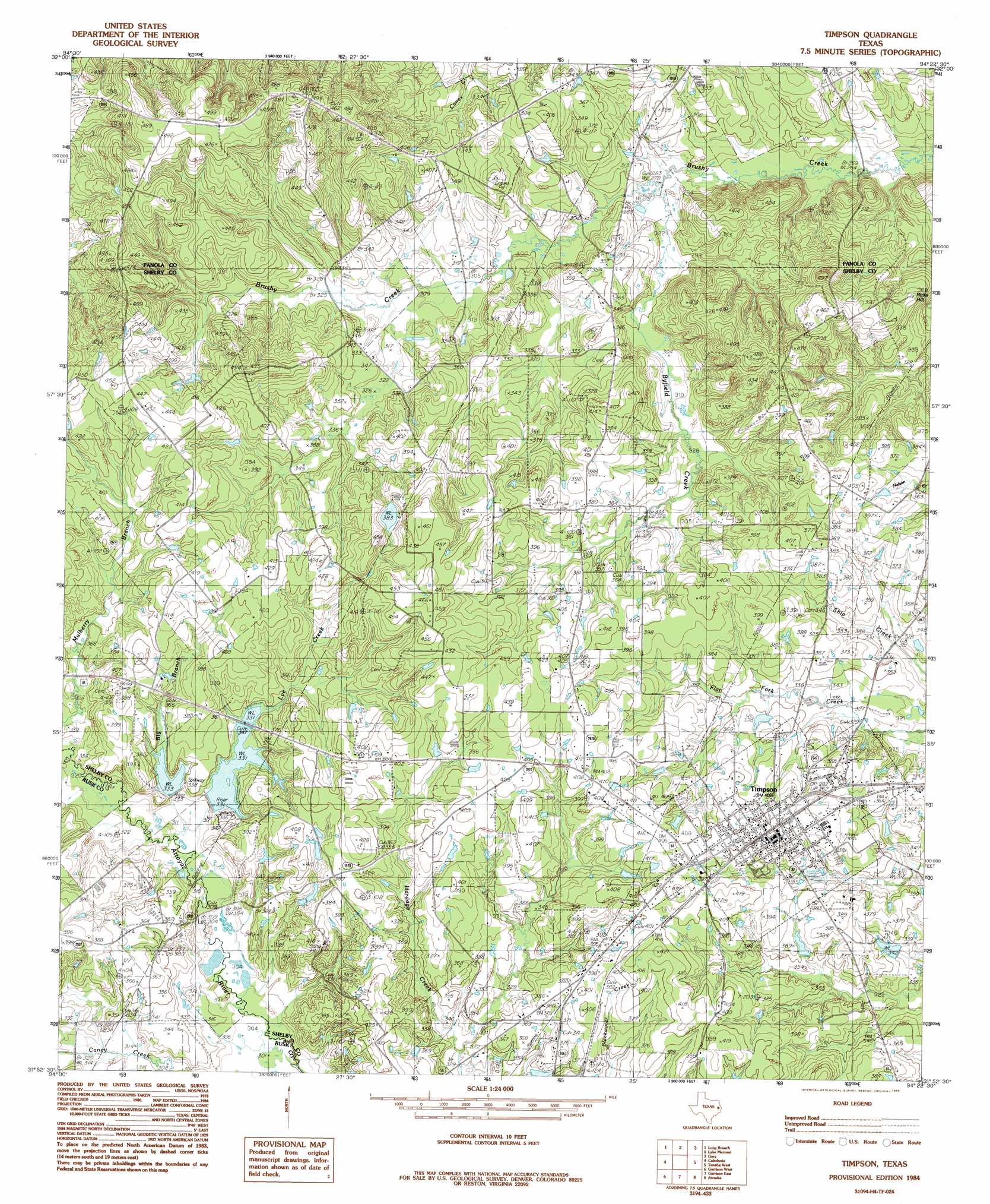
USGS Topo Quad 31094h4 - 1:24,000 scale
| Topo Map Name: | Timpson |
| USGS Topo Quad ID: | 31094h4 |
| Print Size: | ca. 21 1/4" wide x 27" high |
| Southeast Coordinates: | 31.875° N latitude / 94.375° W longitude |
| Map Center Coordinates: | 31.9375° N latitude / 94.4375° W longitude |
| U.S. State: | TX |
| Filename: | o31094h4.jpg |
| Download Map JPG Image: | Timpson topo map 1:24,000 scale |
| Map Type: | Topographic |
| Topo Series: | 7.5´ |
| Map Scale: | 1:24,000 |
| Source of Map Images: | United States Geological Survey (USGS) |
| Alternate Map Versions: |
Timpson TX 1984, updated 1985 Download PDF Buy paper map Timpson TX 2010 Download PDF Buy paper map Timpson TX 2013 Download PDF Buy paper map Timpson TX 2016 Download PDF Buy paper map |
1:24,000 Topo Quads surrounding Timpson
Church Hill |
Fair Play |
Beckville |
Carthage |
River Hill |
Minden |
Long Branch |
Lake Murvaul |
Gary |
Old Center |
Mount Enterprise |
Caledonia |
Timpson |
Tenaha West |
Tenaha East |
Trawick |
Garrison West |
Garrison East |
Arcadia |
Center |
Nacogdoches North |
Appleby |
Martinsville |
Mount Herman |
Neuville |
> Back to 31094e1 at 1:100,000 scale
> Back to 31094a1 at 1:250,000 scale
> Back to U.S. Topo Maps home
Timpson topo map: Gazetteer
Timpson: Dams
Hudman Lake Dam elevation 117m 383′Julian Lake Dam elevation 104m 341′
Soil Conservation Service Site 7 Dam elevation 102m 334′
Soil Conservation Service Site 8 Dam elevation 101m 331′
Timpson: Populated Places
Timpson elevation 119m 390′Timpson: Reservoirs
Hudman Lake elevation 117m 383′Julian Lake elevation 104m 341′
Soil Conservation Service Site 7 Reservoir elevation 102m 334′
Soil Conservation Service Site 8 Reservoir elevation 101m 331′
Timpson: Streams
Big Branch elevation 96m 314′Byfield Creek elevation 86m 282′
Lye Creek elevation 95m 311′
Timpson digital topo map on disk
Buy this Timpson topo map showing relief, roads, GPS coordinates and other geographical features, as a high-resolution digital map file on DVD: