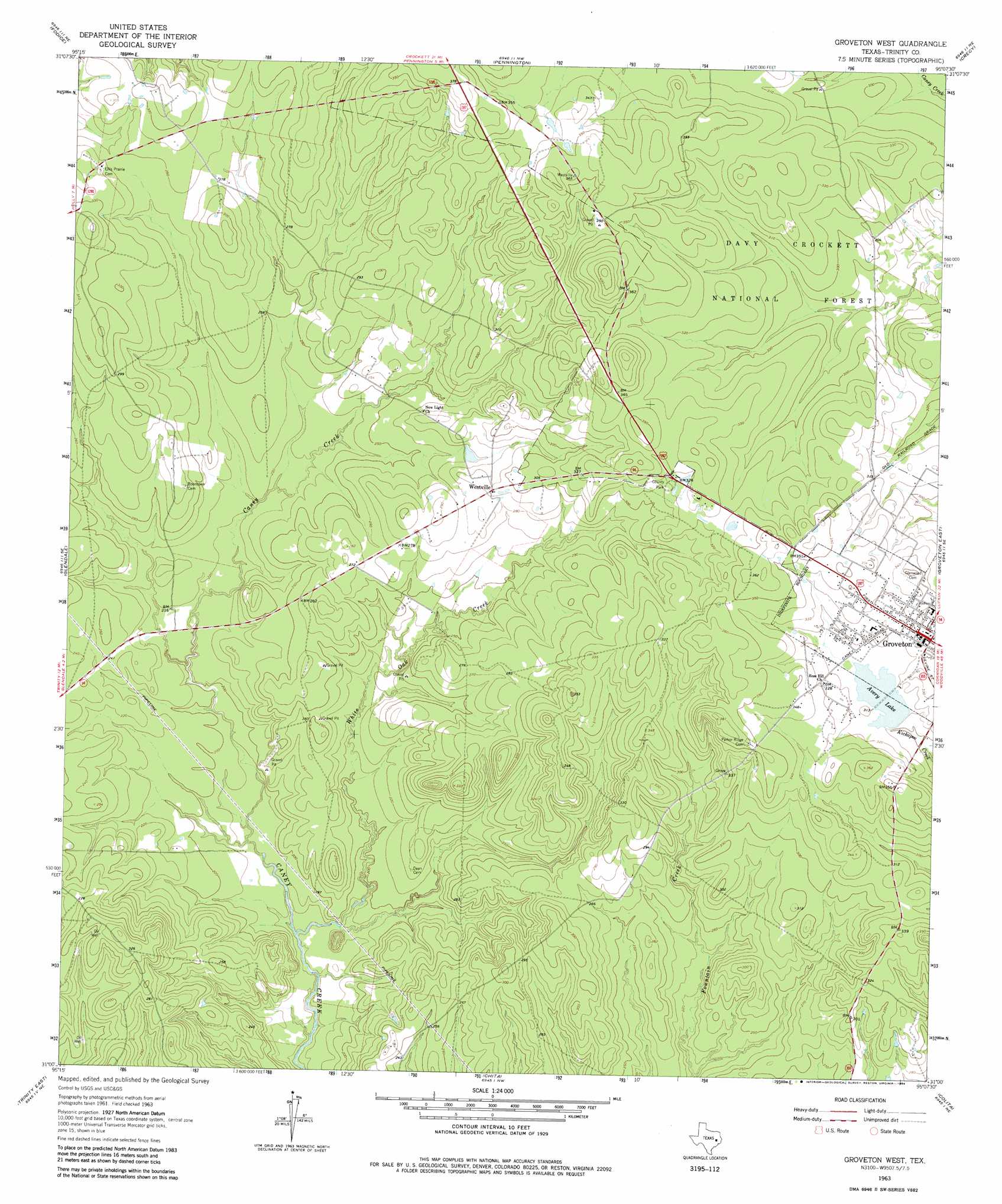
Groveton West Topo Map Texas
To zoom in, hover over the map of Groveton West
USGS Topo Quad 31095a2 - 1:24,000 scale
| Topo Map Name: | Groveton West |
| USGS Topo Quad ID: | 31095a2 |
| Print Size: | ca. 21 1/4" wide x 27" high |
| Southeast Coordinates: | 31° N latitude / 95.125° W longitude |
| Map Center Coordinates: | 31.0625° N latitude / 95.1875° W longitude |
| U.S. State: | TX |
| Filename: | o31095a2.jpg |
| Download Map JPG Image: | Groveton West topo map 1:24,000 scale |
| Map Type: | Topographic |
| Topo Series: | 7.5´ |
| Map Scale: | 1:24,000 |
| Source of Map Images: | United States Geological Survey (USGS) |
| Alternate Map Versions: |
Groveton West TX 1963, updated 1964 Download PDF Buy paper map Groveton West TX 1963, updated 1984 Download PDF Buy paper map Groveton West TX 2004, updated 2006 Download PDF Buy paper map Groveton West TX 2010 Download PDF Buy paper map Groveton West TX 2013 Download PDF Buy paper map Groveton West TX 2016 Download PDF Buy paper map |
| FStopo: | US Forest Service topo Groveton West is available: Download FStopo PDF Download FStopo TIF |
1:24,000 Topo Quads surrounding Groveton West
Crockett |
Berea |
Kennard |
Centralia |
Wells Sw |
Lovelady North |
Fodice |
Pennington |
Crecy |
Apple Springs |
Lovelady South |
Glendale |
Groveton West |
Groveton East |
Trevat |
Trinity West |
Trinity East |
Chita |
Colita |
Carmona |
Riverside |
Staley |
Carlisle |
Onalaska |
New Willard |
> Back to 31095a1 at 1:100,000 scale
> Back to 31094a1 at 1:250,000 scale
> Back to U.S. Topo Maps home
Groveton West topo map: Gazetteer
Groveton West: Airports
Groveton-Trinity County Airport elevation 100m 328′Groveton West: Dams
Lower Lake Avery Dam elevation 96m 314′Upper Lake Avery Dam elevation 96m 314′
Groveton West: Lakes
Avery Lake elevation 96m 314′Groveton West: Parks
Trinity County Park elevation 98m 321′Groveton West: Populated Places
Groveton elevation 100m 328′Westville elevation 89m 291′
Groveton West: Reservoirs
Lower Lake Avery elevation 96m 314′Upper Lake Avery elevation 96m 314′
Groveton West: Streams
White Oak Creek elevation 51m 167′Groveton West digital topo map on disk
Buy this Groveton West topo map showing relief, roads, GPS coordinates and other geographical features, as a high-resolution digital map file on DVD: