Glendale Topo Map Texas
To zoom in, hover over the map of Glendale
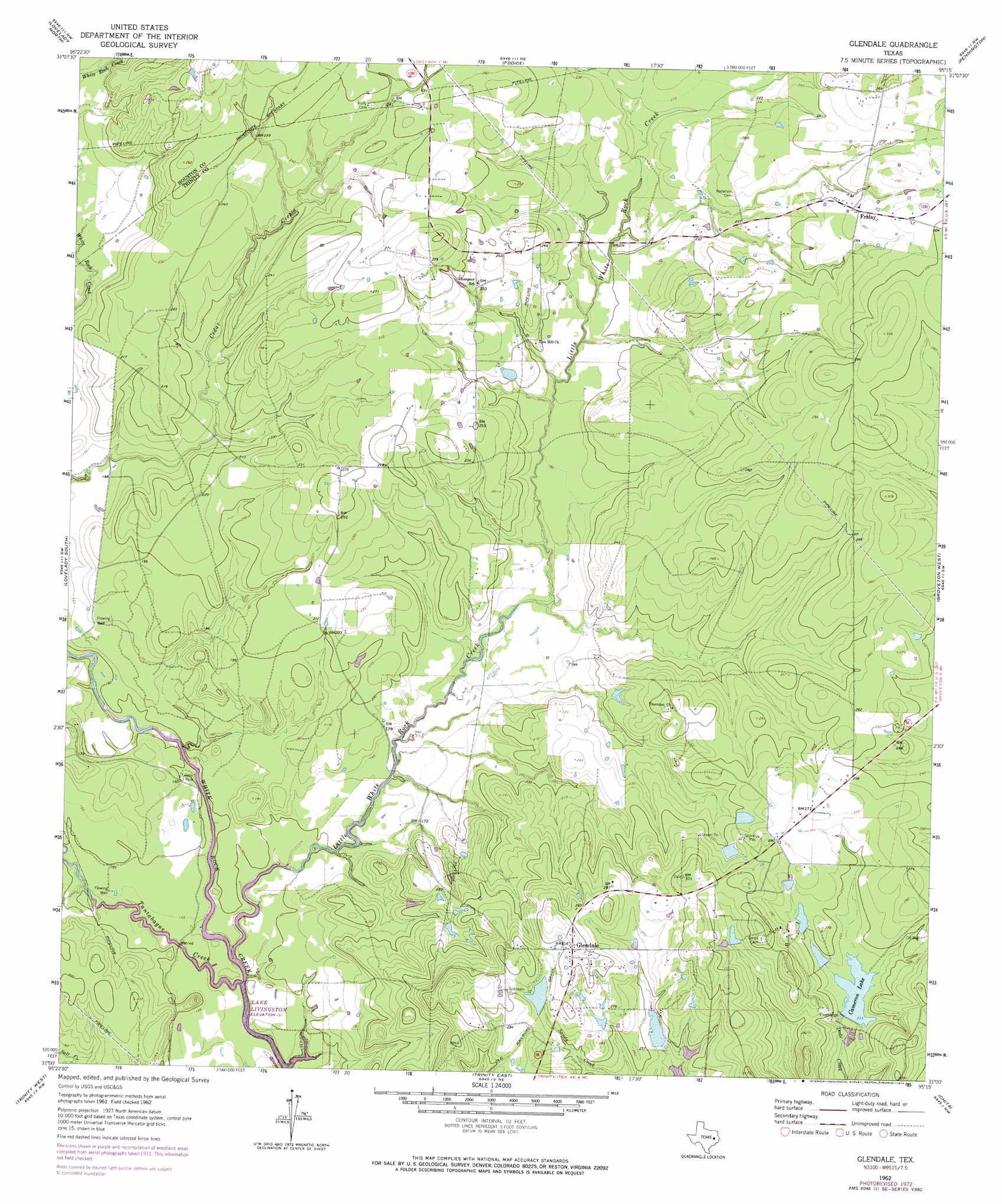
USGS Topo Quad 31095a3 - 1:24,000 scale
| Topo Map Name: | Glendale |
| USGS Topo Quad ID: | 31095a3 |
| Print Size: | ca. 21 1/4" wide x 27" high |
| Southeast Coordinates: | 31° N latitude / 95.25° W longitude |
| Map Center Coordinates: | 31.0625° N latitude / 95.3125° W longitude |
| U.S. State: | TX |
| Filename: | o31095a3.jpg |
| Download Map JPG Image: | Glendale topo map 1:24,000 scale |
| Map Type: | Topographic |
| Topo Series: | 7.5´ |
| Map Scale: | 1:24,000 |
| Source of Map Images: | United States Geological Survey (USGS) |
| Alternate Map Versions: |
Glendale TX 1962, updated 1964 Download PDF Buy paper map Glendale TX 1962, updated 1974 Download PDF Buy paper map Glendale TX 2010 Download PDF Buy paper map Glendale TX 2013 Download PDF Buy paper map Glendale TX 2016 Download PDF Buy paper map |
1:24,000 Topo Quads surrounding Glendale
Porter Springs |
Crockett |
Berea |
Kennard |
Centralia |
Pearsons Chapel |
Lovelady North |
Fodice |
Pennington |
Crecy |
Weldon |
Lovelady South |
Glendale |
Groveton West |
Groveton East |
Wyser Bottom |
Trinity West |
Trinity East |
Chita |
Colita |
Pine Prairie |
Riverside |
Staley |
Carlisle |
Onalaska |
> Back to 31095a1 at 1:100,000 scale
> Back to 31094a1 at 1:250,000 scale
> Back to U.S. Topo Maps home
Glendale topo map: Gazetteer
Glendale: Dams
Adams Lake Dam elevation 82m 269′Lake Dawson Dam elevation 71m 232′
Saron Lake Number 1 Dam elevation 71m 232′
Saron Lake Number 2 Dam elevation 74m 242′
Saron Lake Number 3 Dam elevation 77m 252′
Saron Lake Number 4 Dam elevation 79m 259′
Saron Lake Number 6 Dam elevation 74m 242′
Saron Lake Number 7 Dam elevation 74m 242′
Glendale: Parks
Trilady Park elevation 43m 141′Glendale: Populated Places
Friday elevation 84m 275′Friday elevation 82m 269′
Glendale elevation 97m 318′
Saron elevation 83m 272′
Glendale: Reservoirs
Adams Lake elevation 82m 269′Cameron Lake elevation 71m 232′
Lake Dawson elevation 71m 232′
Saron Lake Number 1 elevation 71m 232′
Saron Lake Number 2 elevation 74m 242′
Saron Lake Number 3 elevation 77m 252′
Saron Lake Number 4 elevation 79m 259′
Saron Lake Number 6 elevation 74m 242′
Saron Lake Number 7 elevation 74m 242′
Glendale: Streams
Little White Rock Creek elevation 40m 131′Tantabogue Creek elevation 40m 131′
Glendale digital topo map on disk
Buy this Glendale topo map showing relief, roads, GPS coordinates and other geographical features, as a high-resolution digital map file on DVD: