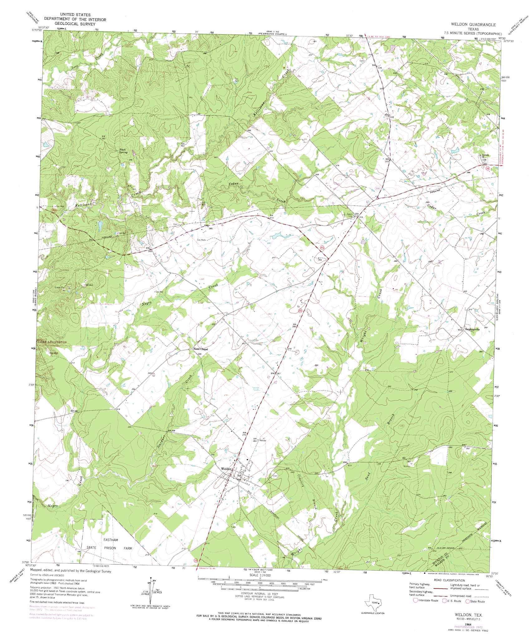
Weldon Topo Map Texas
To zoom in, hover over the map of Weldon
USGS Topo Quad 31095a5 - 1:24,000 scale
| Topo Map Name: | Weldon |
| USGS Topo Quad ID: | 31095a5 |
| Print Size: | ca. 21 1/4" wide x 27" high |
| Southeast Coordinates: | 31° N latitude / 95.5° W longitude |
| Map Center Coordinates: | 31.0625° N latitude / 95.5625° W longitude |
| U.S. State: | TX |
| Filename: | o31095a5.jpg |
| Download Map JPG Image: | Weldon topo map 1:24,000 scale |
| Map Type: | Topographic |
| Topo Series: | 7.5´ |
| Map Scale: | 1:24,000 |
| Source of Map Images: | United States Geological Survey (USGS) |
| Alternate Map Versions: |
Weldon TX 1964, updated 1967 Download PDF Buy paper map Weldon TX 1964, updated 1974 Download PDF Buy paper map Weldon TX 2010 Download PDF Buy paper map Weldon TX 2013 Download PDF Buy paper map Weldon TX 2016 Download PDF Buy paper map |
1:24,000 Topo Quads surrounding Weldon
Eunice |
Halls Bluff |
Porter Springs |
Crockett |
Berea |
Middleton |
Austonio |
Pearsons Chapel |
Lovelady North |
Fodice |
Elwood |
Sand Ridge |
Weldon |
Lovelady South |
Glendale |
Connor |
Baker Lake |
Wyser Bottom |
Trinity West |
Trinity East |
Steep Branch |
Crabbs Prairie |
Pine Prairie |
Riverside |
Staley |
> Back to 31095a1 at 1:100,000 scale
> Back to 31094a1 at 1:250,000 scale
> Back to U.S. Topo Maps home
Weldon topo map: Gazetteer
Weldon: Areas
Volga (historical) elevation 71m 232′Weldon: Bridges
Iron Bridge elevation 68m 223′Weldon: Populated Places
Antioch (historical) elevation 92m 301′Sorghumville elevation 91m 298′
Weldon elevation 76m 249′
Weldon: Post Offices
Antioch Post Office (historical) elevation 92m 301′Weldon Post Office (historical) elevation 80m 262′
Weldon: Springs
Nash Spring elevation 79m 259′Weldon: Streams
Cedar Creek elevation 57m 187′Cemetery Branch elevation 59m 193′
Gardner Creek elevation 51m 167′
Sand Branch elevation 61m 200′
Weldon digital topo map on disk
Buy this Weldon topo map showing relief, roads, GPS coordinates and other geographical features, as a high-resolution digital map file on DVD: