Leona Topo Map Texas
To zoom in, hover over the map of Leona
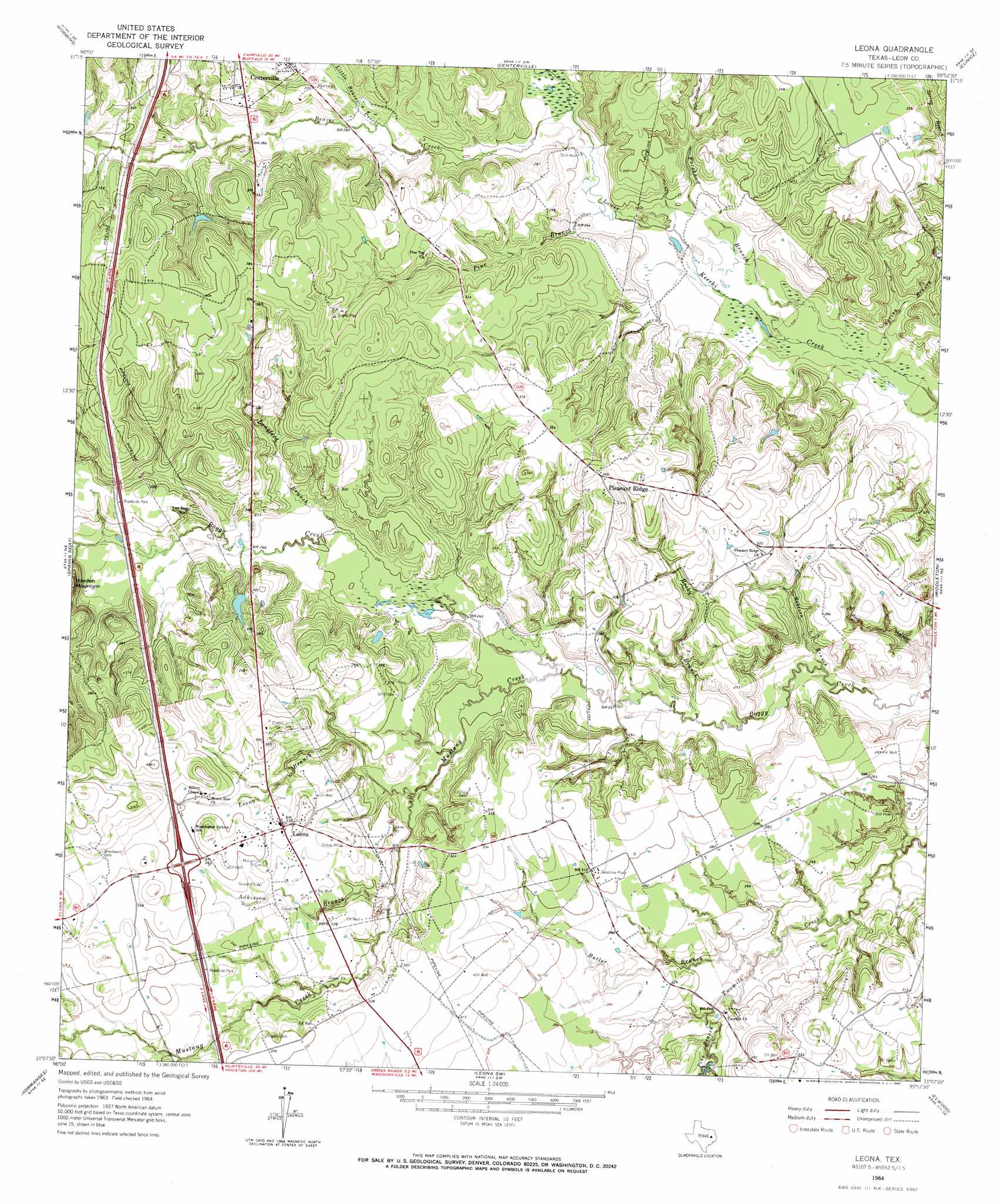
USGS Topo Quad 31095b8 - 1:24,000 scale
| Topo Map Name: | Leona |
| USGS Topo Quad ID: | 31095b8 |
| Print Size: | ca. 21 1/4" wide x 27" high |
| Southeast Coordinates: | 31.125° N latitude / 95.875° W longitude |
| Map Center Coordinates: | 31.1875° N latitude / 95.9375° W longitude |
| U.S. State: | TX |
| Filename: | o31095b8.jpg |
| Download Map JPG Image: | Leona topo map 1:24,000 scale |
| Map Type: | Topographic |
| Topo Series: | 7.5´ |
| Map Scale: | 1:24,000 |
| Source of Map Images: | United States Geological Survey (USGS) |
| Alternate Map Versions: |
Leona TX 1964, updated 1967 Download PDF Buy paper map Leona TX 2010 Download PDF Buy paper map Leona TX 2013 Download PDF Buy paper map Leona TX 2016 Download PDF Buy paper map |
1:24,000 Topo Quads surrounding Leona
Donie |
Buffalo |
Flo |
Lake Leon |
Stanmire Lake |
Jewett |
Robbins |
Centerville |
Eunice |
Halls Bluff |
Margie |
Spring Seat |
Leona |
Middleton |
Austonio |
Hilltop Lakes |
Normangee |
Leona Sw |
Elwood |
Sand Ridge |
Canary |
North Zulch |
Madisonville |
Connor |
Baker Lake |
> Back to 31095a1 at 1:100,000 scale
> Back to 31094a1 at 1:250,000 scale
> Back to U.S. Topo Maps home
Leona topo map: Gazetteer
Leona: Parks
Fort Boggy State Park elevation 81m 265′Leona: Populated Places
Leona elevation 104m 341′Pleasant Ridge elevation 112m 367′
Leona: Streams
Adkisson Branch elevation 82m 269′Beaver Creek elevation 72m 236′
Butler Branch elevation 70m 229′
Cedar Creek elevation 82m 269′
Forehand Branch elevation 66m 216′
Langford Branch elevation 76m 249′
Leona Branch elevation 76m 249′
Little Beaver Creek elevation 77m 252′
Mustang Creek elevation 70m 229′
Pine Branch elevation 70m 229′
Pine Branch elevation 71m 232′
Pole Bridge Branch elevation 79m 259′
Robeson Branch elevation 64m 209′
Rocky Branch elevation 67m 219′
Spring Branch elevation 65m 213′
Leona: Trails
Fort Boggy State Park Trail elevation 94m 308′Leona: Valleys
Red Hollow elevation 64m 209′Leona digital topo map on disk
Buy this Leona topo map showing relief, roads, GPS coordinates and other geographical features, as a high-resolution digital map file on DVD: