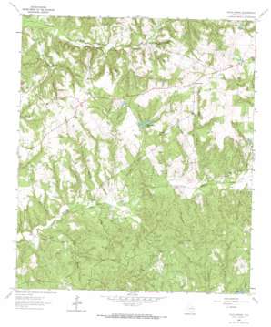
Hays Spring Topo Map Texas
To zoom in, hover over the map of Hays Spring
USGS Topo Quad 31095d5 - 1:24,000 scale
| Topo Map Name: | Hays Spring |
| USGS Topo Quad ID: | 31095d5 |
| Print Size: | ca. 21 1/4" wide x 27" high |
| Southeast Coordinates: | 31.375° N latitude / 95.5° W longitude |
| Map Center Coordinates: | 31.4375° N latitude / 95.5625° W longitude |
| U.S. State: | TX |
| Filename: | o31095d5.jpg |
| Download Map JPG Image: | Hays Spring topo map 1:24,000 scale |
| Map Type: | Topographic |
| Topo Series: | 7.5´ |
| Map Scale: | 1:24,000 |
| Source of Map Images: | United States Geological Survey (USGS) |
| Alternate Map Versions: |
Hays Spring TX 1964, updated 1967 Download PDF Buy paper map Hays Spring TX 2010 Download PDF Buy paper map Hays Spring TX 2013 Download PDF Buy paper map Hays Spring TX 2016 Download PDF Buy paper map |
1:24,000 Topo Quads surrounding Hays Spring
> Back to 31095a1 at 1:100,000 scale
> Back to 31094a1 at 1:250,000 scale
> Back to U.S. Topo Maps home
Hays Spring topo map: Gazetteer
Hays Spring: Crossings
Coonskin Crossing elevation 91m 298′Hays Spring: Dams
Bill Huff Dam elevation 130m 426′Dan Pennington Dam elevation 86m 282′
Houston County Dam elevation 67m 219′
Pennington Dam elevation 104m 341′
Warner Dam Number 1 elevation 119m 390′
Warner Dam Number 2 elevation 116m 380′
Hays Spring: Lakes
Houston County Lake elevation 76m 249′Hays Spring: Populated Places
Hays Spring elevation 137m 449′Hays Spring: Reservoirs
Bill Huff Lake elevation 130m 426′Farm Lake elevation 86m 282′
Houston County Lake elevation 67m 219′
Pennington Lake elevation 104m 341′
Warner Lake Number 1 elevation 119m 390′
Warner Lake Number 2 elevation 116m 380′
Hays Spring: Springs
Caney Creek Springs elevation 130m 426′Hays Branch Springs elevation 127m 416′
Hays Spring: Streams
Caney Creek elevation 85m 278′Clark Branch elevation 67m 219′
Hays Branch elevation 82m 269′
Moccasin Branch elevation 94m 308′
Nealy Branch elevation 76m 249′
Pennington Branch elevation 76m 249′
Spring Creek elevation 91m 298′
Two Mile Branch elevation 116m 380′
Zach Branch elevation 69m 226′
Hays Spring digital topo map on disk
Buy this Hays Spring topo map showing relief, roads, GPS coordinates and other geographical features, as a high-resolution digital map file on DVD:


