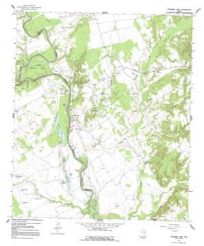
Stanmire Lake Topo Map Texas
To zoom in, hover over the map of Stanmire Lake
USGS Topo Quad 31095d6 - 1:24,000 scale
| Topo Map Name: | Stanmire Lake |
| USGS Topo Quad ID: | 31095d6 |
| Print Size: | ca. 21 1/4" wide x 27" high |
| Southeast Coordinates: | 31.375° N latitude / 95.625° W longitude |
| Map Center Coordinates: | 31.4375° N latitude / 95.6875° W longitude |
| U.S. State: | TX |
| Filename: | o31095d6.jpg |
| Download Map JPG Image: | Stanmire Lake topo map 1:24,000 scale |
| Map Type: | Topographic |
| Topo Series: | 7.5´ |
| Map Scale: | 1:24,000 |
| Source of Map Images: | United States Geological Survey (USGS) |
| Alternate Map Versions: |
Stanmire Lake TX 1964, updated 1967 Download PDF Buy paper map Stanmire Lake TX 1964, updated 1991 Download PDF Buy paper map Stanmire Lake TX 2010 Download PDF Buy paper map Stanmire Lake TX 2013 Download PDF Buy paper map Stanmire Lake TX 2016 Download PDF Buy paper map |
1:24,000 Topo Quads surrounding Stanmire Lake
> Back to 31095a1 at 1:100,000 scale
> Back to 31094a1 at 1:250,000 scale
> Back to U.S. Topo Maps home
Stanmire Lake topo map: Gazetteer
Stanmire Lake: Airports
W C Ranch Airport elevation 101m 331′Stanmire Lake: Bends
Mitchell Bend elevation 59m 193′Stanmire Lake: Lakes
Alligator Lake elevation 55m 180′Ben Lake elevation 58m 190′
Buzzard Lake elevation 53m 173′
Clear Lake elevation 55m 180′
Field Lake elevation 58m 190′
Flat Lake elevation 56m 183′
Gin Lake elevation 57m 187′
Middle Lake elevation 60m 196′
Mud Lake elevation 55m 180′
Perring Lake elevation 56m 183′
Sand Lake elevation 55m 180′
Stanmire Lake elevation 58m 190′
Taylor Lake elevation 60m 196′
Wood Lake elevation 58m 190′
Zeke Lake elevation 58m 190′
Stanmire Lake: Oilfields
Navarro Crossing Oil Field elevation 71m 232′Stanmire Lake: Populated Places
Reynard elevation 61m 200′Wheeler Springs elevation 88m 288′
Stanmire Lake: Streams
Cedar Branch elevation 50m 164′Chiles Branch elevation 61m 200′
Haley Creek elevation 55m 180′
Kinnon Creek elevation 53m 173′
Little Elkhart Creek elevation 52m 170′
Meriwether Branch elevation 79m 259′
Murchison Branch elevation 73m 239′
Upper Keechi Creek elevation 49m 160′
Stanmire Lake: Summits
Kent Hill elevation 67m 219′Stanmire Lake digital topo map on disk
Buy this Stanmire Lake topo map showing relief, roads, GPS coordinates and other geographical features, as a high-resolution digital map file on DVD:


