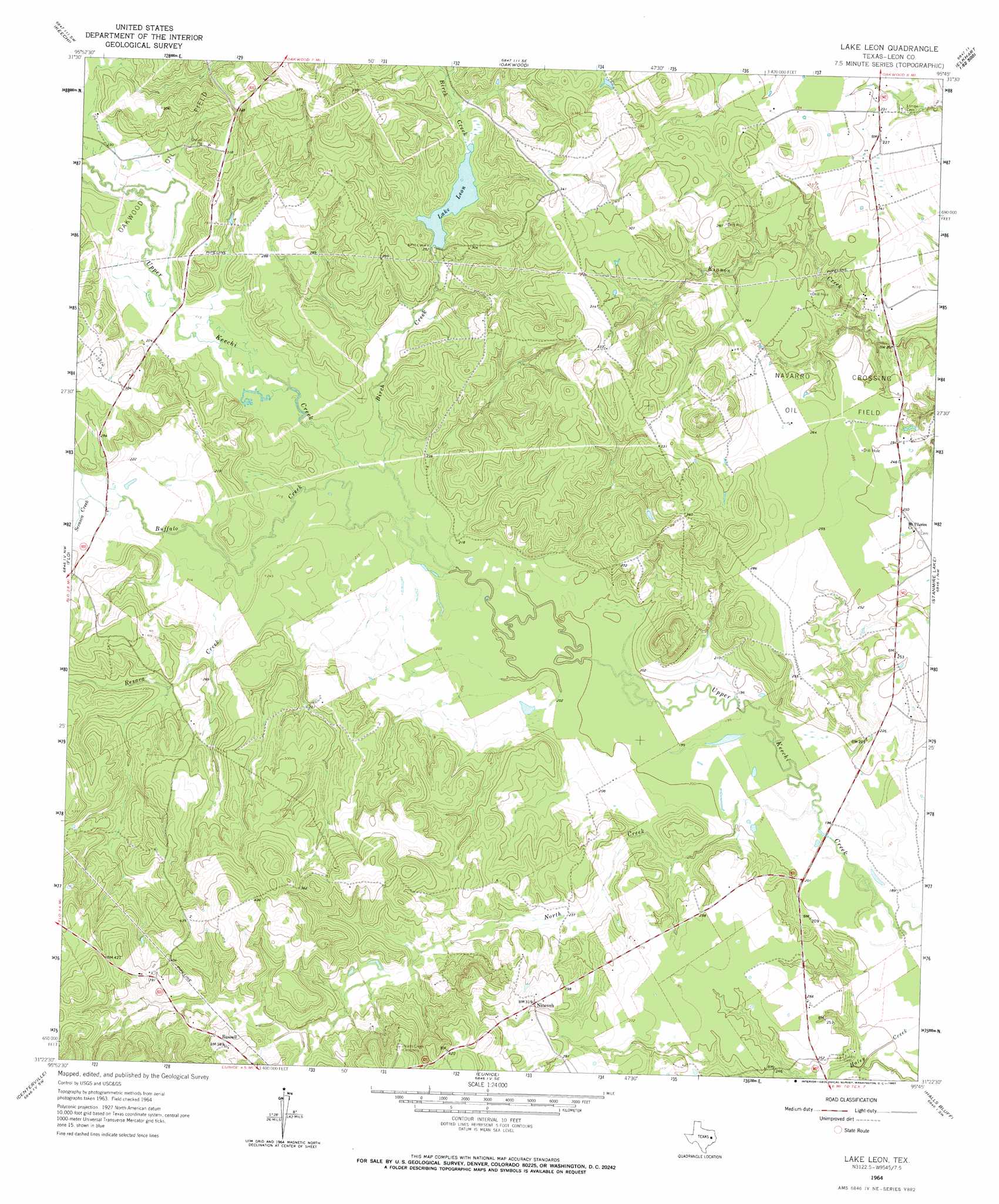
Lake Leon Topo Map Texas
To zoom in, hover over the map of Lake Leon
USGS Topo Quad 31095d7 - 1:24,000 scale
| Topo Map Name: | Lake Leon |
| USGS Topo Quad ID: | 31095d7 |
| Print Size: | ca. 21 1/4" wide x 27" high |
| Southeast Coordinates: | 31.375° N latitude / 95.75° W longitude |
| Map Center Coordinates: | 31.4375° N latitude / 95.8125° W longitude |
| U.S. State: | TX |
| Filename: | o31095d7.jpg |
| Download Map JPG Image: | Lake Leon topo map 1:24,000 scale |
| Map Type: | Topographic |
| Topo Series: | 7.5´ |
| Map Scale: | 1:24,000 |
| Source of Map Images: | United States Geological Survey (USGS) |
| Alternate Map Versions: |
Lake Leon TX 1964, updated 1967 Download PDF Buy paper map Lake Leon TX 2010 Download PDF Buy paper map Lake Leon TX 2013 Download PDF Buy paper map Lake Leon TX 2016 Download PDF Buy paper map |
1:24,000 Topo Quads surrounding Lake Leon
Turlington |
Butler |
Long Lake |
Southwest Palestine |
Southeast Palestine |
Lanely |
Keechi |
Oakwood |
Indian Lake |
Elkhart Creek |
Buffalo |
Flo |
Lake Leon |
Stanmire Lake |
Hays Spring |
Robbins |
Centerville |
Eunice |
Halls Bluff |
Porter Springs |
Spring Seat |
Leona |
Middleton |
Austonio |
Pearsons Chapel |
> Back to 31095a1 at 1:100,000 scale
> Back to 31094a1 at 1:250,000 scale
> Back to U.S. Topo Maps home
Lake Leon topo map: Gazetteer
Lake Leon: Dams
Crow Dam elevation 79m 259′Lake Elverda Dam elevation 66m 216′
Lake Leon: Oilfields
Oakwood Oil Field elevation 68m 223′Lake Leon: Parks
Keechi Creek Wildlife Management Area elevation 62m 203′Lake Leon: Populated Places
Nineveh elevation 93m 305′Russell elevation 116m 380′
Lake Leon: Reservoirs
Lake Elverda elevation 66m 216′Lake Leon elevation 76m 249′
Lake Leon: Streams
Birch Creek elevation 62m 203′Buffalo Creek elevation 61m 200′
North Creek elevation 58m 190′
Red Branch elevation 79m 259′
Resaca Creek elevation 64m 209′
Serasca Creek elevation 66m 216′
Lake Leon digital topo map on disk
Buy this Lake Leon topo map showing relief, roads, GPS coordinates and other geographical features, as a high-resolution digital map file on DVD: