Flo Topo Map Texas
To zoom in, hover over the map of Flo
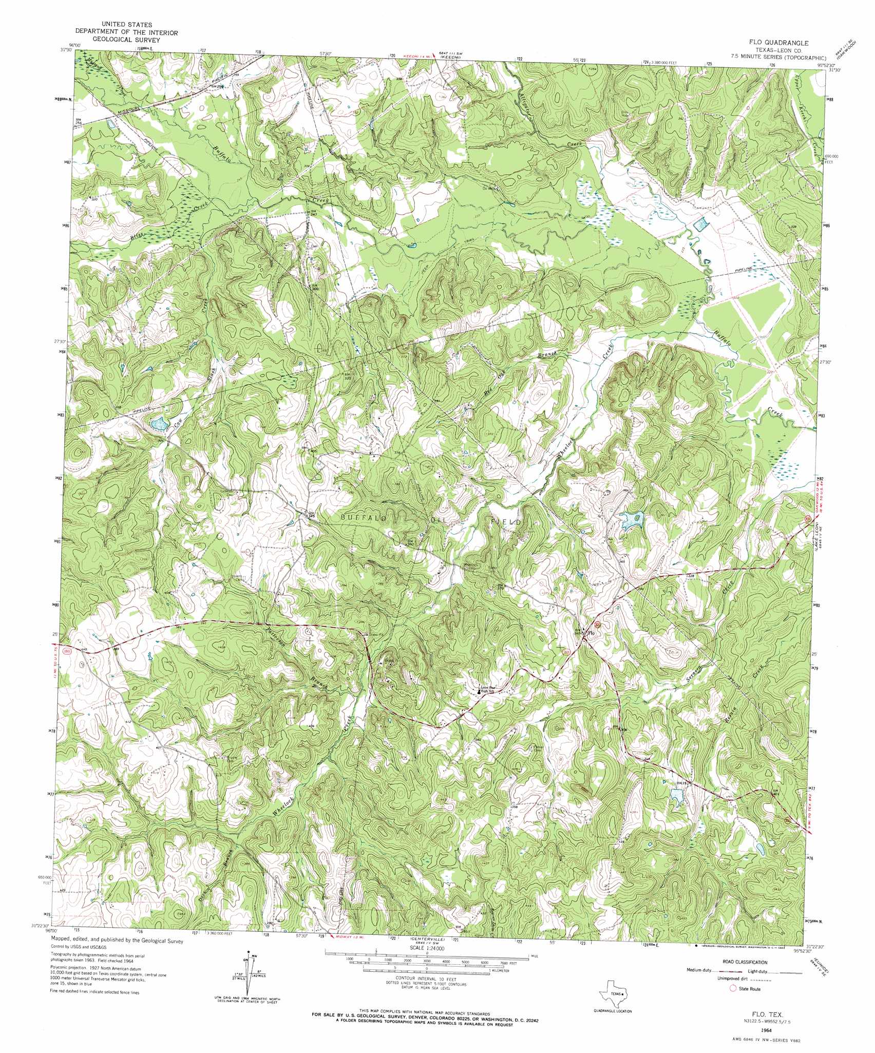
USGS Topo Quad 31095d8 - 1:24,000 scale
| Topo Map Name: | Flo |
| USGS Topo Quad ID: | 31095d8 |
| Print Size: | ca. 21 1/4" wide x 27" high |
| Southeast Coordinates: | 31.375° N latitude / 95.875° W longitude |
| Map Center Coordinates: | 31.4375° N latitude / 95.9375° W longitude |
| U.S. State: | TX |
| Filename: | o31095d8.jpg |
| Download Map JPG Image: | Flo topo map 1:24,000 scale |
| Map Type: | Topographic |
| Topo Series: | 7.5´ |
| Map Scale: | 1:24,000 |
| Source of Map Images: | United States Geological Survey (USGS) |
| Alternate Map Versions: |
Flo TX 1964, updated 1967 Download PDF Buy paper map Flo TX 2010 Download PDF Buy paper map Flo TX 2013 Download PDF Buy paper map Flo TX 2016 Download PDF Buy paper map |
1:24,000 Topo Quads surrounding Flo
Fairfield |
Turlington |
Butler |
Long Lake |
Southwest Palestine |
Dew |
Lanely |
Keechi |
Oakwood |
Indian Lake |
Donie |
Buffalo |
Flo |
Lake Leon |
Stanmire Lake |
Jewett |
Robbins |
Centerville |
Eunice |
Halls Bluff |
Margie |
Spring Seat |
Leona |
Middleton |
Austonio |
> Back to 31095a1 at 1:100,000 scale
> Back to 31094a1 at 1:250,000 scale
> Back to U.S. Topo Maps home
Flo topo map: Gazetteer
Flo: Dams
Schweinle Lake Dam elevation 87m 285′Flo: Oilfields
Buffalo Oil Field elevation 97m 318′Flo: Populated Places
Flo elevation 108m 354′Flo: Reservoirs
Schweinle Lake elevation 87m 285′Flo: Streams
Alligator Creek elevation 70m 229′Bliss Creek elevation 74m 242′
Cow Slash Creek elevation 73m 239′
Dove Branch elevation 98m 321′
Mustang Creek elevation 75m 246′
Patterson Branch elevation 88m 288′
Red Oak Branch elevation 72m 236′
Wheelock Creek elevation 67m 219′
Flo digital topo map on disk
Buy this Flo topo map showing relief, roads, GPS coordinates and other geographical features, as a high-resolution digital map file on DVD: