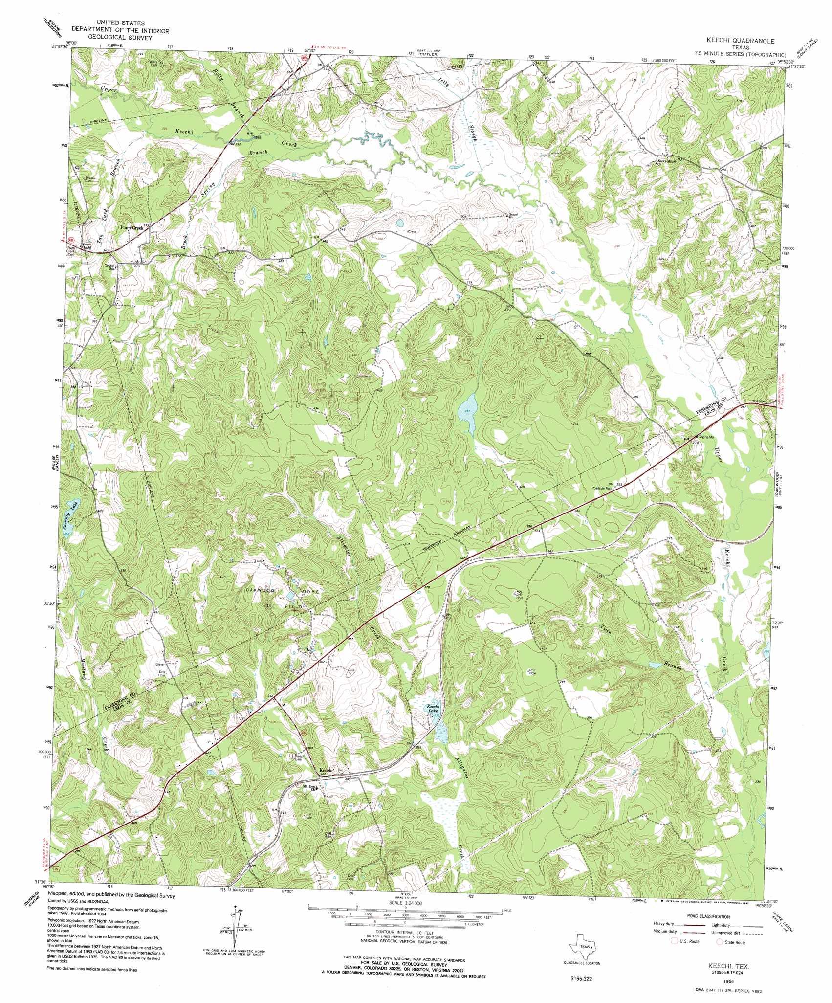
Keechi Topo Map Texas
To zoom in, hover over the map of Keechi
USGS Topo Quad 31095e8 - 1:24,000 scale
| Topo Map Name: | Keechi |
| USGS Topo Quad ID: | 31095e8 |
| Print Size: | ca. 21 1/4" wide x 27" high |
| Southeast Coordinates: | 31.5° N latitude / 95.875° W longitude |
| Map Center Coordinates: | 31.5625° N latitude / 95.9375° W longitude |
| U.S. State: | TX |
| Filename: | o31095e8.jpg |
| Download Map JPG Image: | Keechi topo map 1:24,000 scale |
| Map Type: | Topographic |
| Topo Series: | 7.5´ |
| Map Scale: | 1:24,000 |
| Source of Map Images: | United States Geological Survey (USGS) |
| Alternate Map Versions: |
Keechi TX 1964, updated 1967 Download PDF Buy paper map Keechi TX 1964, updated 1992 Download PDF Buy paper map Keechi TX 2010 Download PDF Buy paper map Keechi TX 2013 Download PDF Buy paper map Keechi TX 2016 Download PDF Buy paper map |
1:24,000 Topo Quads surrounding Keechi
Stewards Mill |
Young |
Yard |
Tennessee Colony |
Northwest Palestine |
Fairfield |
Turlington |
Butler |
Long Lake |
Southwest Palestine |
Dew |
Lanely |
Keechi |
Oakwood |
Indian Lake |
Donie |
Buffalo |
Flo |
Lake Leon |
Stanmire Lake |
Jewett |
Robbins |
Centerville |
Eunice |
Halls Bluff |
> Back to 31095e1 at 1:100,000 scale
> Back to 31094a1 at 1:250,000 scale
> Back to U.S. Topo Maps home
Keechi topo map: Gazetteer
Keechi: Dams
Bess Lake Dam elevation 95m 311′Connolly Lake Dam elevation 116m 380′
Lipsey Lake Dam Number 2 elevation 85m 278′
Little Lake Dam elevation 79m 259′
S C Pickins Dam elevation 106m 347′
T B Pickens Dam elevation 103m 337′
Keechi: Oilfields
Oakwood Dome Oil Field elevation 122m 400′Keechi: Populated Places
Keechi elevation 85m 278′Plum Creek elevation 112m 367′
Keechi: Reservoirs
Bess Lake elevation 95m 311′Connolly Lake elevation 107m 351′
Keechi Lake elevation 83m 272′
Lipsey Lake Number 2 elevation 85m 278′
Little Lake elevation 79m 259′
S C Pickins Lake elevation 106m 347′
T B Pickens Lake elevation 103m 337′
Keechi: Streams
Brook Spring Branch elevation 82m 269′Holly Branch elevation 85m 278′
Jelly Slough elevation 81m 265′
Tan Yard Branch elevation 87m 285′
Twin Branch elevation 73m 239′
Keechi digital topo map on disk
Buy this Keechi topo map showing relief, roads, GPS coordinates and other geographical features, as a high-resolution digital map file on DVD: