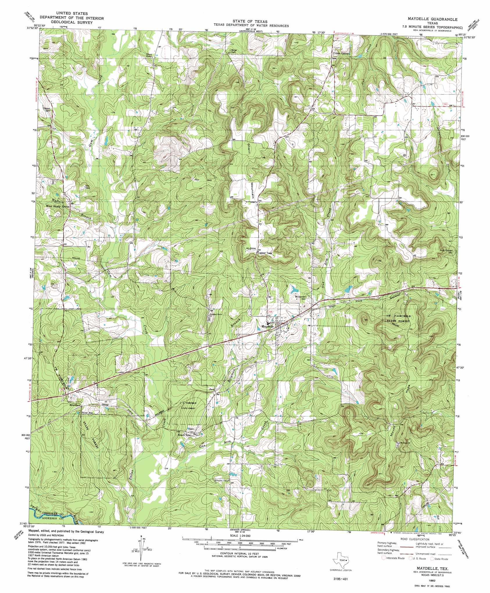
Maydelle Topo Map Texas
To zoom in, hover over the map of Maydelle
USGS Topo Quad 31095g3 - 1:24,000 scale
| Topo Map Name: | Maydelle |
| USGS Topo Quad ID: | 31095g3 |
| Print Size: | ca. 21 1/4" wide x 27" high |
| Southeast Coordinates: | 31.75° N latitude / 95.25° W longitude |
| Map Center Coordinates: | 31.8125° N latitude / 95.3125° W longitude |
| U.S. State: | TX |
| Filename: | o31095g3.jpg |
| Download Map JPG Image: | Maydelle topo map 1:24,000 scale |
| Map Type: | Topographic |
| Topo Series: | 7.5´ |
| Map Scale: | 1:24,000 |
| Source of Map Images: | United States Geological Survey (USGS) |
| Alternate Map Versions: |
Maydelle TX 1982, updated 1982 Download PDF Buy paper map Maydelle TX 2010 Download PDF Buy paper map Maydelle TX 2013 Download PDF Buy paper map Maydelle TX 2016 Download PDF Buy paper map |
1:24,000 Topo Quads surrounding Maydelle
Poynor |
Berryville |
Mount Selman |
Tecula |
Griffin |
Pert |
Todd City |
Jacksonville West |
Jacksonville East |
New Summerfield |
Northeast Palestine |
Neches |
Maydelle |
Rusk |
Atoy |
Southeast Palestine |
Slocum |
Denson Springs |
Pryor Mountain |
Alto |
Elkhart Creek |
Percilla |
Augusta |
Weches |
Forest |
> Back to 31095e1 at 1:100,000 scale
> Back to 31094a1 at 1:250,000 scale
> Back to U.S. Topo Maps home
Maydelle topo map: Gazetteer
Maydelle: Forests
Fairchild State Forest elevation 115m 377′Maydelle: Populated Places
Java elevation 107m 351′Maydelle elevation 125m 410′
Mewshaw elevation 115m 377′
Maydelle: Streams
Brigman Branch elevation 87m 285′Gum Creek elevation 85m 278′
One Arm Creek elevation 79m 259′
Wallace Branch elevation 92m 301′
Maydelle: Summits
Ghent Mountain elevation 207m 679′Mount Hope elevation 206m 675′
Maydelle: Trails
Mount Hope Tract Trail elevation 170m 557′Nature Trail elevation 94m 308′
Maydelle digital topo map on disk
Buy this Maydelle topo map showing relief, roads, GPS coordinates and other geographical features, as a high-resolution digital map file on DVD: