Yard Topo Map Texas
To zoom in, hover over the map of Yard
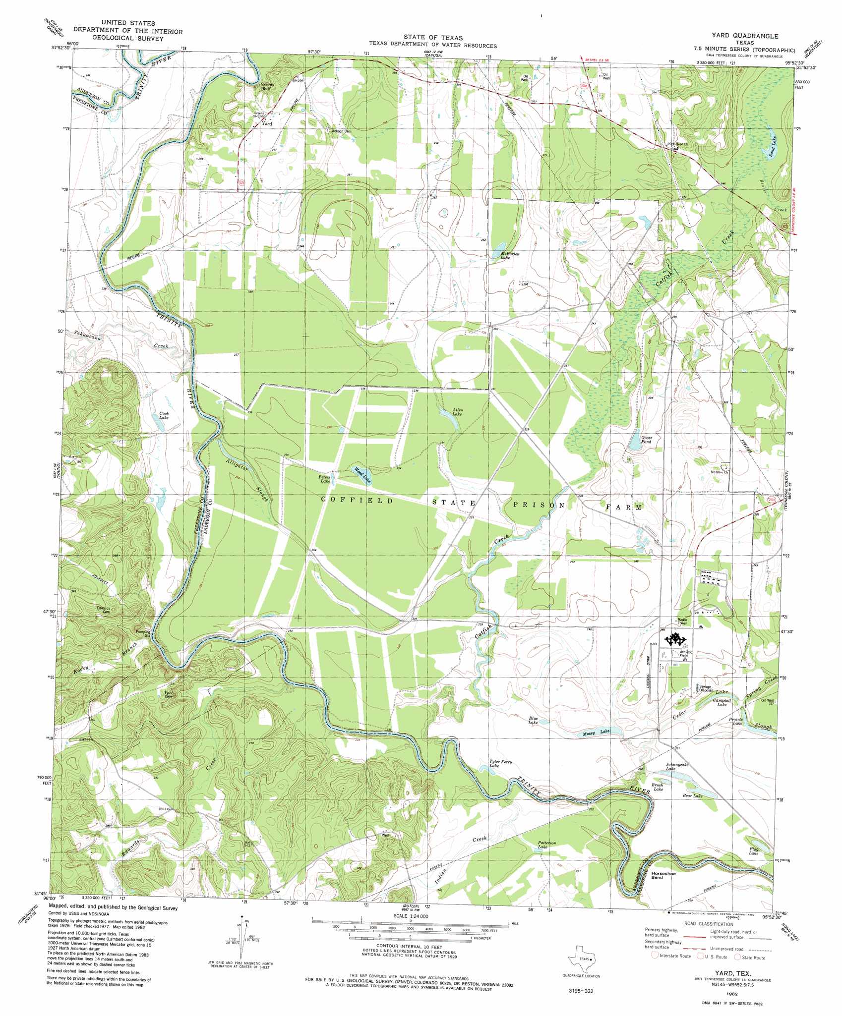
USGS Topo Quad 31095g8 - 1:24,000 scale
| Topo Map Name: | Yard |
| USGS Topo Quad ID: | 31095g8 |
| Print Size: | ca. 21 1/4" wide x 27" high |
| Southeast Coordinates: | 31.75° N latitude / 95.875° W longitude |
| Map Center Coordinates: | 31.8125° N latitude / 95.9375° W longitude |
| U.S. State: | TX |
| Filename: | o31095g8.jpg |
| Download Map JPG Image: | Yard topo map 1:24,000 scale |
| Map Type: | Topographic |
| Topo Series: | 7.5´ |
| Map Scale: | 1:24,000 |
| Source of Map Images: | United States Geological Survey (USGS) |
| Alternate Map Versions: |
Yard TX 1982, updated 1982 Download PDF Buy paper map Yard TX 2010 Download PDF Buy paper map Yard TX 2013 Download PDF Buy paper map Yard TX 2016 Download PDF Buy paper map |
1:24,000 Topo Quads surrounding Yard
Goodlow Park |
Creslenn Ranch |
Cross Roads |
Coon Creek Lake |
La Rue |
Winkler |
Roustabout Camp |
Cayuga |
Blackfoot |
Wilkerson Mountain |
Stewards Mill |
Young |
Yard |
Tennessee Colony |
Northwest Palestine |
Fairfield |
Turlington |
Butler |
Long Lake |
Southwest Palestine |
Dew |
Lanely |
Keechi |
Oakwood |
Indian Lake |
> Back to 31095e1 at 1:100,000 scale
> Back to 31094a1 at 1:250,000 scale
> Back to U.S. Topo Maps home
Yard topo map: Gazetteer
Yard: Airports
W J E Airport elevation 78m 255′Yard: Lakes
Allen Lake elevation 70m 229′Bear Lake elevation 69m 226′
Blue Lake elevation 69m 226′
Brush Lake elevation 69m 226′
Campbell Lake elevation 67m 219′
Cook Lake elevation 72m 236′
Flag Lake elevation 68m 223′
Goose Pond elevation 70m 229′
Johnnycake Lake elevation 69m 226′
McFarlen Lake elevation 76m 249′
Mossy Lake elevation 67m 219′
Patterson Lake elevation 70m 229′
Peters Lake elevation 72m 236′
Prairie Lake elevation 66m 216′
Sand Lake elevation 76m 249′
Tyler Ferry Lake elevation 70m 229′
Weed Lake elevation 71m 232′
Yard: Populated Places
Greens Bluff elevation 77m 252′Yard elevation 85m 278′
Yard elevation 88m 288′
Yard: Streams
Alligator Slough elevation 72m 236′Beaver Creek elevation 75m 246′
Catfish Creek elevation 63m 206′
Cold Springs Branch elevation 90m 295′
Edwards Creek elevation 61m 200′
Indian Creek elevation 68m 223′
Rocky Branch elevation 66m 216′
Spring Creek elevation 69m 226′
Tehuacana Creek elevation 65m 213′
Yard digital topo map on disk
Buy this Yard topo map showing relief, roads, GPS coordinates and other geographical features, as a high-resolution digital map file on DVD: