Franklin Topo Map Texas
To zoom in, hover over the map of Franklin
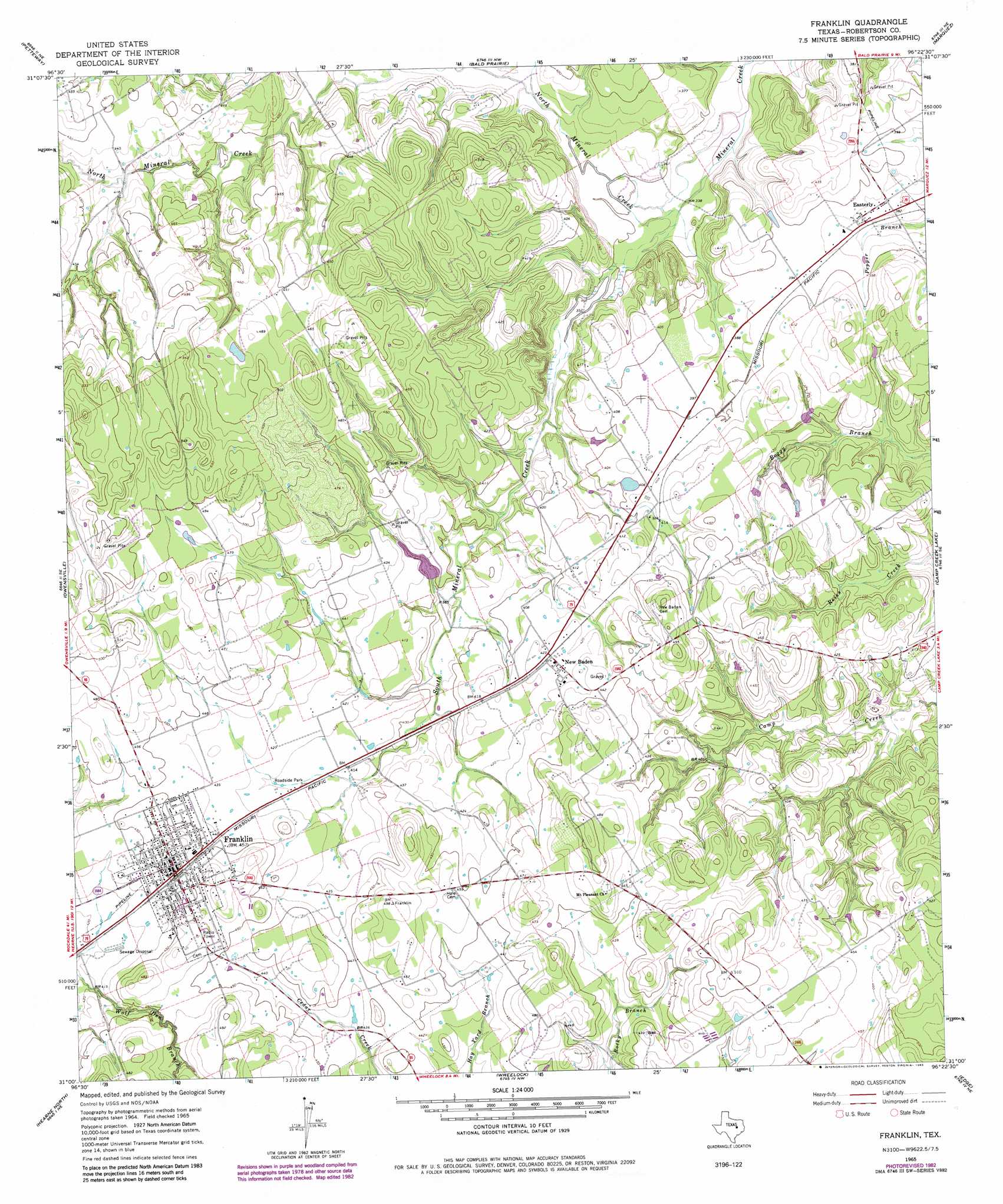
USGS Topo Quad 31096a4 - 1:24,000 scale
| Topo Map Name: | Franklin |
| USGS Topo Quad ID: | 31096a4 |
| Print Size: | ca. 21 1/4" wide x 27" high |
| Southeast Coordinates: | 31° N latitude / 96.375° W longitude |
| Map Center Coordinates: | 31.0625° N latitude / 96.4375° W longitude |
| U.S. State: | TX |
| Filename: | o31096a4.jpg |
| Download Map JPG Image: | Franklin topo map 1:24,000 scale |
| Map Type: | Topographic |
| Topo Series: | 7.5´ |
| Map Scale: | 1:24,000 |
| Source of Map Images: | United States Geological Survey (USGS) |
| Alternate Map Versions: |
Franklin TX 1965, updated 1968 Download PDF Buy paper map Franklin TX 1965, updated 1983 Download PDF Buy paper map Franklin TX 2010 Download PDF Buy paper map Franklin TX 2013 Download PDF Buy paper map Franklin TX 2016 Download PDF Buy paper map |
1:24,000 Topo Quads surrounding Franklin
Kosse West |
Kosse East |
Oletha |
Round Prairie |
Jewett |
Bremond |
Petteway |
Bald Prairie |
Marquez |
Margie |
Hammond |
Owensville |
Franklin |
Camp Creek Lake |
Hilltop Lakes |
Calvert |
Hearne North |
Wheelock |
Edge |
Canary |
Gause |
Hearne South |
Dunn Creek |
Kurten |
Clear Lake |
> Back to 31096a1 at 1:100,000 scale
> Back to 31096a1 at 1:250,000 scale
> Back to U.S. Topo Maps home
Franklin topo map: Gazetteer
Franklin: Dams
Casey Lake Dam elevation 123m 403′Martin Lake Dam elevation 121m 396′
Schultz Lake Dam elevation 123m 403′
Franklin: Populated Places
Easterly elevation 118m 387′Franklin elevation 137m 449′
New Baden elevation 130m 426′
Franklin: Reservoirs
Casey Lake elevation 123m 403′Martin Lake elevation 121m 396′
Schultz Lake elevation 123m 403′
Franklin: Streams
North Mineral Creek elevation 102m 334′South Mineral Creek elevation 101m 331′
Franklin digital topo map on disk
Buy this Franklin topo map showing relief, roads, GPS coordinates and other geographical features, as a high-resolution digital map file on DVD: