Baileyville Topo Map Texas
To zoom in, hover over the map of Baileyville
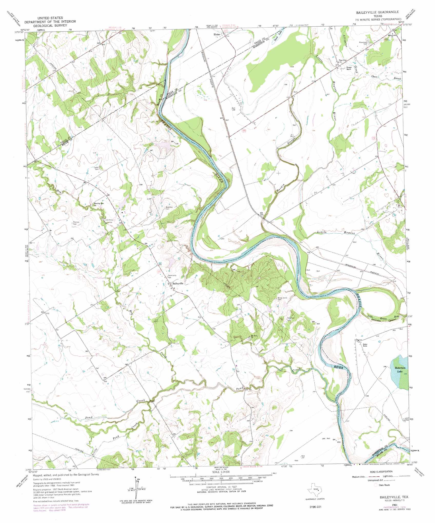
USGS Topo Quad 31096a7 - 1:24,000 scale
| Topo Map Name: | Baileyville |
| USGS Topo Quad ID: | 31096a7 |
| Print Size: | ca. 21 1/4" wide x 27" high |
| Southeast Coordinates: | 31° N latitude / 96.75° W longitude |
| Map Center Coordinates: | 31.0625° N latitude / 96.8125° W longitude |
| U.S. State: | TX |
| Filename: | o31096a7.jpg |
| Download Map JPG Image: | Baileyville topo map 1:24,000 scale |
| Map Type: | Topographic |
| Topo Series: | 7.5´ |
| Map Scale: | 1:24,000 |
| Source of Map Images: | United States Geological Survey (USGS) |
| Alternate Map Versions: |
Baileyville TX 1961, updated 1964 Download PDF Buy paper map Baileyville TX 1961, updated 1978 Download PDF Buy paper map Baileyville TX 2010 Download PDF Buy paper map Baileyville TX 2013 Download PDF Buy paper map Baileyville TX 2016 Download PDF Buy paper map |
1:24,000 Topo Quads surrounding Baileyville
Chilton |
Marlin |
Mcclanahan |
Kosse West |
Kosse East |
Lott |
Cedar Springs |
Reagan |
Bremond |
Petteway |
Westphalia |
Rosebud |
Baileyville |
Hammond |
Owensville |
Yarrelton |
Ben Arnold |
Maysfield |
Calvert |
Hearne North |
Pettibone |
Cameron |
Hanover |
Gause |
Hearne South |
> Back to 31096a1 at 1:100,000 scale
> Back to 31096a1 at 1:250,000 scale
> Back to U.S. Topo Maps home
Baileyville topo map: Gazetteer
Baileyville: Channels
Little Brazos River Diversion Channel elevation 85m 278′Baileyville: Dams
Burns Lake Dam elevation 106m 347′Ellison Lake Dam elevation 103m 337′
Baileyville: Lakes
Duck Lake elevation 94m 308′Baileyville: Populated Places
Baileyville elevation 113m 370′Eloise elevation 95m 311′
Baileyville: Reservoirs
Burns Lake elevation 106m 347′Ellison Lake elevation 103m 337′
Baileyville: Streams
Alligator Creek elevation 93m 305′Chair Branch elevation 94m 308′
Cottonmouth Creek elevation 86m 282′
Darting Minnow Creek elevation 88m 288′
Hardin Slough elevation 84m 275′
Hog Creek elevation 88m 288′
Little Pond Creek elevation 91m 298′
Pond Creek elevation 85m 278′
Baileyville digital topo map on disk
Buy this Baileyville topo map showing relief, roads, GPS coordinates and other geographical features, as a high-resolution digital map file on DVD: