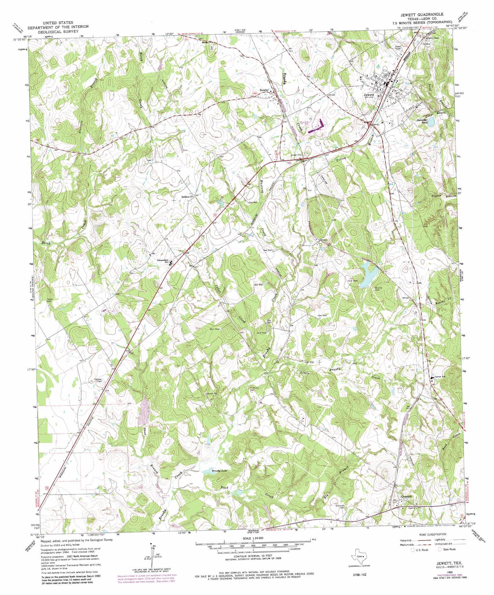
Jewett Topo Map Texas
To zoom in, hover over the map of Jewett
USGS Topo Quad 31096c2 - 1:24,000 scale
| Topo Map Name: | Jewett |
| USGS Topo Quad ID: | 31096c2 |
| Print Size: | ca. 21 1/4" wide x 27" high |
| Southeast Coordinates: | 31.25° N latitude / 96.125° W longitude |
| Map Center Coordinates: | 31.3125° N latitude / 96.1875° W longitude |
| U.S. State: | TX |
| Filename: | o31096c2.jpg |
| Download Map JPG Image: | Jewett topo map 1:24,000 scale |
| Map Type: | Topographic |
| Topo Series: | 7.5´ |
| Map Scale: | 1:24,000 |
| Source of Map Images: | United States Geological Survey (USGS) |
| Alternate Map Versions: |
Jewett TX 1965, updated 1967 Download PDF Buy paper map Jewett TX 1965, updated 1983 Download PDF Buy paper map Jewett TX 2010 Download PDF Buy paper map Jewett TX 2013 Download PDF Buy paper map Jewett TX 2016 Download PDF Buy paper map |
1:24,000 Topo Quads surrounding Jewett
Fallon |
Teague South |
Dew |
Lanely |
Keechi |
Box Church |
Farrar |
Donie |
Buffalo |
Flo |
Oletha |
Round Prairie |
Jewett |
Robbins |
Centerville |
Bald Prairie |
Marquez |
Margie |
Spring Seat |
Leona |
Franklin |
Camp Creek Lake |
Hilltop Lakes |
Normangee |
Leona Sw |
> Back to 31096a1 at 1:100,000 scale
> Back to 31096a1 at 1:250,000 scale
> Back to U.S. Topo Maps home
Jewett topo map: Gazetteer
Jewett: Airports
Miles Field elevation 137m 449′Morris Lazy K Ranch Airport elevation 108m 354′
Jewett: Dams
Rose Lake Dam elevation 131m 429′Jewett: Lakes
Brushy Lake elevation 109m 357′Swindler Pond elevation 123m 403′
Jewett: Populated Places
Concord elevation 161m 528′Jewett elevation 150m 492′
Newby elevation 137m 449′
Jewett: Reservoirs
Rose Lake elevation 131m 429′Jewett: Streams
Big Branch elevation 116m 380′Birch Creek elevation 122m 400′
Buck Creek elevation 105m 344′
Cedar Creek elevation 113m 370′
Little Brushy Creek elevation 113m 370′
Mustang Creek elevation 123m 403′
Sand Branch elevation 118m 387′
Shaw Branch elevation 104m 341′
Starrett Branch elevation 119m 390′
Yellow Branch elevation 129m 423′
Jewett digital topo map on disk
Buy this Jewett topo map showing relief, roads, GPS coordinates and other geographical features, as a high-resolution digital map file on DVD: