Odds Topo Map Texas
To zoom in, hover over the map of Odds
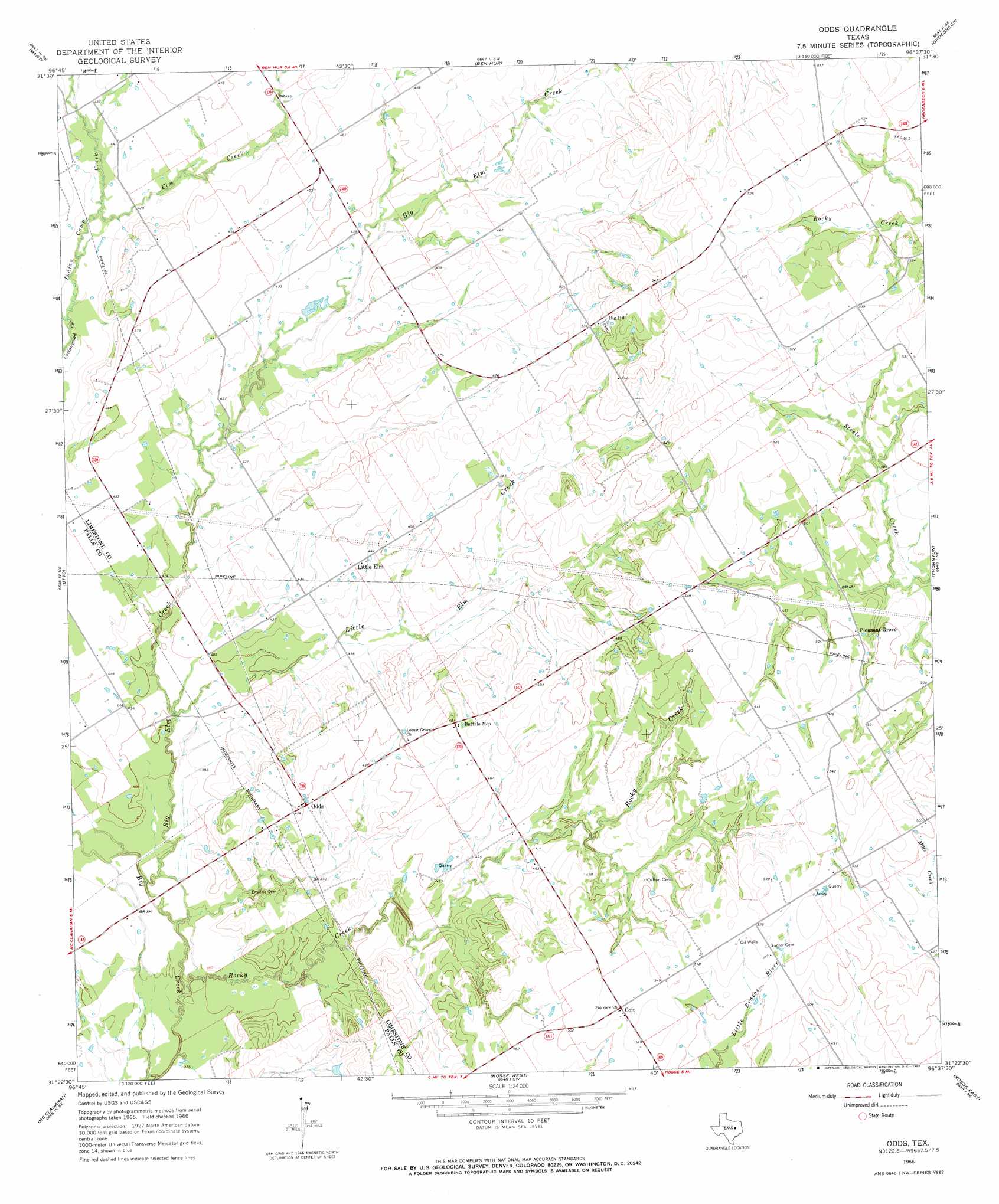
USGS Topo Quad 31096d6 - 1:24,000 scale
| Topo Map Name: | Odds |
| USGS Topo Quad ID: | 31096d6 |
| Print Size: | ca. 21 1/4" wide x 27" high |
| Southeast Coordinates: | 31.375° N latitude / 96.625° W longitude |
| Map Center Coordinates: | 31.4375° N latitude / 96.6875° W longitude |
| U.S. State: | TX |
| Filename: | o31096d6.jpg |
| Download Map JPG Image: | Odds topo map 1:24,000 scale |
| Map Type: | Topographic |
| Topo Series: | 7.5´ |
| Map Scale: | 1:24,000 |
| Source of Map Images: | United States Geological Survey (USGS) |
| Alternate Map Versions: |
Odds TX 1966, updated 1969 Download PDF Buy paper map Odds TX 2010 Download PDF Buy paper map Odds TX 2013 Download PDF Buy paper map Odds TX 2016 Download PDF Buy paper map |
1:24,000 Topo Quads surrounding Odds
Axtell |
Prairie Hill |
Echols |
Tehuacana |
Mexia |
Elk |
Mart |
Ben Hur |
Groesbeck |
Fallon |
Riesel |
Otto |
Odds |
Thornton |
Box Church |
Marlin |
Mcclanahan |
Kosse West |
Kosse East |
Oletha |
Cedar Springs |
Reagan |
Bremond |
Petteway |
Bald Prairie |
> Back to 31096a1 at 1:100,000 scale
> Back to 31096a1 at 1:250,000 scale
> Back to U.S. Topo Maps home
Odds topo map: Gazetteer
Odds: Populated Places
Big Hill elevation 162m 531′Buffalo Mop elevation 148m 485′
Coit elevation 157m 515′
Little Elm elevation 135m 442′
Odds elevation 135m 442′
Pleasant Grove elevation 152m 498′
Odds: Streams
Big Elm Creek elevation 113m 370′Elm Creek elevation 128m 419′
Indian Camp Creek elevation 127m 416′
Little Elm Creek elevation 119m 390′
Rocky Creek elevation 113m 370′
Odds digital topo map on disk
Buy this Odds topo map showing relief, roads, GPS coordinates and other geographical features, as a high-resolution digital map file on DVD: