Otto Topo Map Texas
To zoom in, hover over the map of Otto
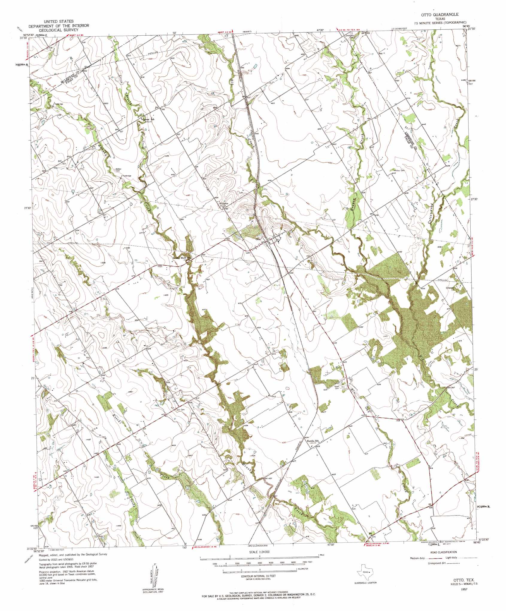
USGS Topo Quad 31096d7 - 1:24,000 scale
| Topo Map Name: | Otto |
| USGS Topo Quad ID: | 31096d7 |
| Print Size: | ca. 21 1/4" wide x 27" high |
| Southeast Coordinates: | 31.375° N latitude / 96.75° W longitude |
| Map Center Coordinates: | 31.4375° N latitude / 96.8125° W longitude |
| U.S. State: | TX |
| Filename: | o31096d7.jpg |
| Download Map JPG Image: | Otto topo map 1:24,000 scale |
| Map Type: | Topographic |
| Topo Series: | 7.5´ |
| Map Scale: | 1:24,000 |
| Source of Map Images: | United States Geological Survey (USGS) |
| Alternate Map Versions: |
Otto TX 1957, updated 1958 Download PDF Buy paper map Otto TX 2010 Download PDF Buy paper map Otto TX 2013 Download PDF Buy paper map Otto TX 2016 Download PDF Buy paper map |
1:24,000 Topo Quads surrounding Otto
Elm Mott |
Axtell |
Prairie Hill |
Echols |
Tehuacana |
Waco East |
Elk |
Mart |
Ben Hur |
Groesbeck |
Robinson |
Riesel |
Otto |
Odds |
Thornton |
Chilton |
Marlin |
Mcclanahan |
Kosse West |
Kosse East |
Lott |
Cedar Springs |
Reagan |
Bremond |
Petteway |
> Back to 31096a1 at 1:100,000 scale
> Back to 31096a1 at 1:250,000 scale
> Back to U.S. Topo Maps home
Otto topo map: Gazetteer
Otto: Populated Places
Otto elevation 142m 465′Otto: Streams
Cottonwood Creek elevation 116m 380′Hogpen Creek elevation 119m 390′
Little Brushy Creek elevation 137m 449′
Otto digital topo map on disk
Buy this Otto topo map showing relief, roads, GPS coordinates and other geographical features, as a high-resolution digital map file on DVD: