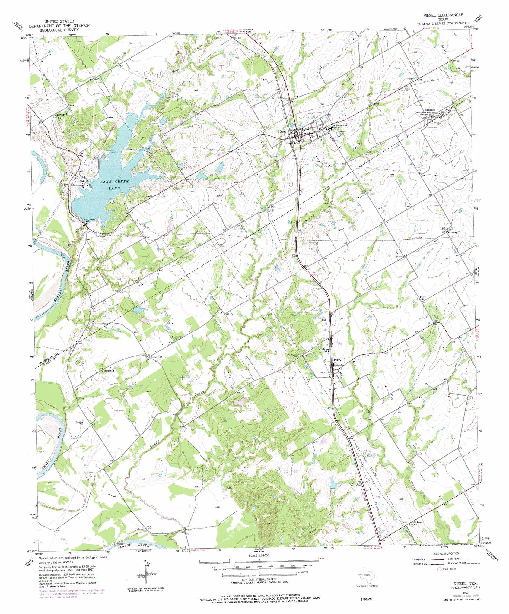
Riesel Topo Map Texas
To zoom in, hover over the map of Riesel
USGS Topo Quad 31096d8 - 1:24,000 scale
| Topo Map Name: | Riesel |
| USGS Topo Quad ID: | 31096d8 |
| Print Size: | ca. 21 1/4" wide x 27" high |
| Southeast Coordinates: | 31.375° N latitude / 96.875° W longitude |
| Map Center Coordinates: | 31.4375° N latitude / 96.9375° W longitude |
| U.S. State: | TX |
| Filename: | o31096d8.jpg |
| Download Map JPG Image: | Riesel topo map 1:24,000 scale |
| Map Type: | Topographic |
| Topo Series: | 7.5´ |
| Map Scale: | 1:24,000 |
| Source of Map Images: | United States Geological Survey (USGS) |
| Alternate Map Versions: |
Riesel TX 1957, updated 1958 Download PDF Buy paper map Riesel TX 1957, updated 1958 Download PDF Buy paper map Riesel TX 1957, updated 1978 Download PDF Buy paper map Riesel TX 2010 Download PDF Buy paper map Riesel TX 2013 Download PDF Buy paper map Riesel TX 2016 Download PDF Buy paper map |
1:24,000 Topo Quads surrounding Riesel
Gholson |
Elm Mott |
Axtell |
Prairie Hill |
Echols |
Waco West |
Waco East |
Elk |
Mart |
Ben Hur |
Lorena |
Robinson |
Riesel |
Otto |
Odds |
Bruceville |
Chilton |
Marlin |
Mcclanahan |
Kosse West |
Belfalls |
Lott |
Cedar Springs |
Reagan |
Bremond |
> Back to 31096a1 at 1:100,000 scale
> Back to 31096a1 at 1:250,000 scale
> Back to U.S. Topo Maps home
Riesel topo map: Gazetteer
Riesel: Dams
Able Lake Dam elevation 127m 416′Hesse Lake Dam elevation 142m 465′
Lake Creek Dam elevation 125m 410′
Mann Lake Dam elevation 129m 423′
Texas No Name Number 11 Dam elevation 127m 416′
Riesel: Populated Places
Blackland elevation 171m 561′Perry elevation 144m 472′
Riesel elevation 154m 505′
Riesel: Reservoirs
Able Lake elevation 127m 416′Hesse Lake elevation 142m 465′
Lake Creek Lake elevation 124m 406′
Mann Lake elevation 129m 423′
Riesel: Streams
Manos Creek elevation 111m 364′Riesel digital topo map on disk
Buy this Riesel topo map showing relief, roads, GPS coordinates and other geographical features, as a high-resolution digital map file on DVD: