Fallon Topo Map Texas
To zoom in, hover over the map of Fallon
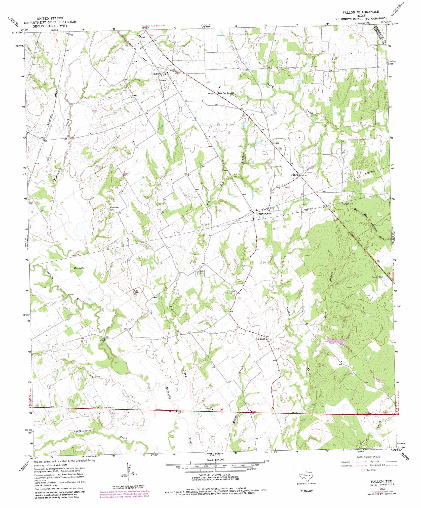
USGS Topo Quad 31096e4 - 1:24,000 scale
| Topo Map Name: | Fallon |
| USGS Topo Quad ID: | 31096e4 |
| Print Size: | ca. 21 1/4" wide x 27" high |
| Southeast Coordinates: | 31.5° N latitude / 96.375° W longitude |
| Map Center Coordinates: | 31.5625° N latitude / 96.4375° W longitude |
| U.S. State: | TX |
| Filename: | o31096e4.jpg |
| Download Map JPG Image: | Fallon topo map 1:24,000 scale |
| Map Type: | Topographic |
| Topo Series: | 7.5´ |
| Map Scale: | 1:24,000 |
| Source of Map Images: | United States Geological Survey (USGS) |
| Alternate Map Versions: |
Fallon TX 1966, updated 1969 Download PDF Buy paper map Fallon TX 1966, updated 1983 Download PDF Buy paper map Fallon TX 2010 Download PDF Buy paper map Fallon TX 2013 Download PDF Buy paper map Fallon TX 2016 Download PDF Buy paper map |
1:24,000 Topo Quads surrounding Fallon
Coolidge |
Union High |
Wortham |
Kirvin |
Stewards Mill |
Echols |
Tehuacana |
Mexia |
Teague North |
Fairfield |
Ben Hur |
Groesbeck |
Fallon |
Teague South |
Dew |
Odds |
Thornton |
Box Church |
Farrar |
Donie |
Kosse West |
Kosse East |
Oletha |
Round Prairie |
Jewett |
> Back to 31096e1 at 1:100,000 scale
> Back to 31096a1 at 1:250,000 scale
> Back to U.S. Topo Maps home
Fallon topo map: Gazetteer
Fallon: Bridges
Long Bridge elevation 118m 387′Fallon: Dams
Duke Lake Dam elevation 138m 452′Fallon: Lakes
Duck Pond elevation 146m 479′Moss Lake elevation 118m 387′
Fallon: Populated Places
Center elevation 131m 429′Fallon elevation 155m 508′
LaSalle elevation 140m 459′
Prairie Grove elevation 150m 492′
Shiloh elevation 145m 475′
Fallon: Reservoirs
Duke Lake elevation 138m 452′Fallon: Streams
Pin Oak Creek elevation 113m 370′Plummers Creek elevation 117m 383′
Sand Branch elevation 123m 403′
Fallon: Summits
Morgan Hill elevation 174m 570′Fallon digital topo map on disk
Buy this Fallon topo map showing relief, roads, GPS coordinates and other geographical features, as a high-resolution digital map file on DVD: