Fairfield Topo Map Texas
To zoom in, hover over the map of Fairfield
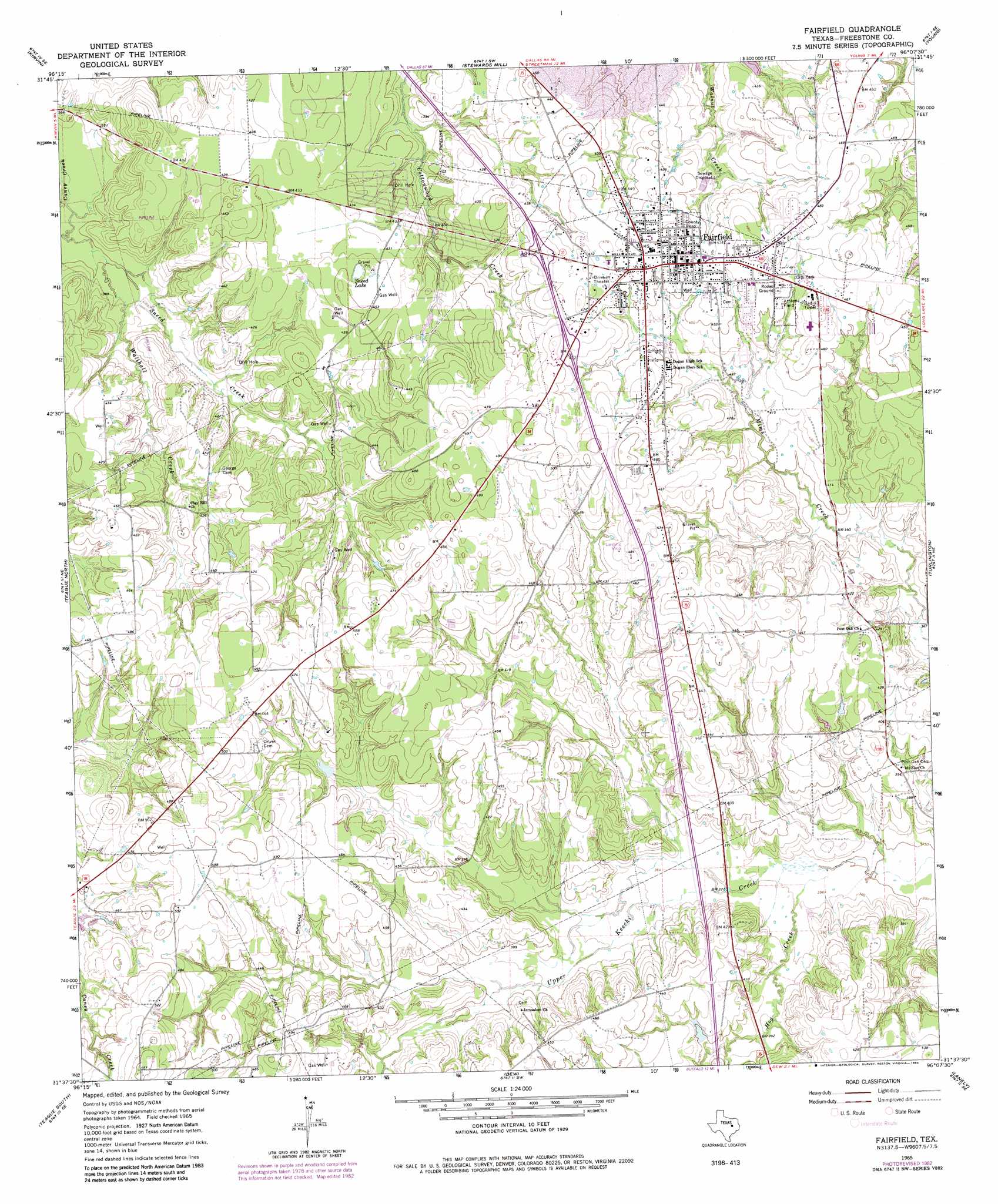
USGS Topo Quad 31096f2 - 1:24,000 scale
| Topo Map Name: | Fairfield |
| USGS Topo Quad ID: | 31096f2 |
| Print Size: | ca. 21 1/4" wide x 27" high |
| Southeast Coordinates: | 31.625° N latitude / 96.125° W longitude |
| Map Center Coordinates: | 31.6875° N latitude / 96.1875° W longitude |
| U.S. State: | TX |
| Filename: | o31096f2.jpg |
| Download Map JPG Image: | Fairfield topo map 1:24,000 scale |
| Map Type: | Topographic |
| Topo Series: | 7.5´ |
| Map Scale: | 1:24,000 |
| Source of Map Images: | United States Geological Survey (USGS) |
| Alternate Map Versions: |
Fairfield TX 1965, updated 1968 Download PDF Buy paper map Fairfield TX 1965, updated 1983 Download PDF Buy paper map Fairfield TX 2010 Download PDF Buy paper map Fairfield TX 2013 Download PDF Buy paper map Fairfield TX 2016 Download PDF Buy paper map |
1:24,000 Topo Quads surrounding Fairfield
Richland |
Streetman |
Winkler |
Roustabout Camp |
Cayuga |
Wortham |
Kirvin |
Stewards Mill |
Young |
Yard |
Mexia |
Teague North |
Fairfield |
Turlington |
Butler |
Fallon |
Teague South |
Dew |
Lanely |
Keechi |
Box Church |
Farrar |
Donie |
Buffalo |
Flo |
> Back to 31096e1 at 1:100,000 scale
> Back to 31096a1 at 1:250,000 scale
> Back to U.S. Topo Maps home
Fairfield topo map: Gazetteer
Fairfield: Lakes
Sneed Lake elevation 134m 439′Fairfield: Parks
Fairfield Arena elevation 142m 465′Fairfield: Populated Places
Fairfield elevation 141m 462′Fairfield: Streams
Hog Creek elevation 107m 351′Sneed Creek elevation 104m 341′
Walthall Creek elevation 107m 351′
Fairfield digital topo map on disk
Buy this Fairfield topo map showing relief, roads, GPS coordinates and other geographical features, as a high-resolution digital map file on DVD: