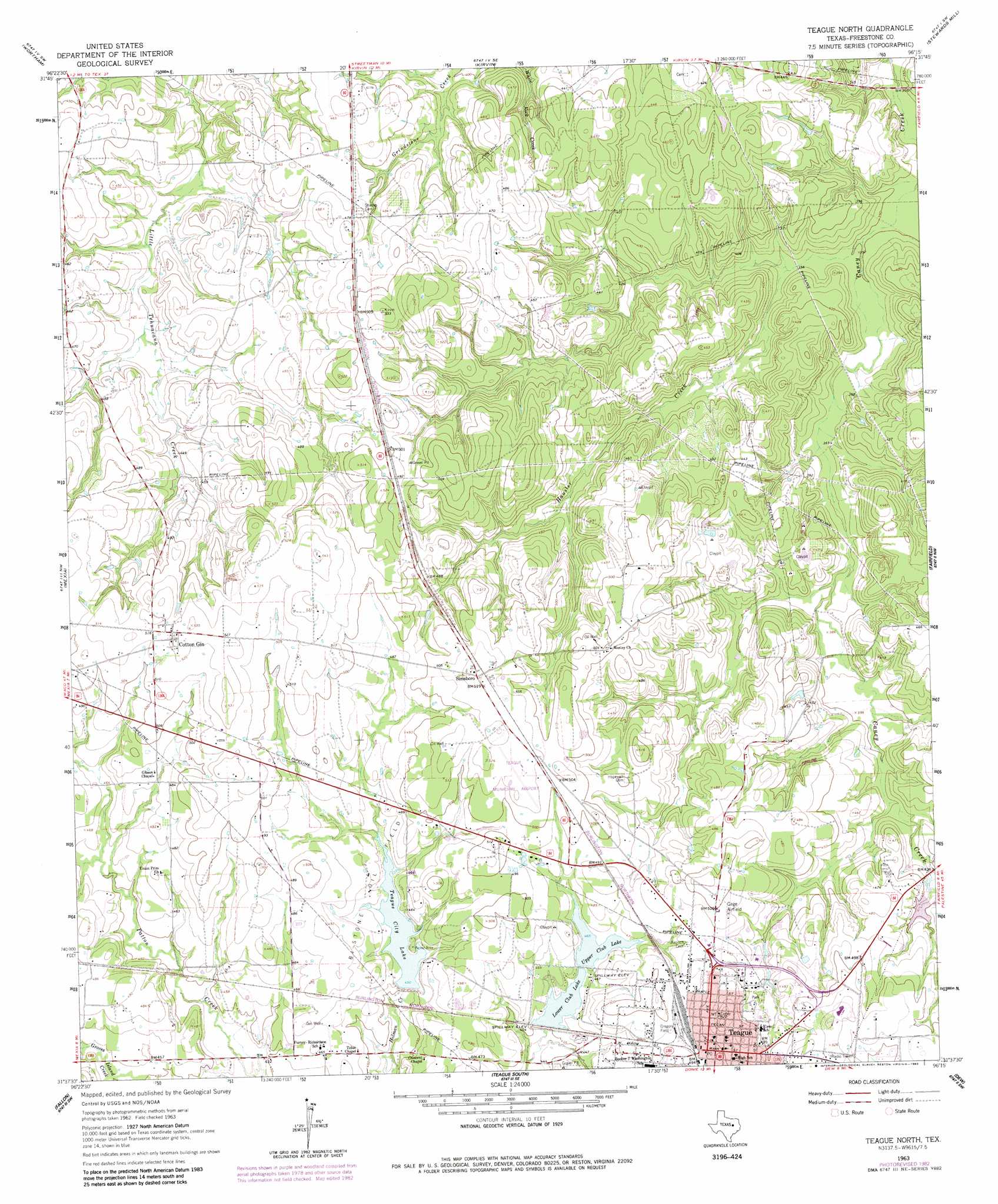
Teague North Topo Map Texas
To zoom in, hover over the map of Teague North
USGS Topo Quad 31096f3 - 1:24,000 scale
| Topo Map Name: | Teague North |
| USGS Topo Quad ID: | 31096f3 |
| Print Size: | ca. 21 1/4" wide x 27" high |
| Southeast Coordinates: | 31.625° N latitude / 96.25° W longitude |
| Map Center Coordinates: | 31.6875° N latitude / 96.3125° W longitude |
| U.S. State: | TX |
| Filename: | o31096f3.jpg |
| Download Map JPG Image: | Teague North topo map 1:24,000 scale |
| Map Type: | Topographic |
| Topo Series: | 7.5´ |
| Map Scale: | 1:24,000 |
| Source of Map Images: | United States Geological Survey (USGS) |
| Alternate Map Versions: |
Teague North TX 1963, updated 1966 Download PDF Buy paper map Teague North TX 1963, updated 1983 Download PDF Buy paper map Teague North TX 2010 Download PDF Buy paper map Teague North TX 2013 Download PDF Buy paper map Teague North TX 2016 Download PDF Buy paper map |
1:24,000 Topo Quads surrounding Teague North
Purdon |
Richland |
Streetman |
Winkler |
Roustabout Camp |
Union High |
Wortham |
Kirvin |
Stewards Mill |
Young |
Tehuacana |
Mexia |
Teague North |
Fairfield |
Turlington |
Groesbeck |
Fallon |
Teague South |
Dew |
Lanely |
Thornton |
Box Church |
Farrar |
Donie |
Buffalo |
> Back to 31096e1 at 1:100,000 scale
> Back to 31096a1 at 1:250,000 scale
> Back to U.S. Topo Maps home
Teague North topo map: Gazetteer
Teague North: Airports
Teague Municipal Airport elevation 157m 515′Teague North: Dams
City Lake Dam elevation 134m 439′Jones Lake Dam elevation 141m 462′
Lower Club Lake Dam elevation 137m 449′
Upper Club Lake Dam elevation 142m 465′
Teague North: Oilfields
Bi-Stone Oil Field elevation 144m 472′Teague North: Parks
Gregory Field elevation 150m 492′Teague North: Populated Places
Cotton Gin elevation 159m 521′Simsboro elevation 159m 521′
Teague elevation 151m 495′
Teague North: Reservoirs
City Lake elevation 134m 439′Jones Lake elevation 141m 462′
Lower Club Lake elevation 140m 459′
Teague City Lake elevation 137m 449′
Upper Club Lake elevation 142m 465′
Teague North: Streams
Hausler Creek elevation 106m 347′Teague North digital topo map on disk
Buy this Teague North topo map showing relief, roads, GPS coordinates and other geographical features, as a high-resolution digital map file on DVD: