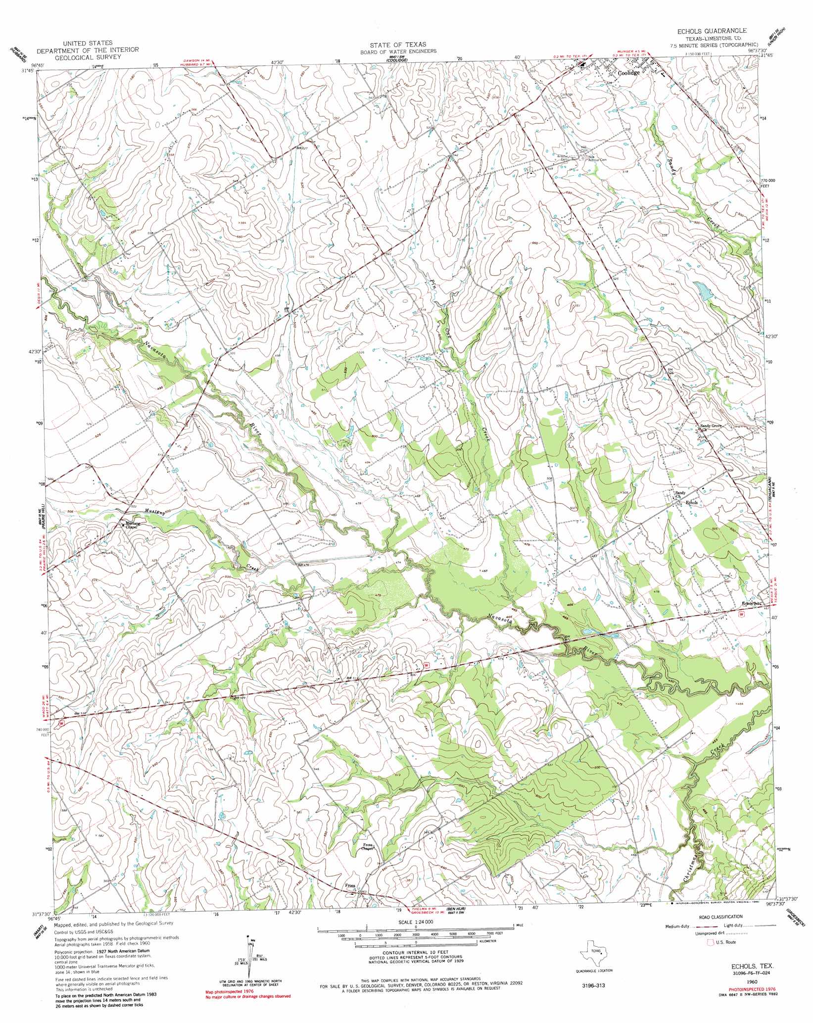
Echols Topo Map Texas
To zoom in, hover over the map of Echols
USGS Topo Quad 31096f6 - 1:24,000 scale
| Topo Map Name: | Echols |
| USGS Topo Quad ID: | 31096f6 |
| Print Size: | ca. 21 1/4" wide x 27" high |
| Southeast Coordinates: | 31.625° N latitude / 96.625° W longitude |
| Map Center Coordinates: | 31.6875° N latitude / 96.6875° W longitude |
| U.S. State: | TX |
| Filename: | o31096f6.jpg |
| Download Map JPG Image: | Echols topo map 1:24,000 scale |
| Map Type: | Topographic |
| Topo Series: | 7.5´ |
| Map Scale: | 1:24,000 |
| Source of Map Images: | United States Geological Survey (USGS) |
| Alternate Map Versions: |
Echols TX 1960, updated 1961 Download PDF Buy paper map Echols TX 1960, updated 1985 Download PDF Buy paper map Echols TX 2010 Download PDF Buy paper map Echols TX 2013 Download PDF Buy paper map Echols TX 2016 Download PDF Buy paper map |
1:24,000 Topo Quads surrounding Echols
Malone |
Irene |
Dawson |
Purdon |
Richland |
Penelope |
Hubbard |
Coolidge |
Union High |
Wortham |
Axtell |
Prairie Hill |
Echols |
Tehuacana |
Mexia |
Elk |
Mart |
Ben Hur |
Groesbeck |
Fallon |
Riesel |
Otto |
Odds |
Thornton |
Box Church |
> Back to 31096e1 at 1:100,000 scale
> Back to 31096a1 at 1:250,000 scale
> Back to U.S. Topo Maps home
Echols topo map: Gazetteer
Echols: Populated Places
Echols elevation 158m 518′Frosa elevation 172m 564′
Mustang elevation 155m 508′
Sandy elevation 156m 511′
Echols: Streams
Mustang Creek elevation 143m 469′Pin Oak Creek elevation 140m 459′
Echols digital topo map on disk
Buy this Echols topo map showing relief, roads, GPS coordinates and other geographical features, as a high-resolution digital map file on DVD: