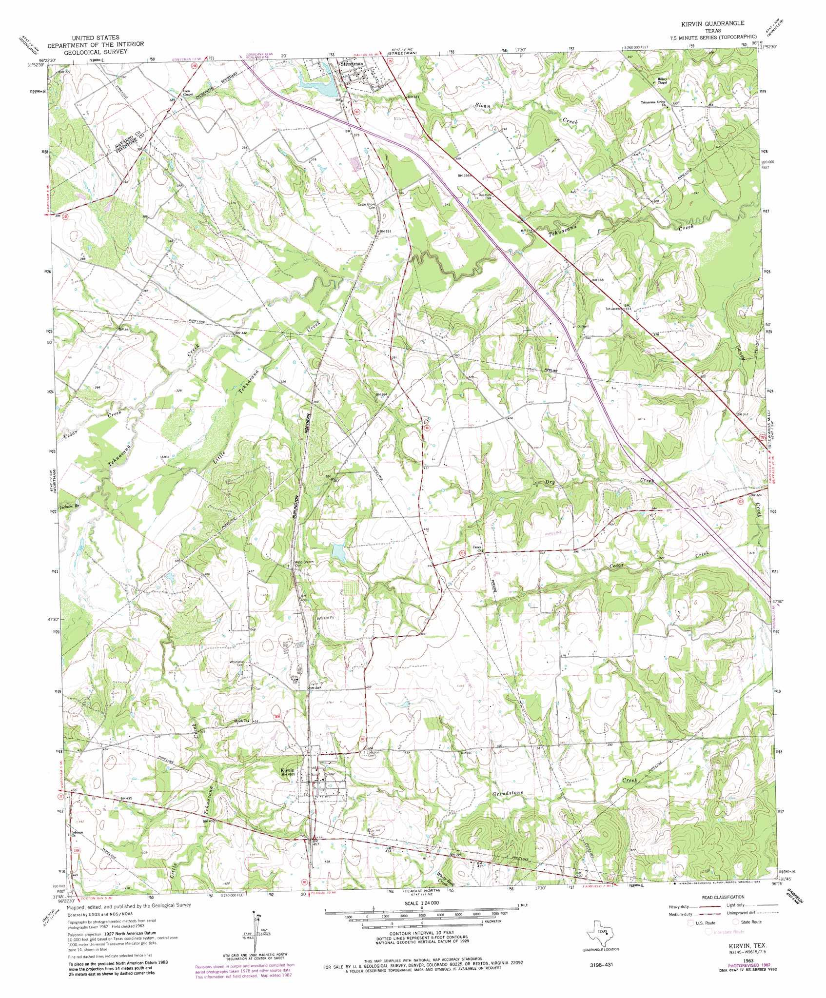
Kirvin Topo Map Texas
To zoom in, hover over the map of Kirvin
USGS Topo Quad 31096g3 - 1:24,000 scale
| Topo Map Name: | Kirvin |
| USGS Topo Quad ID: | 31096g3 |
| Print Size: | ca. 21 1/4" wide x 27" high |
| Southeast Coordinates: | 31.75° N latitude / 96.25° W longitude |
| Map Center Coordinates: | 31.8125° N latitude / 96.3125° W longitude |
| U.S. State: | TX |
| Filename: | o31096g3.jpg |
| Download Map JPG Image: | Kirvin topo map 1:24,000 scale |
| Map Type: | Topographic |
| Topo Series: | 7.5´ |
| Map Scale: | 1:24,000 |
| Source of Map Images: | United States Geological Survey (USGS) |
| Alternate Map Versions: |
Kirvin TX 1963, updated 1966 Download PDF Buy paper map Kirvin TX 1963, updated 1983 Download PDF Buy paper map Kirvin TX 2010 Download PDF Buy paper map Kirvin TX 2013 Download PDF Buy paper map Kirvin TX 2016 Download PDF Buy paper map |
1:24,000 Topo Quads surrounding Kirvin
Corbet |
Corsicana |
Powell |
Goodlow Park |
Creslenn Ranch |
Purdon |
Richland |
Streetman |
Winkler |
Roustabout Camp |
Union High |
Wortham |
Kirvin |
Stewards Mill |
Young |
Tehuacana |
Mexia |
Teague North |
Fairfield |
Turlington |
Groesbeck |
Fallon |
Teague South |
Dew |
Lanely |
> Back to 31096e1 at 1:100,000 scale
> Back to 31096a1 at 1:250,000 scale
> Back to U.S. Topo Maps home
Kirvin topo map: Gazetteer
Kirvin: Dams
Loper Lake Dam elevation 117m 383′Streetman Lake Dam elevation 111m 364′
Kirvin: Populated Places
Kirvin elevation 141m 462′Kirvin: Reservoirs
Loper Lake elevation 117m 383′Streetman Lake elevation 111m 364′
Kirvin: Streams
Cedar Creek elevation 101m 331′Cedar Creek elevation 95m 311′
Dry Creek elevation 93m 305′
Jackson Branch elevation 102m 334′
Little Tehuacana Creek elevation 96m 314′
Sloan Creek elevation 88m 288′
White Rock Creek elevation 119m 390′
Kirvin digital topo map on disk
Buy this Kirvin topo map showing relief, roads, GPS coordinates and other geographical features, as a high-resolution digital map file on DVD: