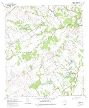
Purdon Topo Map Texas
To zoom in, hover over the map of Purdon
USGS Topo Quad 31096h5 - 1:24,000 scale
| Topo Map Name: | Purdon |
| USGS Topo Quad ID: | 31096h5 |
| Print Size: | ca. 21 1/4" wide x 27" high |
| Southeast Coordinates: | 31.875° N latitude / 96.5° W longitude |
| Map Center Coordinates: | 31.9375° N latitude / 96.5625° W longitude |
| U.S. State: | TX |
| Filename: | o31096h5.jpg |
| Download Map JPG Image: | Purdon topo map 1:24,000 scale |
| Map Type: | Topographic |
| Topo Series: | 7.5´ |
| Map Scale: | 1:24,000 |
| Source of Map Images: | United States Geological Survey (USGS) |
| Alternate Map Versions: |
Purdon TX 1965, updated 1967 Download PDF Buy paper map Purdon TX 1965, updated 1978 Download PDF Buy paper map Purdon TX 2010 Download PDF Buy paper map Purdon TX 2013 Download PDF Buy paper map Purdon TX 2016 Download PDF Buy paper map |
1:24,000 Topo Quads surrounding Purdon
> Back to 31096e1 at 1:100,000 scale
> Back to 31096a1 at 1:250,000 scale
> Back to U.S. Topo Maps home
Purdon topo map: Gazetteer
Purdon: Airports
Rainbow Field elevation 134m 439′Purdon: Dams
Carroll Lake Dam elevation 111m 364′Dam Number 129 elevation 125m 410′
Dam Number 32 elevation 124m 406′
Dam Number 33 elevation 115m 377′
Dam Number 34 elevation 114m 374′
Dam Number 35 elevation 115m 377′
Soil Conservation Service Site 115 Dam elevation 124m 406′
Soil Conservation Service Site 116 Dam elevation 125m 410′
Soil Conservation Service Site 118 Dam elevation 112m 367′
Soil Conservation Service Site 129 Dam elevation 120m 393′
Soil Conservation Service Site 32 Dam elevation 122m 400′
Soil Conservation Service Site 33 Dam elevation 116m 380′
Soil Conservation Service Site 34 Dam elevation 112m 367′
Soil Conservation Service Site 35 Dam elevation 113m 370′
Purdon: Populated Places
Purdon elevation 121m 396′Pursley elevation 139m 456′
Purdon: Reservoirs
Carroll Lake elevation 111m 364′Soil Conservation Service Site 115 Reservoir elevation 124m 406′
Soil Conservation Service Site 116 Reservoir elevation 125m 410′
Soil Conservation Service Site 118 Reservoir elevation 112m 367′
Soil Conservation Service Site 129 Reservoir elevation 120m 393′
Soil Conservation Service Site 32 Reservoir elevation 122m 400′
Soil Conservation Service Site 33 Reservoir elevation 116m 380′
Soil Conservation Service Site 34 Reservoir elevation 112m 367′
Soil Conservation Service Site 35 Reservoir elevation 113m 370′
Purdon: Streams
Battle Creek elevation 110m 360′Board Creek elevation 106m 347′
Briar Creek elevation 102m 334′
Cedar Creek elevation 102m 334′
Hughes Branch elevation 110m 360′
Melton Branch elevation 104m 341′
Rush Creek elevation 103m 337′
Purdon digital topo map on disk
Buy this Purdon topo map showing relief, roads, GPS coordinates and other geographical features, as a high-resolution digital map file on DVD:


