Seaton Topo Map Texas
To zoom in, hover over the map of Seaton
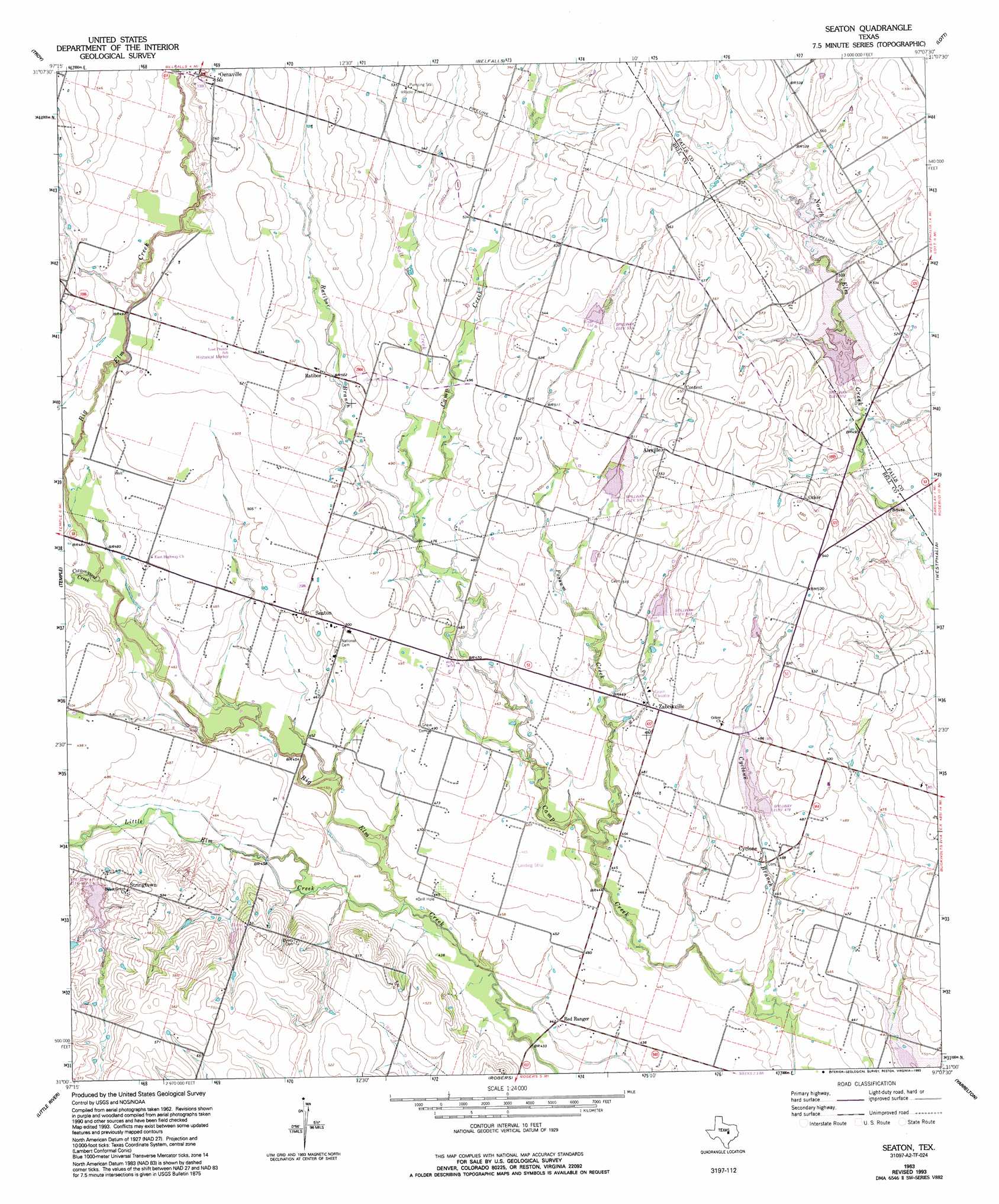
USGS Topo Quad 31097a2 - 1:24,000 scale
| Topo Map Name: | Seaton |
| USGS Topo Quad ID: | 31097a2 |
| Print Size: | ca. 21 1/4" wide x 27" high |
| Southeast Coordinates: | 31° N latitude / 97.125° W longitude |
| Map Center Coordinates: | 31.0625° N latitude / 97.1875° W longitude |
| U.S. State: | TX |
| Filename: | o31097a2.jpg |
| Download Map JPG Image: | Seaton topo map 1:24,000 scale |
| Map Type: | Topographic |
| Topo Series: | 7.5´ |
| Map Scale: | 1:24,000 |
| Source of Map Images: | United States Geological Survey (USGS) |
| Alternate Map Versions: |
Seaton TX 1963, updated 1965 Download PDF Buy paper map Seaton TX 1963, updated 1992 Download PDF Buy paper map Seaton TX 1963, updated 1993 Download PDF Buy paper map Seaton TX 2010 Download PDF Buy paper map Seaton TX 2012 Download PDF Buy paper map Seaton TX 2016 Download PDF Buy paper map |
1:24,000 Topo Quads surrounding Seaton
Eagle Springs |
Moody |
Bruceville |
Chilton |
Marlin |
Moffat |
Troy |
Belfalls |
Lott |
Cedar Springs |
Belton |
Temple |
Seaton |
Westphalia |
Rosebud |
Holland |
Little River |
Rogers |
Yarrelton |
Ben Arnold |
Bartlett |
Davilla |
Sharp |
Pettibone |
Cameron |
> Back to 31097a1 at 1:100,000 scale
> Back to 31096a1 at 1:250,000 scale
> Back to U.S. Topo Maps home
Seaton topo map: Gazetteer
Seaton: Airports
Lesikar Farms Airport elevation 142m 465′Seaton: Dams
Marek Lake Dam elevation 156m 511′Seaton: Populated Places
Airville elevation 166m 544′Cyclone elevation 141m 462′
Ocker elevation 163m 534′
Ratibor elevation 154m 505′
Red Ranger elevation 134m 439′
Seaton elevation 152m 498′
Stringtown elevation 168m 551′
Zabcikville elevation 150m 492′
Seaton: Reservoirs
Marek Lake elevation 156m 511′Seaton: Streams
Cottonwood Creek elevation 143m 469′Cyclone Branch elevation 128m 419′
Little Elm Creek elevation 134m 439′
Pecan Creek elevation 155m 508′
Possum Creek elevation 131m 429′
Ratibor Branch elevation 144m 472′
Salt Creek elevation 143m 469′
Seaton digital topo map on disk
Buy this Seaton topo map showing relief, roads, GPS coordinates and other geographical features, as a high-resolution digital map file on DVD: