Mcgregor Topo Map Texas
To zoom in, hover over the map of Mcgregor
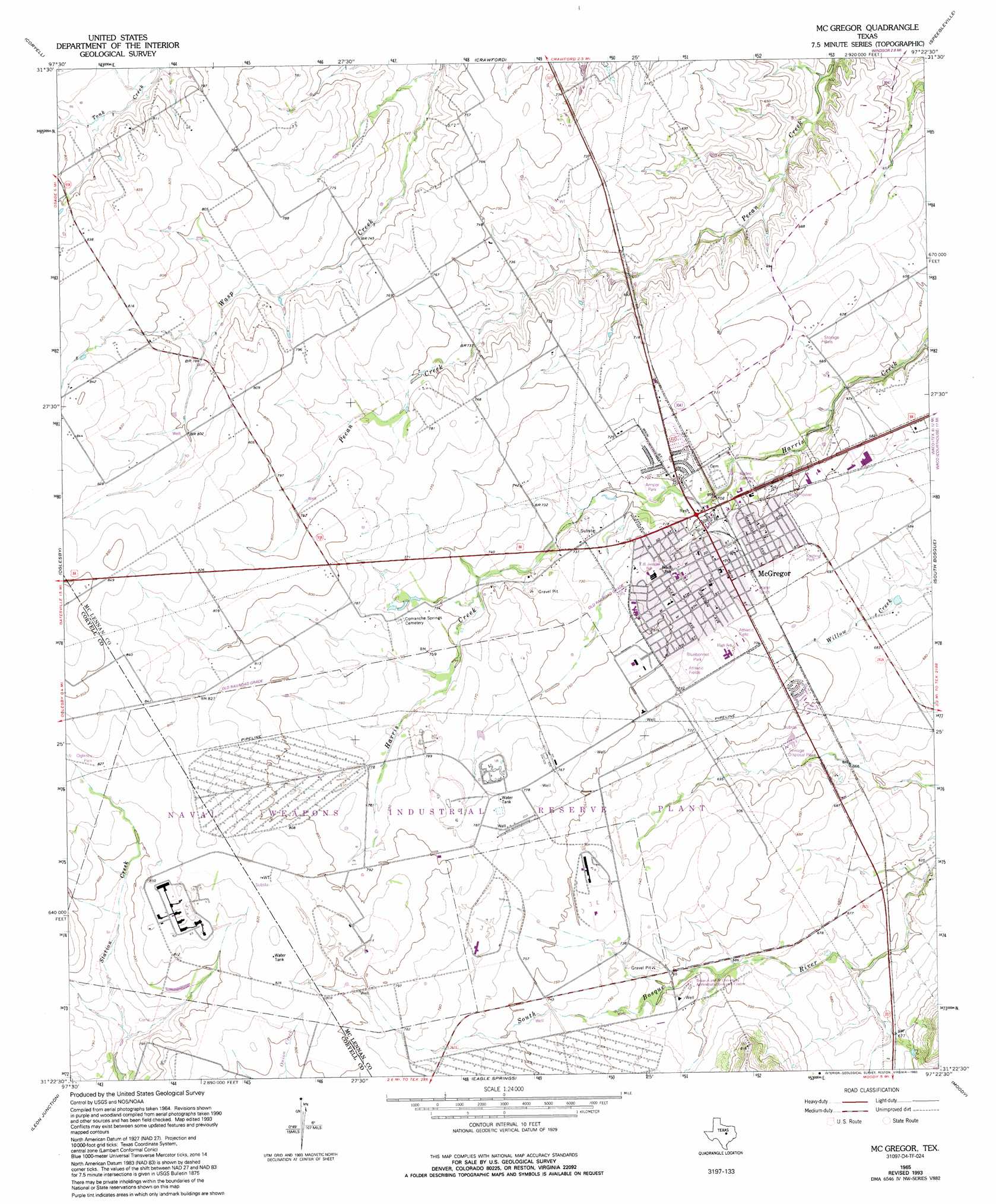
USGS Topo Quad 31097d4 - 1:24,000 scale
| Topo Map Name: | Mcgregor |
| USGS Topo Quad ID: | 31097d4 |
| Print Size: | ca. 21 1/4" wide x 27" high |
| Southeast Coordinates: | 31.375° N latitude / 97.375° W longitude |
| Map Center Coordinates: | 31.4375° N latitude / 97.4375° W longitude |
| U.S. State: | TX |
| Filename: | o31097d4.jpg |
| Download Map JPG Image: | Mcgregor topo map 1:24,000 scale |
| Map Type: | Topographic |
| Topo Series: | 7.5´ |
| Map Scale: | 1:24,000 |
| Source of Map Images: | United States Geological Survey (USGS) |
| Alternate Map Versions: |
McGregor TX 1965, updated 1969 Download PDF Buy paper map McGregor TX 1965, updated 1993 Download PDF Buy paper map McGregor TX 2010 Download PDF Buy paper map McGregor TX 2012 Download PDF Buy paper map McGregor TX 2016 Download PDF Buy paper map |
1:24,000 Topo Quads surrounding Mcgregor
Hurst Spring |
Mosheim |
Valley Mills |
China Springs |
Gholson |
Turnersville |
Coryell |
Crawford |
Speegleville |
Waco West |
Gatesville East |
Oglesby |
Mcgregor |
South Bosque |
Lorena |
North Fort Hood |
Leon Junction |
Eagle Springs |
Moody |
Bruceville |
Post Oak Mountain |
Bland |
Moffat |
Troy |
Belfalls |
> Back to 31097a1 at 1:100,000 scale
> Back to 31096a1 at 1:250,000 scale
> Back to U.S. Topo Maps home
Mcgregor topo map: Gazetteer
Mcgregor: Parks
Amsler Park elevation 212m 695′Bluebonnet Park elevation 223m 731′
Kasting Park elevation 216m 708′
Oglesby Park elevation 252m 826′
Mcgregor: Populated Places
McGregor elevation 211m 692′Mcgregor digital topo map on disk
Buy this Mcgregor topo map showing relief, roads, GPS coordinates and other geographical features, as a high-resolution digital map file on DVD: