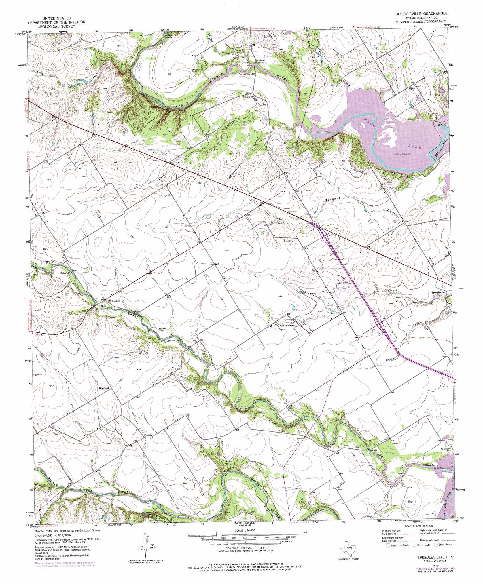
Speegleville Topo Map Texas
To zoom in, hover over the map of Speegleville
USGS Topo Quad 31097e3 - 1:24,000 scale
| Topo Map Name: | Speegleville |
| USGS Topo Quad ID: | 31097e3 |
| Print Size: | ca. 21 1/4" wide x 27" high |
| Southeast Coordinates: | 31.5° N latitude / 97.25° W longitude |
| Map Center Coordinates: | 31.5625° N latitude / 97.3125° W longitude |
| U.S. State: | TX |
| Filename: | o31097e3.jpg |
| Download Map JPG Image: | Speegleville topo map 1:24,000 scale |
| Map Type: | Topographic |
| Topo Series: | 7.5´ |
| Map Scale: | 1:24,000 |
| Source of Map Images: | United States Geological Survey (USGS) |
| Alternate Map Versions: |
Speegleville TX 1957, updated 1957 Download PDF Buy paper map Speegleville TX 1957, updated 1968 Download PDF Buy paper map Speegleville TX 1957, updated 1971 Download PDF Buy paper map Speegleville TX 1957, updated 1977 Download PDF Buy paper map Speegleville TX 2010 Download PDF Buy paper map Speegleville TX 2012 Download PDF Buy paper map Speegleville TX 2016 Download PDF Buy paper map |
1:24,000 Topo Quads surrounding Speegleville
Clifton |
Laguna Park |
Smiths Bend |
Aquilla |
West |
Mosheim |
Valley Mills |
China Springs |
Gholson |
Elm Mott |
Coryell |
Crawford |
Speegleville |
Waco West |
Waco East |
Oglesby |
Mcgregor |
South Bosque |
Lorena |
Robinson |
Leon Junction |
Eagle Springs |
Moody |
Bruceville |
Chilton |
> Back to 31097e1 at 1:100,000 scale
> Back to 31096a1 at 1:250,000 scale
> Back to U.S. Topo Maps home
Speegleville topo map: Gazetteer
Speegleville: Airports
Scott Airport elevation 177m 580′Speegleville: Parks
Cougar Stadium elevation 167m 547′Speegleville: Populated Places
Caldwell Crossing elevation 142m 465′Eichelberger Crossing elevation 140m 459′
Highland elevation 191m 626′
Ocee elevation 175m 574′
Speegleville elevation 140m 459′
Willow Grove elevation 171m 561′
Windsor elevation 178m 583′
Speegleville: Streams
Davis Branch elevation 140m 459′Hog Creek elevation 139m 456′
Live Oak Creek elevation 139m 456′
Long Branch elevation 140m 459′
Pecan Creek elevation 163m 534′
Schoolhouse Branch elevation 141m 462′
Spring Branch elevation 140m 459′
Speegleville digital topo map on disk
Buy this Speegleville topo map showing relief, roads, GPS coordinates and other geographical features, as a high-resolution digital map file on DVD: