Kempner Topo Map Texas
To zoom in, hover over the map of Kempner
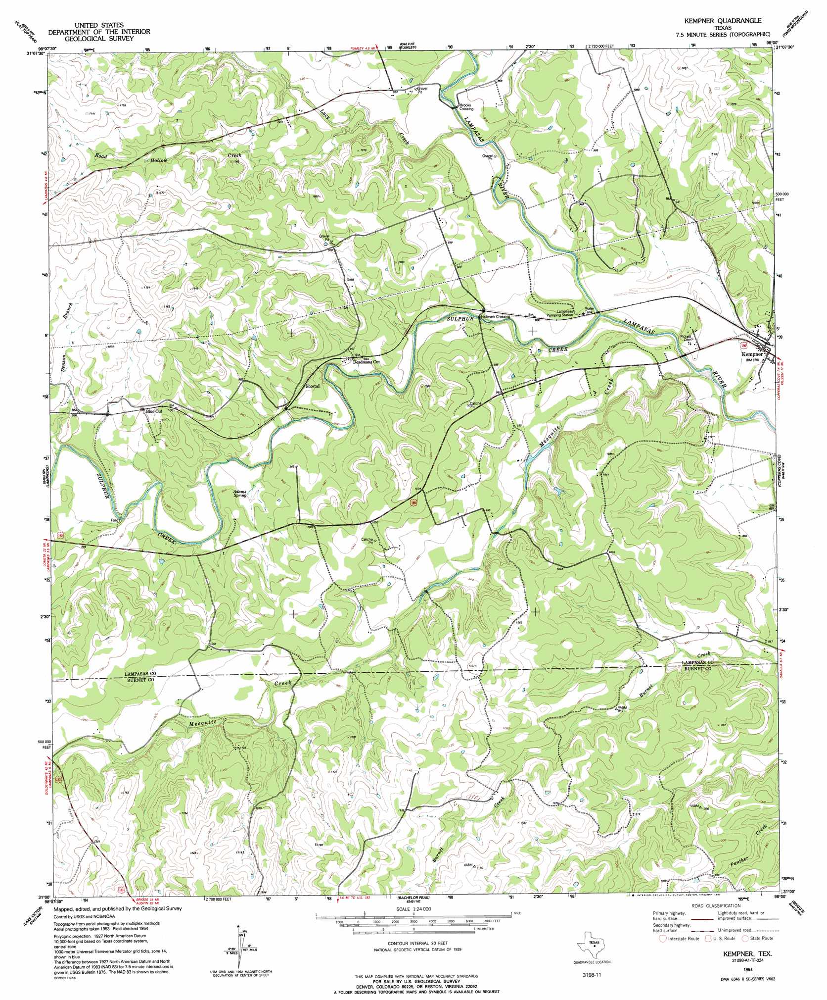
USGS Topo Quad 31098a1 - 1:24,000 scale
| Topo Map Name: | Kempner |
| USGS Topo Quad ID: | 31098a1 |
| Print Size: | ca. 21 1/4" wide x 27" high |
| Southeast Coordinates: | 31° N latitude / 98° W longitude |
| Map Center Coordinates: | 31.0625° N latitude / 98.0625° W longitude |
| U.S. State: | TX |
| Filename: | o31098a1.jpg |
| Download Map JPG Image: | Kempner topo map 1:24,000 scale |
| Map Type: | Topographic |
| Topo Series: | 7.5´ |
| Map Scale: | 1:24,000 |
| Source of Map Images: | United States Geological Survey (USGS) |
| Alternate Map Versions: |
Kempner TX 1954, updated 1957 Download PDF Buy paper map Kempner TX 1954, updated 1992 Download PDF Buy paper map Kempner TX 2010 Download PDF Buy paper map Kempner TX 2013 Download PDF Buy paper map Kempner TX 2016 Download PDF Buy paper map |
1:24,000 Topo Quads surrounding Kempner
Castle Peak |
Adamsville |
Izoro |
Pidcoke |
Shell Mountains |
Ogles |
Flat Top Peak |
Rumley |
Twin Mountains |
Fort Hood |
Nix |
Lampasas |
Kempner |
Copperas Cove |
Mcmillan Mountains |
Naruna |
Lake Victor |
Bachelor Peak |
Briggs |
Ding Dong |
Council Creek |
Burnet |
Joppa |
Mahomet |
Florence |
> Back to 31098a1 at 1:100,000 scale
> Back to 31098a1 at 1:250,000 scale
> Back to U.S. Topo Maps home
Kempner topo map: Gazetteer
Kempner: Airports
Kings Ranch Airport elevation 321m 1053′Kempner: Gaps
Blue Cut elevation 305m 1000′Deadmans Cut elevation 279m 915′
Kempner: Populated Places
Brooks Crossing elevation 268m 879′Hallmark Crossing elevation 262m 859′
Kempner elevation 264m 866′
Shortall elevation 286m 938′
Kempner: Springs
Adams Spring elevation 280m 918′Kempner: Streams
Denson Branch elevation 287m 941′Lucy Creek elevation 262m 859′
Mesquite Creek elevation 253m 830′
Road Hollow Creek elevation 267m 875′
Sulphur Creek elevation 256m 839′
Kempner digital topo map on disk
Buy this Kempner topo map showing relief, roads, GPS coordinates and other geographical features, as a high-resolution digital map file on DVD: