Brady Mountain Topo Map Texas
To zoom in, hover over the map of Brady Mountain
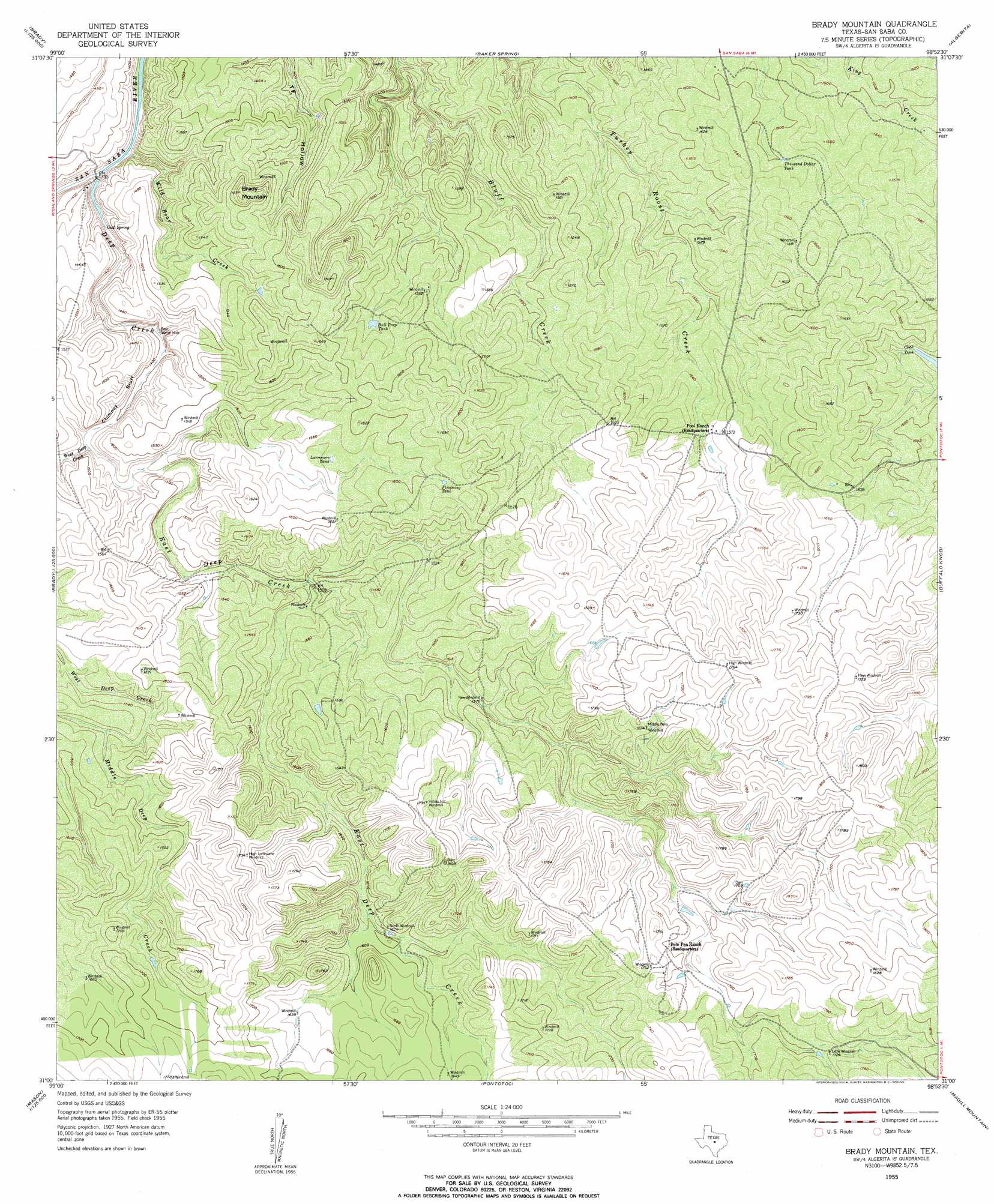
USGS Topo Quad 31098a8 - 1:24,000 scale
| Topo Map Name: | Brady Mountain |
| USGS Topo Quad ID: | 31098a8 |
| Print Size: | ca. 21 1/4" wide x 27" high |
| Southeast Coordinates: | 31° N latitude / 98.875° W longitude |
| Map Center Coordinates: | 31.0625° N latitude / 98.9375° W longitude |
| U.S. State: | TX |
| Filename: | o31098a8.jpg |
| Download Map JPG Image: | Brady Mountain topo map 1:24,000 scale |
| Map Type: | Topographic |
| Topo Series: | 7.5´ |
| Map Scale: | 1:24,000 |
| Source of Map Images: | United States Geological Survey (USGS) |
| Alternate Map Versions: |
Brady Mountian TX 1955, updated 1956 Download PDF Buy paper map Brady Mountian TX 1955, updated 1956 Download PDF Buy paper map Brady Mountain TX 2010 Download PDF Buy paper map Brady Mountain TX 2013 Download PDF Buy paper map Brady Mountain TX 2016 Download PDF Buy paper map |
1:24,000 Topo Quads surrounding Brady Mountain
Placid |
Hall |
Richland Springs |
Blucher Mountain |
Big Valley South |
Rochelle |
Lost Creek |
Baker Spring |
Algerita |
San Saba |
Voca |
Pecan Springs |
Brady Mountain |
Buffalo Knob |
Bear Hollow |
Spy Rock |
Fredonia |
Pontotoc |
Magill Mountain |
Cherokee |
Purdy Hill |
Fly Gap |
Smoothingiron Mountain |
Valley Spring |
Llano North |
> Back to 31098a1 at 1:100,000 scale
> Back to 31098a1 at 1:250,000 scale
> Back to U.S. Topo Maps home
Brady Mountain topo map: Gazetteer
Brady Mountain: Cliffs
Chimney Bluff elevation 440m 1443′Brady Mountain: Lakes
Bear Water Hole elevation 419m 1374′Brady Mountain: Reservoirs
Bull Trap Tank elevation 465m 1525′Flemming Tank elevation 492m 1614′
Larremore Tank elevation 477m 1564′
Thousand Dollar Tank elevation 459m 1505′
Brady Mountain: Springs
Cold Spring elevation 406m 1332′Deep Creek Spring elevation 398m 1305′
Brady Mountain: Streams
Deep Creek elevation 399m 1309′East Deep Creek elevation 431m 1414′
Middle Deep Creek elevation 468m 1535′
West Deep Creek elevation 431m 1414′
Wild Boar Creek elevation 399m 1309′
Brady Mountain: Summits
Brady Mountain elevation 508m 1666′Brady Mountain digital topo map on disk
Buy this Brady Mountain topo map showing relief, roads, GPS coordinates and other geographical features, as a high-resolution digital map file on DVD: