Baker Spring Topo Map Texas
To zoom in, hover over the map of Baker Spring
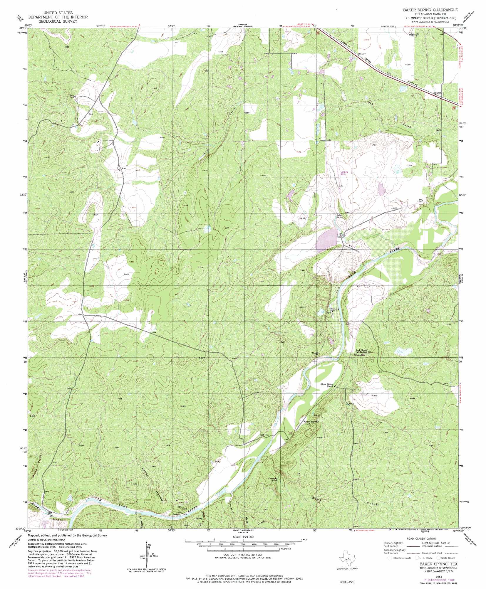
USGS Topo Quad 31098b8 - 1:24,000 scale
| Topo Map Name: | Baker Spring |
| USGS Topo Quad ID: | 31098b8 |
| Print Size: | ca. 21 1/4" wide x 27" high |
| Southeast Coordinates: | 31.125° N latitude / 98.875° W longitude |
| Map Center Coordinates: | 31.1875° N latitude / 98.9375° W longitude |
| U.S. State: | TX |
| Filename: | o31098b8.jpg |
| Download Map JPG Image: | Baker Spring topo map 1:24,000 scale |
| Map Type: | Topographic |
| Topo Series: | 7.5´ |
| Map Scale: | 1:24,000 |
| Source of Map Images: | United States Geological Survey (USGS) |
| Alternate Map Versions: |
Baker Spring TX 1955, updated 1956 Download PDF Buy paper map Baker Spring TX 1955, updated 1983 Download PDF Buy paper map Baker Spring TX 2010 Download PDF Buy paper map Baker Spring TX 2013 Download PDF Buy paper map Baker Spring TX 2016 Download PDF Buy paper map |
1:24,000 Topo Quads surrounding Baker Spring
Mercury |
Elm Grove |
Bowser |
Regency |
Big Valley North |
Placid |
Hall |
Richland Springs |
Blucher Mountain |
Big Valley South |
Rochelle |
Lost Creek |
Baker Spring |
Algerita |
San Saba |
Voca |
Pecan Springs |
Brady Mountain |
Buffalo Knob |
Bear Hollow |
Spy Rock |
Fredonia |
Pontotoc |
Magill Mountain |
Cherokee |
> Back to 31098a1 at 1:100,000 scale
> Back to 31098a1 at 1:250,000 scale
> Back to U.S. Topo Maps home
Baker Spring topo map: Gazetteer
Baker Spring: Dams
Deep Creek Ranch Lake Dam elevation 406m 1332′Lake Margery Dam elevation 400m 1312′
Baker Spring: Populated Places
Sloan elevation 400m 1312′Baker Spring: Reservoirs
Deep Creek Ranch Lake elevation 406m 1332′Lake Margery elevation 400m 1312′
Baker Spring: Springs
Baker Spring elevation 407m 1335′Deep Creek Spring elevation 411m 1348′
Flemming Spring elevation 408m 1338′
Hart Springs elevation 410m 1345′
Sloan Pool Spring elevation 402m 1318′
Turkey Roost Springs elevation 398m 1305′
Baker Spring: Streams
Bluff Creek elevation 394m 1292′Brady Creek elevation 400m 1312′
King Creek elevation 389m 1276′
Turkey Roost Creek elevation 393m 1289′
Baker Spring: Valleys
Cedar Hollow elevation 395m 1295′T F Hollow elevation 396m 1299′
Baker Spring digital topo map on disk
Buy this Baker Spring topo map showing relief, roads, GPS coordinates and other geographical features, as a high-resolution digital map file on DVD: