San Saba Peak Topo Map Texas
To zoom in, hover over the map of San Saba Peak
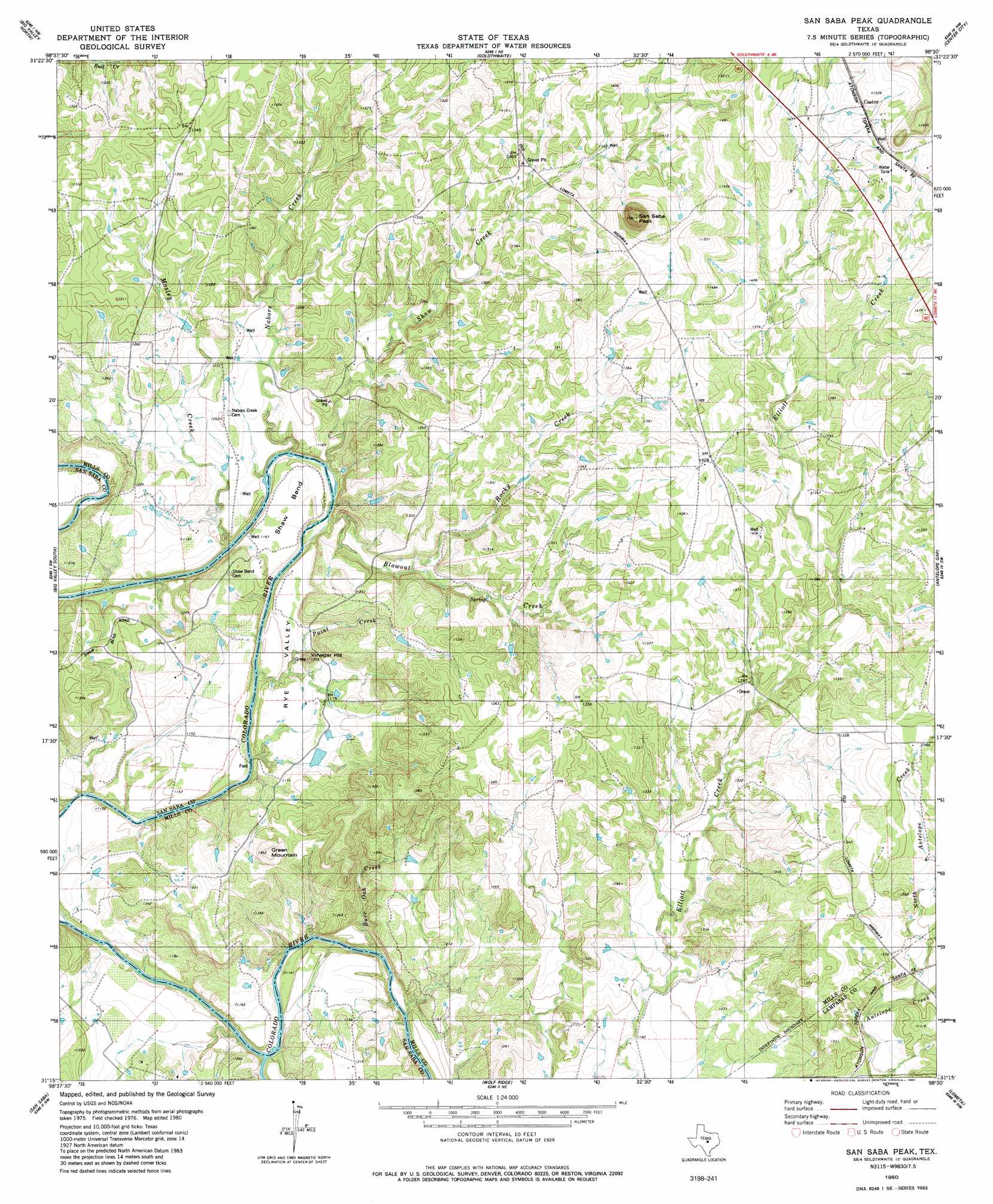
USGS Topo Quad 31098c5 - 1:24,000 scale
| Topo Map Name: | San Saba Peak |
| USGS Topo Quad ID: | 31098c5 |
| Print Size: | ca. 21 1/4" wide x 27" high |
| Southeast Coordinates: | 31.25° N latitude / 98.5° W longitude |
| Map Center Coordinates: | 31.3125° N latitude / 98.5625° W longitude |
| U.S. State: | TX |
| Filename: | o31098c5.jpg |
| Download Map JPG Image: | San Saba Peak topo map 1:24,000 scale |
| Map Type: | Topographic |
| Topo Series: | 7.5´ |
| Map Scale: | 1:24,000 |
| Source of Map Images: | United States Geological Survey (USGS) |
| Alternate Map Versions: |
San Saba Peak TX 1980, updated 1980 Download PDF Buy paper map San Saba Peak TX 2010 Download PDF Buy paper map San Saba Peak TX 2013 Download PDF Buy paper map San Saba Peak TX 2016 Download PDF Buy paper map |
1:24,000 Topo Quads surrounding San Saba Peak
Blanket Springs |
Mullin |
Lake Merritt |
Caradan |
Pecan Wells |
Regency |
Big Valley North |
Goldthwaite |
Center City |
Star |
Blucher Mountain |
Big Valley South |
San Saba Peak |
Antelope Gap |
Castle Peak |
Algerita |
San Saba |
Wolf Ridge |
Lometa |
Ogles |
Buffalo Knob |
Bear Hollow |
Bend |
Gorman Falls |
Nix |
> Back to 31098a1 at 1:100,000 scale
> Back to 31098a1 at 1:250,000 scale
> Back to U.S. Topo Maps home
San Saba Peak topo map: Gazetteer
San Saba Peak: Airports
Edwards Airport elevation 397m 1302′San Saba Peak: Bends
Shaw Bend elevation 354m 1161′San Saba Peak: Dams
Dyer Lake Dam elevation 352m 1154′San Saba Peak: Lakes
Fourmile Hole elevation 354m 1161′San Saba Peak: Populated Places
Castor elevation 457m 1499′Double Ford elevation 340m 1115′
San Saba Peak: Reservoirs
Dyer Lake elevation 352m 1154′San Saba Peak: Streams
Blowout Creek elevation 344m 1128′Burr Oak Creek elevation 339m 1112′
Mosley Creek elevation 351m 1151′
Nabors Creek elevation 345m 1131′
North Antelope Creek elevation 387m 1269′
Paint Creek elevation 342m 1122′
Rocky Creek elevation 359m 1177′
San Saba River elevation 338m 1108′
Shaw Creek elevation 344m 1128′
San Saba Peak: Summits
Green Mountain elevation 408m 1338′San Saba Peak elevation 510m 1673′
Vinegar Hill elevation 380m 1246′
San Saba Peak: Valleys
Rye Valley elevation 350m 1148′San Saba Peak digital topo map on disk
Buy this San Saba Peak topo map showing relief, roads, GPS coordinates and other geographical features, as a high-resolution digital map file on DVD: