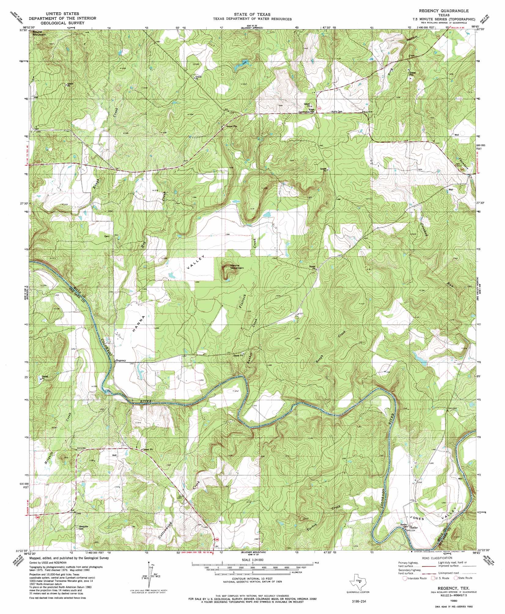
Regency Topo Map Texas
To zoom in, hover over the map of Regency
USGS Topo Quad 31098d7 - 1:24,000 scale
| Topo Map Name: | Regency |
| USGS Topo Quad ID: | 31098d7 |
| Print Size: | ca. 21 1/4" wide x 27" high |
| Southeast Coordinates: | 31.375° N latitude / 98.75° W longitude |
| Map Center Coordinates: | 31.4375° N latitude / 98.8125° W longitude |
| U.S. State: | TX |
| Filename: | o31098d7.jpg |
| Download Map JPG Image: | Regency topo map 1:24,000 scale |
| Map Type: | Topographic |
| Topo Series: | 7.5´ |
| Map Scale: | 1:24,000 |
| Source of Map Images: | United States Geological Survey (USGS) |
| Alternate Map Versions: |
Regency TX 1980, updated 1980 Download PDF Buy paper map Regency TX 2010 Download PDF Buy paper map Regency TX 2012 Download PDF Buy paper map Regency TX 2016 Download PDF Buy paper map |
1:24,000 Topo Quads surrounding Regency
Bangs East |
Brownwood |
Zephyr |
Democrat |
Priddy |
Brookesmith |
Indian Creek |
Blanket Springs |
Mullin |
Lake Merritt |
Elm Grove |
Bowser |
Regency |
Big Valley North |
Goldthwaite |
Hall |
Richland Springs |
Blucher Mountain |
Big Valley South |
San Saba Peak |
Lost Creek |
Baker Spring |
Algerita |
San Saba |
Wolf Ridge |
> Back to 31098a1 at 1:100,000 scale
> Back to 31098a1 at 1:250,000 scale
> Back to U.S. Topo Maps home
Regency topo map: Gazetteer
Regency: Bends
Jones Valley elevation 375m 1230′Regency: Bridges
Regency Suspension Bridge elevation 362m 1187′Regency: Dams
Renfro Dam elevation 362m 1187′Wilcox Lake Dam elevation 380m 1246′
Regency: Populated Places
Ratler elevation 378m 1240′Regency elevation 382m 1253′
Ridge elevation 451m 1479′
Regency: Reservoirs
Wilcox Lake elevation 380m 1246′Regency: Streams
Bunker Creek elevation 366m 1200′Cottonwood Creek elevation 365m 1197′
Flatrock Creek elevation 374m 1227′
Hog Creek elevation 371m 1217′
Mesquite Creek elevation 366m 1200′
Rough Creek elevation 366m 1200′
Spring Creek elevation 365m 1197′
Turkey Creek elevation 364m 1194′
Regency: Summits
Hanna Mountain elevation 425m 1394′Round Mountain elevation 444m 1456′
Regency: Valleys
Hanna Valley elevation 371m 1217′Regency digital topo map on disk
Buy this Regency topo map showing relief, roads, GPS coordinates and other geographical features, as a high-resolution digital map file on DVD: