Pottsville Topo Map Texas
To zoom in, hover over the map of Pottsville
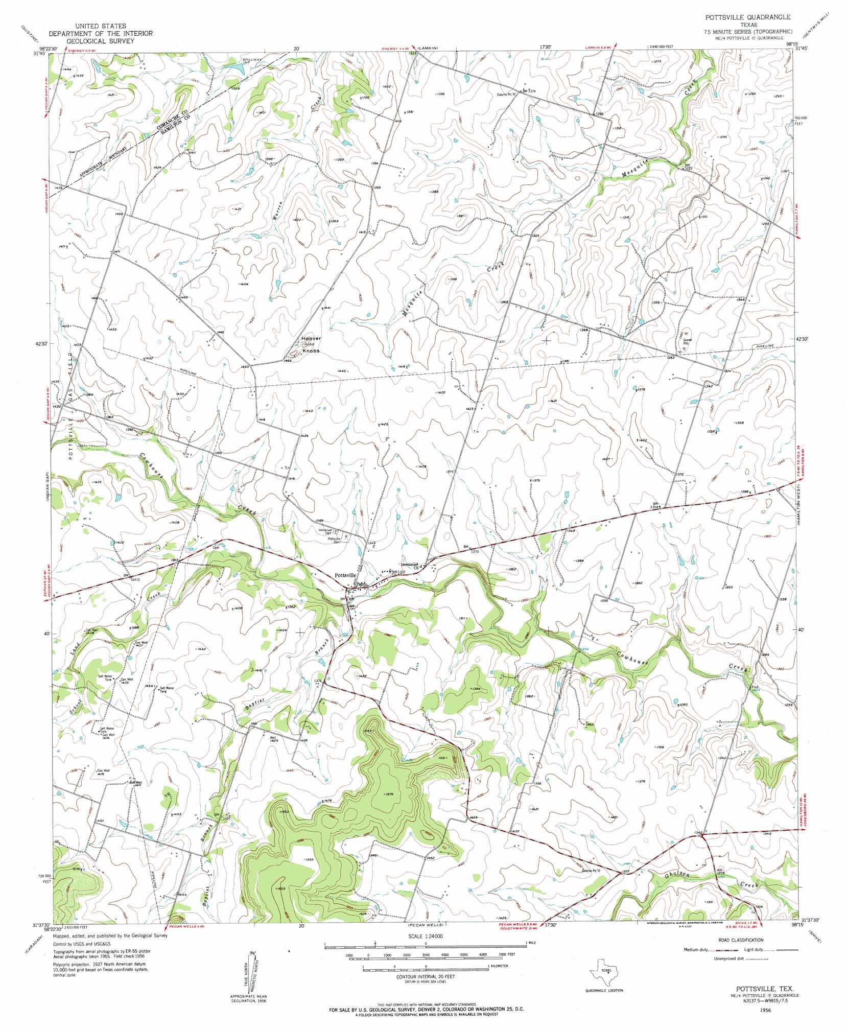
USGS Topo Quad 31098f3 - 1:24,000 scale
| Topo Map Name: | Pottsville |
| USGS Topo Quad ID: | 31098f3 |
| Print Size: | ca. 21 1/4" wide x 27" high |
| Southeast Coordinates: | 31.625° N latitude / 98.25° W longitude |
| Map Center Coordinates: | 31.6875° N latitude / 98.3125° W longitude |
| U.S. State: | TX |
| Filename: | o31098f3.jpg |
| Download Map JPG Image: | Pottsville topo map 1:24,000 scale |
| Map Type: | Topographic |
| Topo Series: | 7.5´ |
| Map Scale: | 1:24,000 |
| Source of Map Images: | United States Geological Survey (USGS) |
| Alternate Map Versions: |
Pottsville TX 1956, updated 1957 Download PDF Buy paper map Pottsville TX 2010 Download PDF Buy paper map Pottsville TX 2012 Download PDF Buy paper map Pottsville TX 2016 Download PDF Buy paper map |
1:24,000 Topo Quads surrounding Pottsville
Comanche |
Proctor |
Edna Hill |
Carlton |
Hico |
Newburg |
Gustine |
Lamkin |
Gentrys Mill |
Eidson Lake |
Priddy |
Indian Gap |
Pottsville |
Hamilton West |
Hamilton East |
Lake Merritt |
Caradan |
Pecan Wells |
Shive |
Ohio |
Goldthwaite |
Center City |
Star |
Evant |
Pearl |
> Back to 31098e1 at 1:100,000 scale
> Back to 31098a1 at 1:250,000 scale
> Back to U.S. Topo Maps home
Pottsville topo map: Gazetteer
Pottsville: Populated Places
Pottsville elevation 403m 1322′Pottsville: Streams
Baptist Branch elevation 395m 1295′School Land Creek elevation 402m 1318′
Pottsville: Summits
Hoover Knobs elevation 457m 1499′Pottsville digital topo map on disk
Buy this Pottsville topo map showing relief, roads, GPS coordinates and other geographical features, as a high-resolution digital map file on DVD: