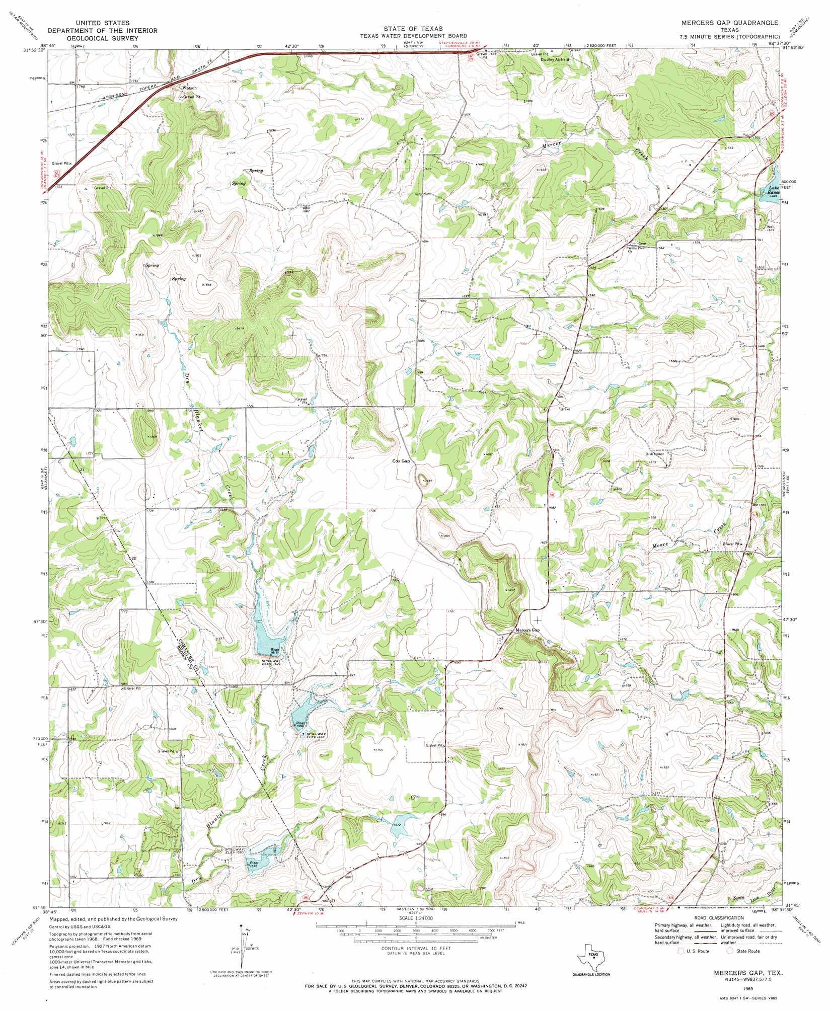
Mercers Gap Topo Map Texas
To zoom in, hover over the map of Mercers Gap
USGS Topo Quad 31098g6 - 1:24,000 scale
| Topo Map Name: | Mercers Gap |
| USGS Topo Quad ID: | 31098g6 |
| Print Size: | ca. 21 1/4" wide x 27" high |
| Southeast Coordinates: | 31.75° N latitude / 98.625° W longitude |
| Map Center Coordinates: | 31.8125° N latitude / 98.6875° W longitude |
| U.S. State: | TX |
| Filename: | o31098g6.jpg |
| Download Map JPG Image: | Mercers Gap topo map 1:24,000 scale |
| Map Type: | Topographic |
| Topo Series: | 7.5´ |
| Map Scale: | 1:24,000 |
| Source of Map Images: | United States Geological Survey (USGS) |
| Alternate Map Versions: |
Mercers Gap TX 1969, updated 1972 Download PDF Buy paper map Mercers Gap TX 2010 Download PDF Buy paper map Mercers Gap TX 2012 Download PDF Buy paper map Mercers Gap TX 2016 Download PDF Buy paper map |
1:24,000 Topo Quads surrounding Mercers Gap
Rising Star |
Sipe Springs |
Duster |
De Leon |
Comyn |
May |
Star Mountain |
Sidney |
Comanche |
Proctor |
Owens |
Blanket |
Mercers Gap |
Newburg |
Gustine |
Brownwood |
Zephyr |
Democrat |
Priddy |
Indian Gap |
Indian Creek |
Blanket Springs |
Mullin |
Lake Merritt |
Caradan |
> Back to 31098e1 at 1:100,000 scale
> Back to 31098a1 at 1:250,000 scale
> Back to U.S. Topo Maps home
Mercers Gap topo map: Gazetteer
Mercers Gap: Dams
Soil Conservation Service Site 12 Dam elevation 493m 1617′Soil Conservation Service Site 13 Dam elevation 488m 1601′
Soil Conservation Service Site 14 Dam elevation 483m 1584′
Willis Lake Dam elevation 508m 1666′
Mercers Gap: Gaps
Cox Gap elevation 517m 1696′Mercers Gap: Populated Places
Watson elevation 531m 1742′Mercers Gap: Reservoirs
Soil Conservation Service Site 12 Reservoir elevation 493m 1617′Soil Conservation Service Site 13 Reservoir elevation 488m 1601′
Soil Conservation Service Site 14 Reservoir elevation 483m 1584′
Willis Lake elevation 508m 1666′
Mercers Gap digital topo map on disk
Buy this Mercers Gap topo map showing relief, roads, GPS coordinates and other geographical features, as a high-resolution digital map file on DVD: