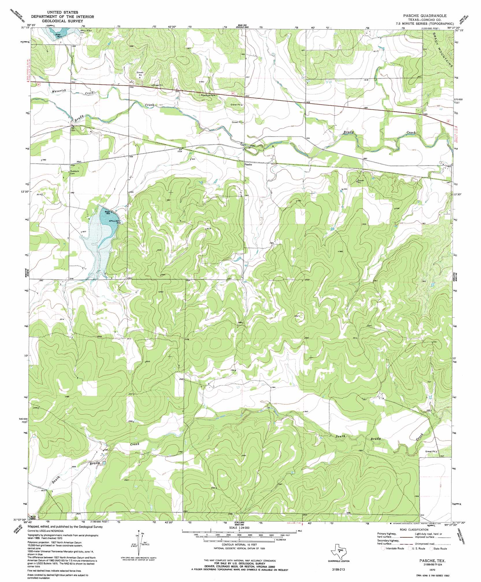
Pasche Topo Map Texas
To zoom in, hover over the map of Pasche
USGS Topo Quad 31099b6 - 1:24,000 scale
| Topo Map Name: | Pasche |
| USGS Topo Quad ID: | 31099b6 |
| Print Size: | ca. 21 1/4" wide x 27" high |
| Southeast Coordinates: | 31.125° N latitude / 99.625° W longitude |
| Map Center Coordinates: | 31.1875° N latitude / 99.6875° W longitude |
| U.S. State: | TX |
| Filename: | o31099b6.jpg |
| Download Map JPG Image: | Pasche topo map 1:24,000 scale |
| Map Type: | Topographic |
| Topo Series: | 7.5´ |
| Map Scale: | 1:24,000 |
| Source of Map Images: | United States Geological Survey (USGS) |
| Alternate Map Versions: |
Pasche TX 1970, updated 1973 Download PDF Buy paper map Pasche TX 1970, updated 1992 Download PDF Buy paper map Pasche TX 2010 Download PDF Buy paper map Pasche TX 2012 Download PDF Buy paper map Pasche TX 2016 Download PDF Buy paper map |
1:24,000 Topo Quads surrounding Pasche
Millersview Nw |
Millersview |
Mustang Creek |
Doole |
Fife |
Millersview Sw |
Millersview Se |
Doole Sw |
Salt Gap |
Lohn |
Live Oak |
Eden |
Pasche |
Melvin |
West Sweden |
Eden Sw |
Eden Se |
Callan |
Needle Creek |
Brady Sw |
Clear Creek Lake |
Menard |
Chapman Draw |
Robbers Roost |
Calf Creek |
> Back to 31099a1 at 1:100,000 scale
> Back to 31098a1 at 1:250,000 scale
> Back to U.S. Topo Maps home
Pasche topo map: Gazetteer
Pasche: Dams
Soil Conservation Service Site 20 Dam elevation 628m 2060′Soil Conservation Service Site 21 Dam elevation 596m 1955′
Soil Conservation Service Site 38 Dam elevation 598m 1961′
Pasche: Populated Places
Pasche elevation 581m 1906′Pasche: Reservoirs
Soil Conservation Service Site 20 Reservoir elevation 628m 2060′Soil Conservation Service Site 21 Reservoir elevation 596m 1955′
Soil Conservation Service Site 38 Reservoir elevation 598m 1961′
Pasche: Streams
Maverick Creek elevation 585m 1919′Pasche digital topo map on disk
Buy this Pasche topo map showing relief, roads, GPS coordinates and other geographical features, as a high-resolution digital map file on DVD: