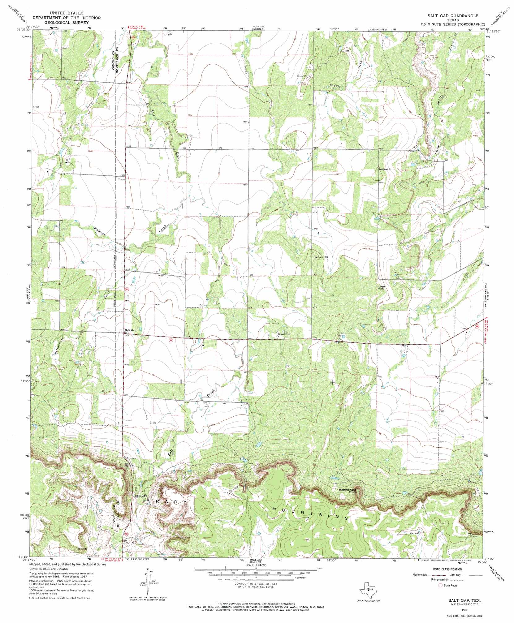
Salt Gap Topo Map Texas
To zoom in, hover over the map of Salt Gap
USGS Topo Quad 31099c5 - 1:24,000 scale
| Topo Map Name: | Salt Gap |
| USGS Topo Quad ID: | 31099c5 |
| Print Size: | ca. 21 1/4" wide x 27" high |
| Southeast Coordinates: | 31.25° N latitude / 99.5° W longitude |
| Map Center Coordinates: | 31.3125° N latitude / 99.5625° W longitude |
| U.S. State: | TX |
| Filename: | o31099c5.jpg |
| Download Map JPG Image: | Salt Gap topo map 1:24,000 scale |
| Map Type: | Topographic |
| Topo Series: | 7.5´ |
| Map Scale: | 1:24,000 |
| Source of Map Images: | United States Geological Survey (USGS) |
| Alternate Map Versions: |
Salt Gap TX 1967, updated 1969 Download PDF Buy paper map Salt Gap TX 1967, updated 1970 Download PDF Buy paper map Salt Gap TX 2010 Download PDF Buy paper map Salt Gap TX 2013 Download PDF Buy paper map Salt Gap TX 2016 Download PDF Buy paper map |
1:24,000 Topo Quads surrounding Salt Gap
Concho |
Leaday |
Voss |
Gouldbusk |
Speck Mountain |
Millersview |
Mustang Creek |
Doole |
Fife |
Whon |
Millersview Se |
Doole Sw |
Salt Gap |
Lohn |
Bluff Creek |
Eden |
Pasche |
Melvin |
West Sweden |
Brady North |
Eden Se |
Callan |
Needle Creek |
Brady Sw |
Brady South |
> Back to 31099a1 at 1:100,000 scale
> Back to 31098a1 at 1:250,000 scale
> Back to U.S. Topo Maps home
Salt Gap topo map: Gazetteer
Salt Gap: Gaps
Salt Gap elevation 545m 1788′Salt Gap: Populated Places
Salt Gap elevation 509m 1669′Salt Gap: Ranges
Brady Mountains elevation 616m 2020′Salt Gap: Streams
Cottonwood Creek elevation 486m 1594′Waloope Creek elevation 477m 1564′
Salt Gap: Summits
Rattlesnake Point elevation 602m 1975′Salt Gap digital topo map on disk
Buy this Salt Gap topo map showing relief, roads, GPS coordinates and other geographical features, as a high-resolution digital map file on DVD: