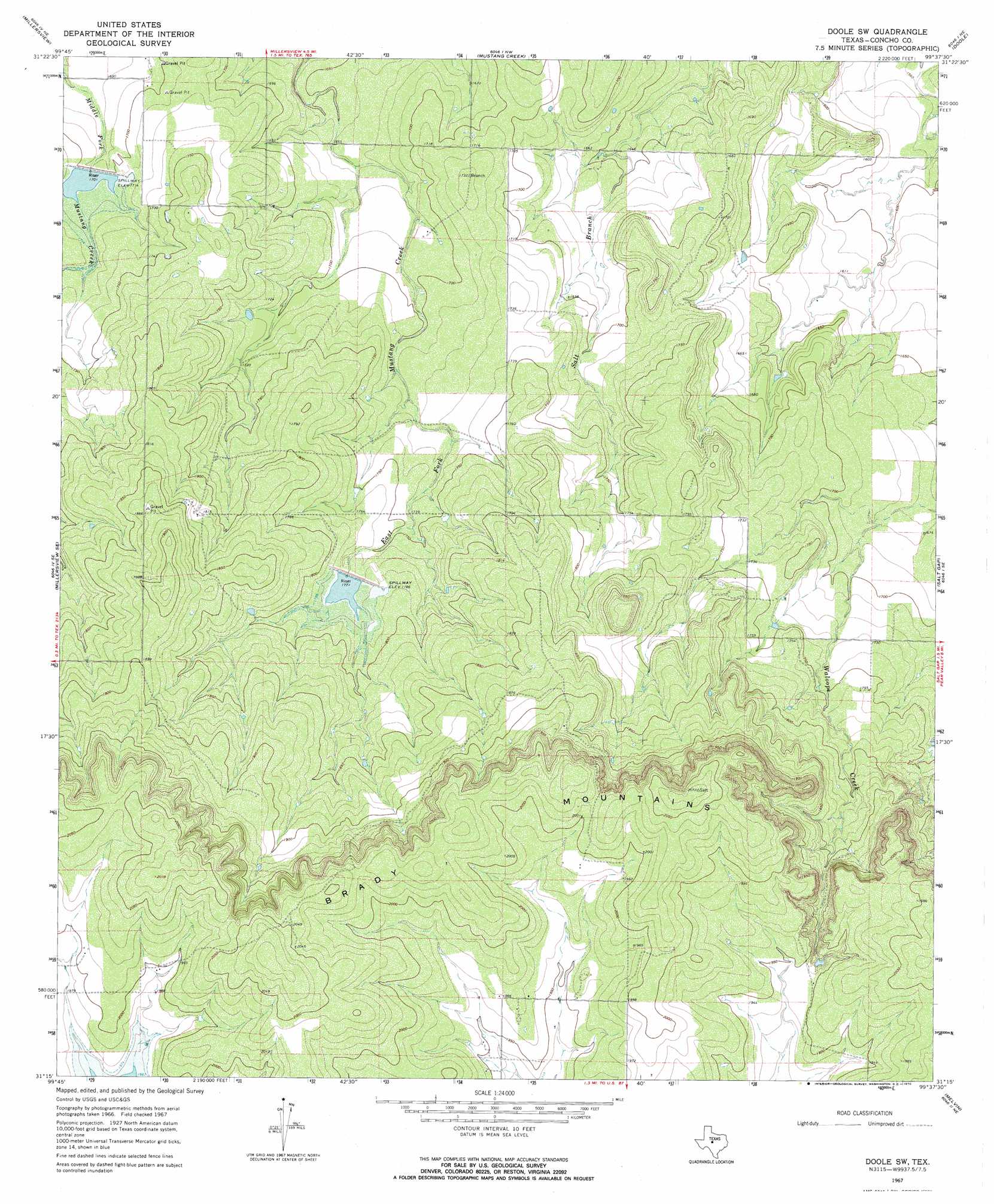
Doole Sw Topo Map Texas
To zoom in, hover over the map of Doole Sw
USGS Topo Quad 31099c6 - 1:24,000 scale
| Topo Map Name: | Doole Sw |
| USGS Topo Quad ID: | 31099c6 |
| Print Size: | ca. 21 1/4" wide x 27" high |
| Southeast Coordinates: | 31.25° N latitude / 99.625° W longitude |
| Map Center Coordinates: | 31.3125° N latitude / 99.6875° W longitude |
| U.S. State: | TX |
| Filename: | o31099c6.jpg |
| Download Map JPG Image: | Doole Sw topo map 1:24,000 scale |
| Map Type: | Topographic |
| Topo Series: | 7.5´ |
| Map Scale: | 1:24,000 |
| Source of Map Images: | United States Geological Survey (USGS) |
| Alternate Map Versions: |
Doole SW TX 1967, updated 1969 Download PDF Buy paper map Doole SW TX 2010 Download PDF Buy paper map Doole SW TX 2013 Download PDF Buy paper map Doole SW TX 2016 Download PDF Buy paper map |
1:24,000 Topo Quads surrounding Doole Sw
Paint Rock |
Concho |
Leaday |
Voss |
Gouldbusk |
Millersview Nw |
Millersview |
Mustang Creek |
Doole |
Fife |
Millersview Sw |
Millersview Se |
Doole Sw |
Salt Gap |
Lohn |
Live Oak |
Eden |
Pasche |
Melvin |
West Sweden |
Eden Sw |
Eden Se |
Callan |
Needle Creek |
Brady Sw |
> Back to 31099a1 at 1:100,000 scale
> Back to 31098a1 at 1:250,000 scale
> Back to U.S. Topo Maps home
Doole Sw topo map: Gazetteer
Doole Sw: Dams
Soil Conservation Service Site 1 Dam elevation 543m 1781′Soil Conservation Service Site 3 Dam elevation 516m 1692′
Doole Sw: Reservoirs
Soil Conservation Service Site 1 Reservoir elevation 543m 1781′Soil Conservation Service Site 3 Reservoir elevation 516m 1692′
Doole Sw digital topo map on disk
Buy this Doole Sw topo map showing relief, roads, GPS coordinates and other geographical features, as a high-resolution digital map file on DVD: