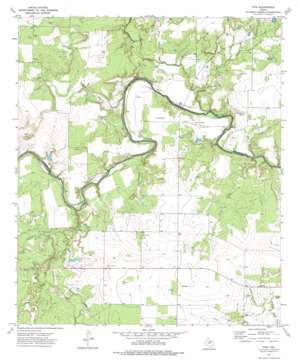
Fife Topo Map Texas
To zoom in, hover over the map of Fife
USGS Topo Quad 31099d4 - 1:24,000 scale
| Topo Map Name: | Fife |
| USGS Topo Quad ID: | 31099d4 |
| Print Size: | ca. 21 1/4" wide x 27" high |
| Southeast Coordinates: | 31.375° N latitude / 99.375° W longitude |
| Map Center Coordinates: | 31.4375° N latitude / 99.4375° W longitude |
| U.S. State: | TX |
| Filename: | o31099d4.jpg |
| Download Map JPG Image: | Fife topo map 1:24,000 scale |
| Map Type: | Topographic |
| Topo Series: | 7.5´ |
| Map Scale: | 1:24,000 |
| Source of Map Images: | United States Geological Survey (USGS) |
| Alternate Map Versions: |
Fife TX 1973, updated 1976 Download PDF Buy paper map Fife TX 2010 Download PDF Buy paper map Fife TX 2013 Download PDF Buy paper map Fife TX 2016 Download PDF Buy paper map |
1:24,000 Topo Quads surrounding Fife
> Back to 31099a1 at 1:100,000 scale
> Back to 31098a1 at 1:250,000 scale
> Back to U.S. Topo Maps home
Fife topo map: Gazetteer
Fife: Airports
Walker Ranch Airport elevation 433m 1420′Fife: Populated Places
Chaffin Crossing elevation 412m 1351′Fife elevation 441m 1446′
Hays Crossing elevation 416m 1364′
Waldrip elevation 432m 1417′
Fife: Reservoirs
Leman Lake elevation 440m 1443′Fife: Streams
Big Elm Creek elevation 430m 1410′Bull Creek elevation 410m 1345′
Little Bull Creek elevation 419m 1374′
Little Elm Creek elevation 430m 1410′
Little Saddle Creek elevation 428m 1404′
Live Oak Creek elevation 413m 1354′
Saddle Creek elevation 417m 1368′
Fife: Valleys
Public Hollow elevation 427m 1400′Rough Hollow elevation 412m 1351′
Yoho Hollow elevation 431m 1414′
Fife digital topo map on disk
Buy this Fife topo map showing relief, roads, GPS coordinates and other geographical features, as a high-resolution digital map file on DVD:


