Trickham Topo Map Texas
To zoom in, hover over the map of Trickham
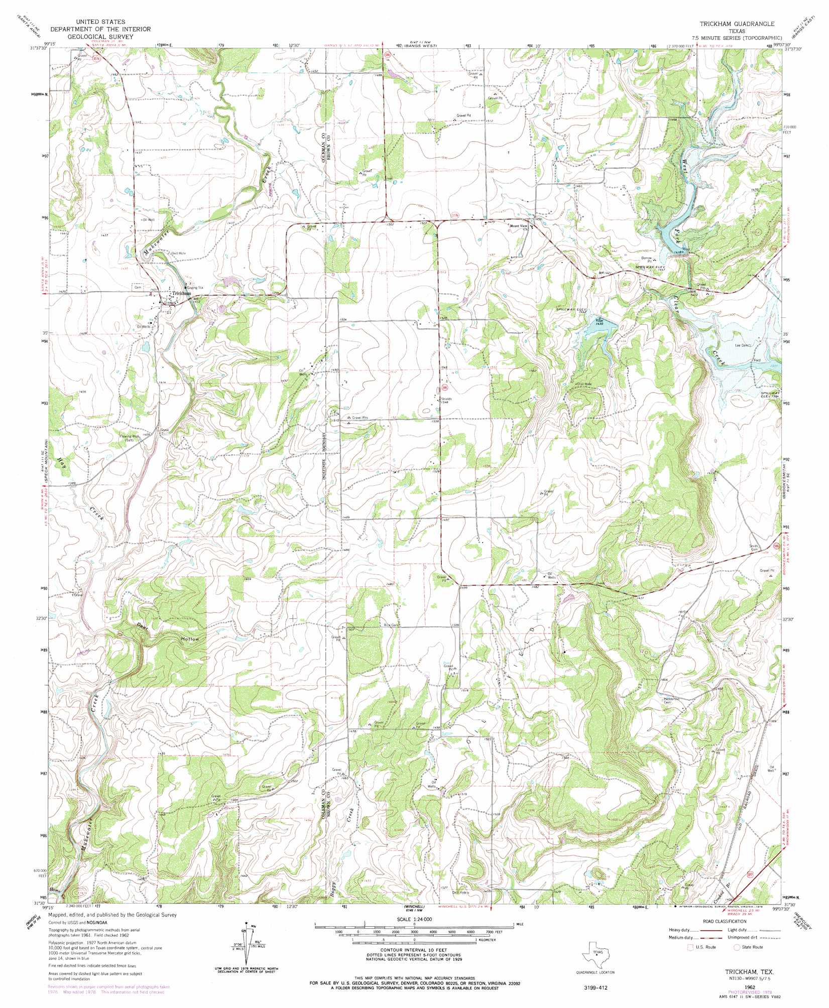
USGS Topo Quad 31099e2 - 1:24,000 scale
| Topo Map Name: | Trickham |
| USGS Topo Quad ID: | 31099e2 |
| Print Size: | ca. 21 1/4" wide x 27" high |
| Southeast Coordinates: | 31.5° N latitude / 99.125° W longitude |
| Map Center Coordinates: | 31.5625° N latitude / 99.1875° W longitude |
| U.S. State: | TX |
| Filename: | o31099e2.jpg |
| Download Map JPG Image: | Trickham topo map 1:24,000 scale |
| Map Type: | Topographic |
| Topo Series: | 7.5´ |
| Map Scale: | 1:24,000 |
| Source of Map Images: | United States Geological Survey (USGS) |
| Alternate Map Versions: |
Trickham TX 1962, updated 1964 Download PDF Buy paper map Trickham TX 1962, updated 1978 Download PDF Buy paper map Trickham TX 2010 Download PDF Buy paper map Trickham TX 2013 Download PDF Buy paper map Trickham TX 2016 Download PDF Buy paper map |
1:24,000 Topo Quads surrounding Trickham
Coleman |
Lake San Tana |
Thrifty |
Lake Brownwood |
Owens |
Fisk |
Santa Anna |
Bangs West |
Bangs East |
Brownwood |
Gouldbusk |
Speck Mountain |
Trickham |
Brookesmith |
Indian Creek |
Fife |
Whon |
Mercury |
Elm Grove |
Bowser |
Lohn |
Bluff Creek |
Placid |
Hall |
Richland Springs |
> Back to 31099e1 at 1:100,000 scale
> Back to 31098a1 at 1:250,000 scale
> Back to U.S. Topo Maps home
Trickham topo map: Gazetteer
Trickham: Dams
Soil Conservation Service Site 1 Dam elevation 423m 1387′Soil Conservation Service Site 2 Dam elevation 433m 1420′
Soil Conservation Service Site 3 Dam elevation 441m 1446′
Trickham: Populated Places
Trickham elevation 434m 1423′Trickham: Reservoirs
Soil Conservation Service Site 1 Reservoir elevation 423m 1387′Soil Conservation Service Site 2 Reservoir elevation 433m 1420′
Soil Conservation Service Site 3 Reservoir elevation 441m 1446′
Trickham: Streams
Hay Creek elevation 418m 1371′Mukewater Creek elevation 419m 1374′
Trickham: Valleys
Deer Hollow elevation 414m 1358′Trickham digital topo map on disk
Buy this Trickham topo map showing relief, roads, GPS coordinates and other geographical features, as a high-resolution digital map file on DVD: