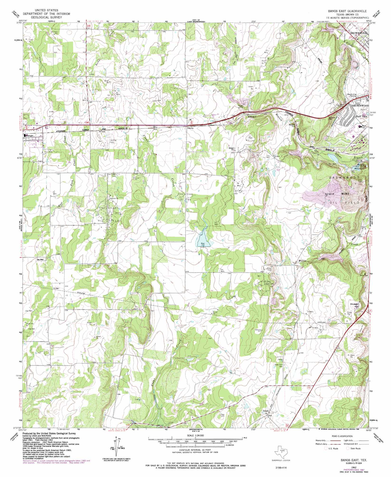
Bangs East Topo Map Texas
To zoom in, hover over the map of Bangs East
USGS Topo Quad 31099f1 - 1:24,000 scale
| Topo Map Name: | Bangs East |
| USGS Topo Quad ID: | 31099f1 |
| Print Size: | ca. 21 1/4" wide x 27" high |
| Southeast Coordinates: | 31.625° N latitude / 99° W longitude |
| Map Center Coordinates: | 31.6875° N latitude / 99.0625° W longitude |
| U.S. State: | TX |
| Filename: | o31099f1.jpg |
| Download Map JPG Image: | Bangs East topo map 1:24,000 scale |
| Map Type: | Topographic |
| Topo Series: | 7.5´ |
| Map Scale: | 1:24,000 |
| Source of Map Images: | United States Geological Survey (USGS) |
| Alternate Map Versions: |
Bangs East TX 1962, updated 1964 Download PDF Buy paper map Bangs East TX 1962, updated 1978 Download PDF Buy paper map Bangs East TX 1962, updated 1988 Download PDF Buy paper map Bangs East TX 2010 Download PDF Buy paper map Bangs East TX 2013 Download PDF Buy paper map Bangs East TX 2016 Download PDF Buy paper map |
1:24,000 Topo Quads surrounding Bangs East
Coleman Ne |
Burkett |
Byrds |
May |
Star Mountain |
Lake San Tana |
Thrifty |
Lake Brownwood |
Owens |
Blanket |
Santa Anna |
Bangs West |
Bangs East |
Brownwood |
Zephyr |
Speck Mountain |
Trickham |
Brookesmith |
Indian Creek |
Blanket Springs |
Whon |
Mercury |
Elm Grove |
Bowser |
Regency |
> Back to 31099e1 at 1:100,000 scale
> Back to 31098a1 at 1:250,000 scale
> Back to U.S. Topo Maps home
Bangs East topo map: Gazetteer
Bangs East: Canals
Brownwood Water Supply Canal elevation 428m 1404′Bangs East: Dams
Soil Conservation Service Site 1 Dam elevation 435m 1427′Soil Conservation Service Site 2 Dam elevation 436m 1430′
Soil Conservation Service Site 2a Dam elevation 467m 1532′
Soil Conservation Service Site 3 Dam elevation 428m 1404′
Soil Conservation Service Site 5 Dam elevation 473m 1551′
Bangs East: Gaps
Boysen Cut elevation 445m 1459′Bangs East: Oilfields
Brownwood Oil Field elevation 465m 1525′Childress Oil Field elevation 491m 1610′
Clear Creek Oil Field elevation 480m 1574′
Bangs East: Parks
Trigg Park elevation 415m 1361′Bangs East: Populated Places
Bluff View elevation 419m 1374′Dalzell elevation 460m 1509′
Bangs East: Reservoirs
Soil Conservation Service Site 1 Reservoir elevation 435m 1427′Soil Conservation Service Site 2 Reservoir elevation 436m 1430′
Soil Conservation Service Site 2a Reservoir elevation 467m 1532′
Soil Conservation Service Site 3 Reservoir elevation 428m 1404′
Soil Conservation Service Site 5 Reservoir elevation 473m 1551′
Bangs East: Summits
Krueger Hill elevation 485m 1591′Round Mountain elevation 471m 1545′
Bangs East digital topo map on disk
Buy this Bangs East topo map showing relief, roads, GPS coordinates and other geographical features, as a high-resolution digital map file on DVD: