Little Grape Creek Topo Map Texas
To zoom in, hover over the map of Little Grape Creek
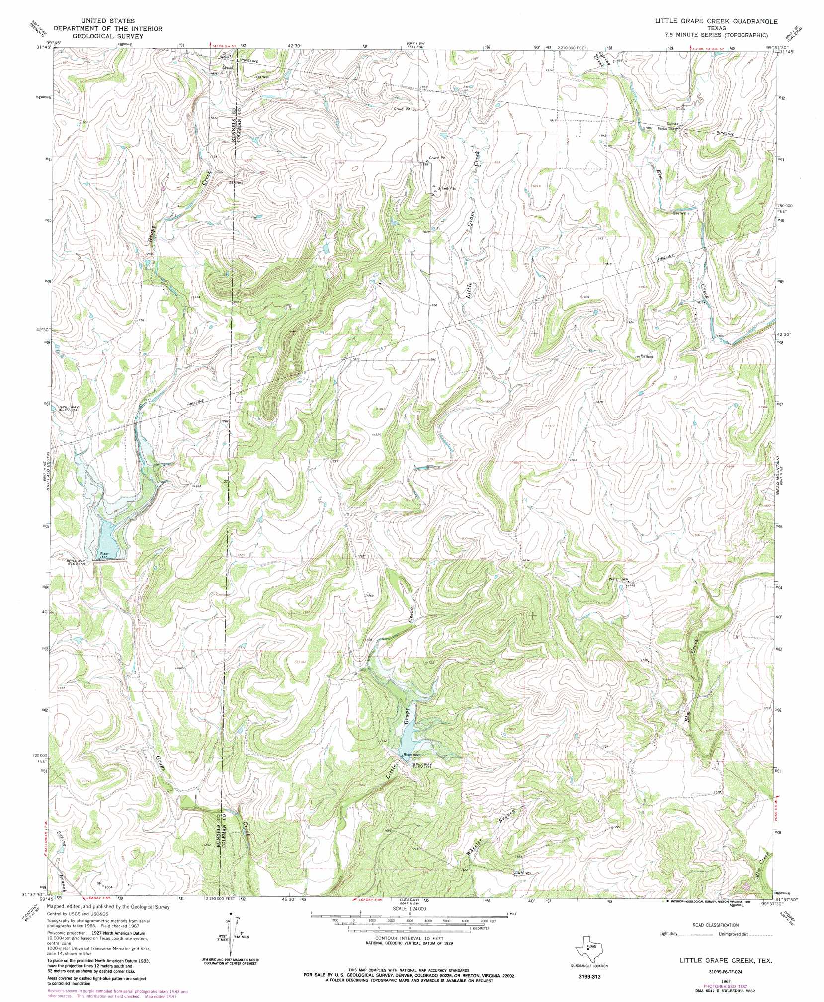
USGS Topo Quad 31099f6 - 1:24,000 scale
| Topo Map Name: | Little Grape Creek |
| USGS Topo Quad ID: | 31099f6 |
| Print Size: | ca. 21 1/4" wide x 27" high |
| Southeast Coordinates: | 31.625° N latitude / 99.625° W longitude |
| Map Center Coordinates: | 31.6875° N latitude / 99.6875° W longitude |
| U.S. State: | TX |
| Filename: | o31099f6.jpg |
| Download Map JPG Image: | Little Grape Creek topo map 1:24,000 scale |
| Map Type: | Topographic |
| Topo Series: | 7.5´ |
| Map Scale: | 1:24,000 |
| Source of Map Images: | United States Geological Survey (USGS) |
| Alternate Map Versions: |
Little Grape Creek TX 1967, updated 1969 Download PDF Buy paper map Little Grape Creek TX 1967, updated 1970 Download PDF Buy paper map Little Grape Creek TX 1967, updated 1988 Download PDF Buy paper map Little Grape Creek TX 2010 Download PDF Buy paper map Little Grape Creek TX 2013 Download PDF Buy paper map Little Grape Creek TX 2016 Download PDF Buy paper map |
1:24,000 Topo Quads surrounding Little Grape Creek
Winters |
Crews |
Novice West |
Novice East |
Lake Scarborough |
Hatchel |
Benoit |
Talpa |
Valera |
Coleman |
Ballinger |
Buffalo Bluff |
Little Grape Creek |
Bead Mountain |
Fisk |
Paint Rock |
Concho |
Leaday |
Voss |
Gouldbusk |
Millersview Nw |
Millersview |
Mustang Creek |
Doole |
Fife |
> Back to 31099e1 at 1:100,000 scale
> Back to 31098a1 at 1:250,000 scale
> Back to U.S. Topo Maps home
Little Grape Creek topo map: Gazetteer
Little Grape Creek: Dams
Soil Conservation Service Site 1 Dam elevation 511m 1676′Soil Conservation Service Site 2 Dam elevation 504m 1653′
Little Grape Creek: Reservoirs
Soil Conservation Service Site 1 Reservoir elevation 511m 1676′Soil Conservation Service Site 2 Reservoir elevation 504m 1653′
Little Grape Creek: Streams
Spring Creek elevation 577m 1893′Little Grape Creek digital topo map on disk
Buy this Little Grape Creek topo map showing relief, roads, GPS coordinates and other geographical features, as a high-resolution digital map file on DVD: