Buffalo Bluff Topo Map Texas
To zoom in, hover over the map of Buffalo Bluff
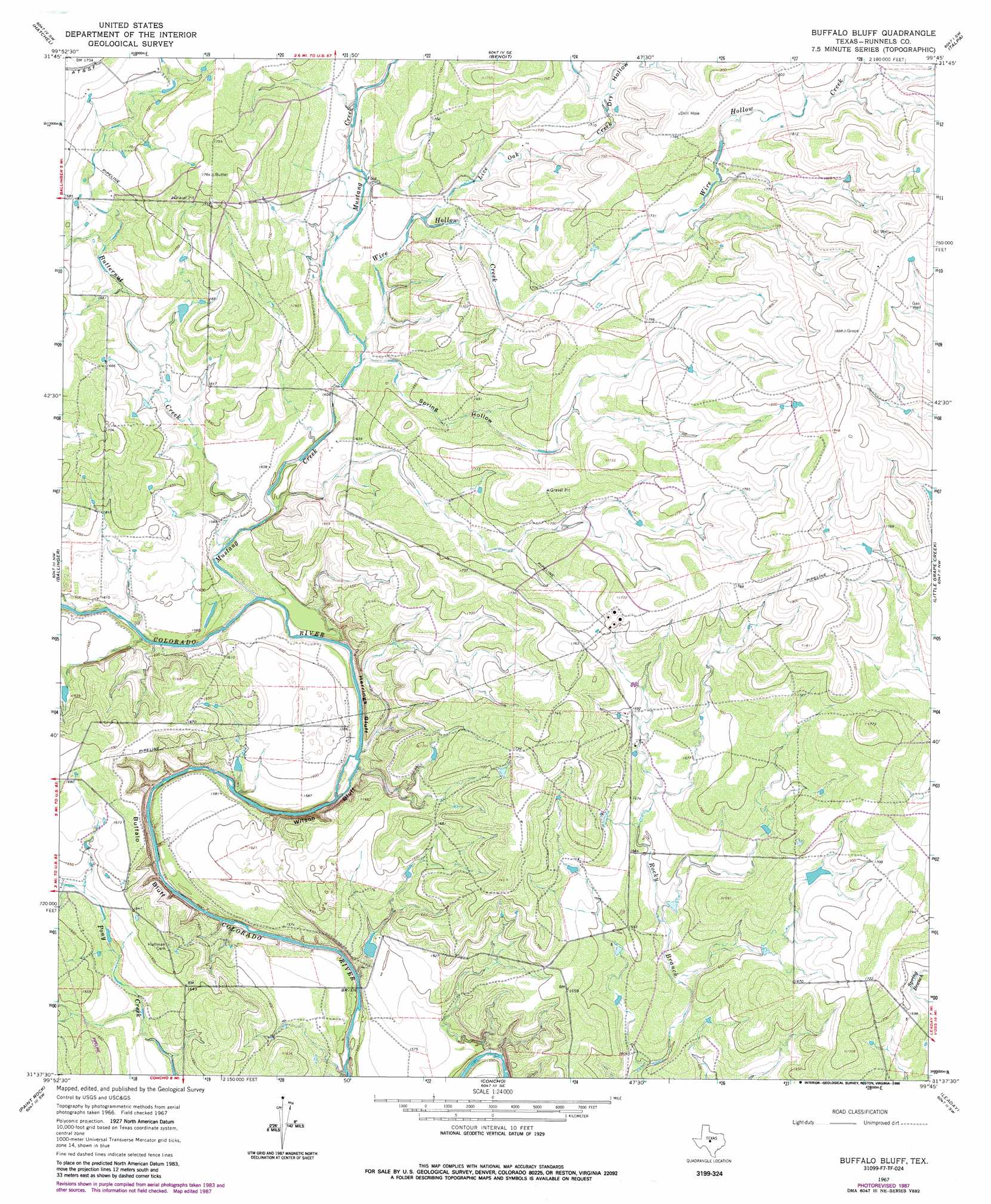
USGS Topo Quad 31099f7 - 1:24,000 scale
| Topo Map Name: | Buffalo Bluff |
| USGS Topo Quad ID: | 31099f7 |
| Print Size: | ca. 21 1/4" wide x 27" high |
| Southeast Coordinates: | 31.625° N latitude / 99.75° W longitude |
| Map Center Coordinates: | 31.6875° N latitude / 99.8125° W longitude |
| U.S. State: | TX |
| Filename: | o31099f7.jpg |
| Download Map JPG Image: | Buffalo Bluff topo map 1:24,000 scale |
| Map Type: | Topographic |
| Topo Series: | 7.5´ |
| Map Scale: | 1:24,000 |
| Source of Map Images: | United States Geological Survey (USGS) |
| Alternate Map Versions: |
Buffalo Bluff TX 1967, updated 1969 Download PDF Buy paper map Buffalo Bluff TX 1967, updated 1970 Download PDF Buy paper map Buffalo Bluff TX 1967, updated 1988 Download PDF Buy paper map Buffalo Bluff TX 2010 Download PDF Buy paper map Buffalo Bluff TX 2013 Download PDF Buy paper map Buffalo Bluff TX 2016 Download PDF Buy paper map |
1:24,000 Topo Quads surrounding Buffalo Bluff
Wilmeth |
Winters |
Crews |
Novice West |
Novice East |
Herring Ranch |
Hatchel |
Benoit |
Talpa |
Valera |
Rowena |
Ballinger |
Buffalo Bluff |
Little Grape Creek |
Bead Mountain |
Lowake |
Paint Rock |
Concho |
Leaday |
Voss |
Eola |
Millersview Nw |
Millersview |
Mustang Creek |
Doole |
> Back to 31099e1 at 1:100,000 scale
> Back to 31098a1 at 1:250,000 scale
> Back to U.S. Topo Maps home
Buffalo Bluff topo map: Gazetteer
Buffalo Bluff: Cliffs
Buffalo Bluff elevation 496m 1627′Herrings Bluff elevation 484m 1587′
Wilson Bluff elevation 485m 1591′
Buffalo Bluff: Streams
Butternut Creek elevation 480m 1574′Live Oak Creek elevation 503m 1650′
Mustang Creek elevation 476m 1561′
Wire Hollow Creek elevation 494m 1620′
Buffalo Bluff: Valleys
Dry Hollow elevation 517m 1696′Spring Hollow elevation 491m 1610′
Buffalo Bluff digital topo map on disk
Buy this Buffalo Bluff topo map showing relief, roads, GPS coordinates and other geographical features, as a high-resolution digital map file on DVD: