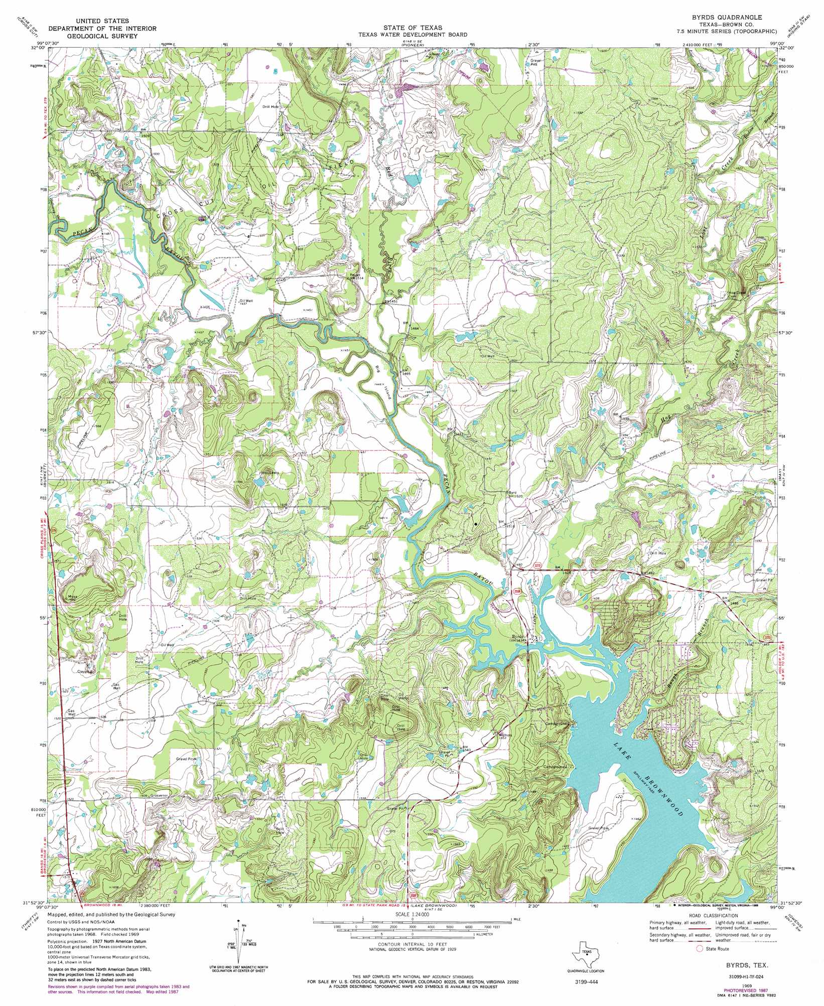
Byrds Topo Map Texas
To zoom in, hover over the map of Byrds
USGS Topo Quad 31099h1 - 1:24,000 scale
| Topo Map Name: | Byrds |
| USGS Topo Quad ID: | 31099h1 |
| Print Size: | ca. 21 1/4" wide x 27" high |
| Southeast Coordinates: | 31.875° N latitude / 99° W longitude |
| Map Center Coordinates: | 31.9375° N latitude / 99.0625° W longitude |
| U.S. State: | TX |
| Filename: | o31099h1.jpg |
| Download Map JPG Image: | Byrds topo map 1:24,000 scale |
| Map Type: | Topographic |
| Topo Series: | 7.5´ |
| Map Scale: | 1:24,000 |
| Source of Map Images: | United States Geological Survey (USGS) |
| Alternate Map Versions: |
Byrds TX 1969, updated 1972 Download PDF Buy paper map Byrds TX 1969, updated 1988 Download PDF Buy paper map Byrds TX 2010 Download PDF Buy paper map Byrds TX 2013 Download PDF Buy paper map Byrds TX 2016 Download PDF Buy paper map |
1:24,000 Topo Quads surrounding Byrds
Rowden |
Cross Plains North |
Sabanno |
Union Center |
Hunting Shirt Creek |
Webbville |
Cross Cut |
Pioneer |
Rising Star |
Sipe Springs |
Coleman Ne |
Burkett |
Byrds |
May |
Star Mountain |
Lake San Tana |
Thrifty |
Lake Brownwood |
Owens |
Blanket |
Santa Anna |
Bangs West |
Bangs East |
Brownwood |
Zephyr |
> Back to 31099e1 at 1:100,000 scale
> Back to 31098a1 at 1:250,000 scale
> Back to U.S. Topo Maps home
Byrds topo map: Gazetteer
Byrds: Dams
Pitcock Cattle Company Dam Number 1 elevation 452m 1482′Pitcock Cattle Company Dam Number 2 elevation 445m 1459′
Byrds: Islands
Big Island elevation 441m 1446′Byrds: Populated Places
Byrds elevation 437m 1433′Byrds: Reservoirs
Dam Number 1 elevation 452m 1482′Dam Number 2 elevation 445m 1459′
Byrds: Streams
Bledsoe Branch elevation 462m 1515′Hog Creek elevation 434m 1423′
Holloway Creek elevation 444m 1456′
Lost Creek elevation 442m 1450′
Red River elevation 439m 1440′
Rough Branch elevation 435m 1427′
Byrds digital topo map on disk
Buy this Byrds topo map showing relief, roads, GPS coordinates and other geographical features, as a high-resolution digital map file on DVD: