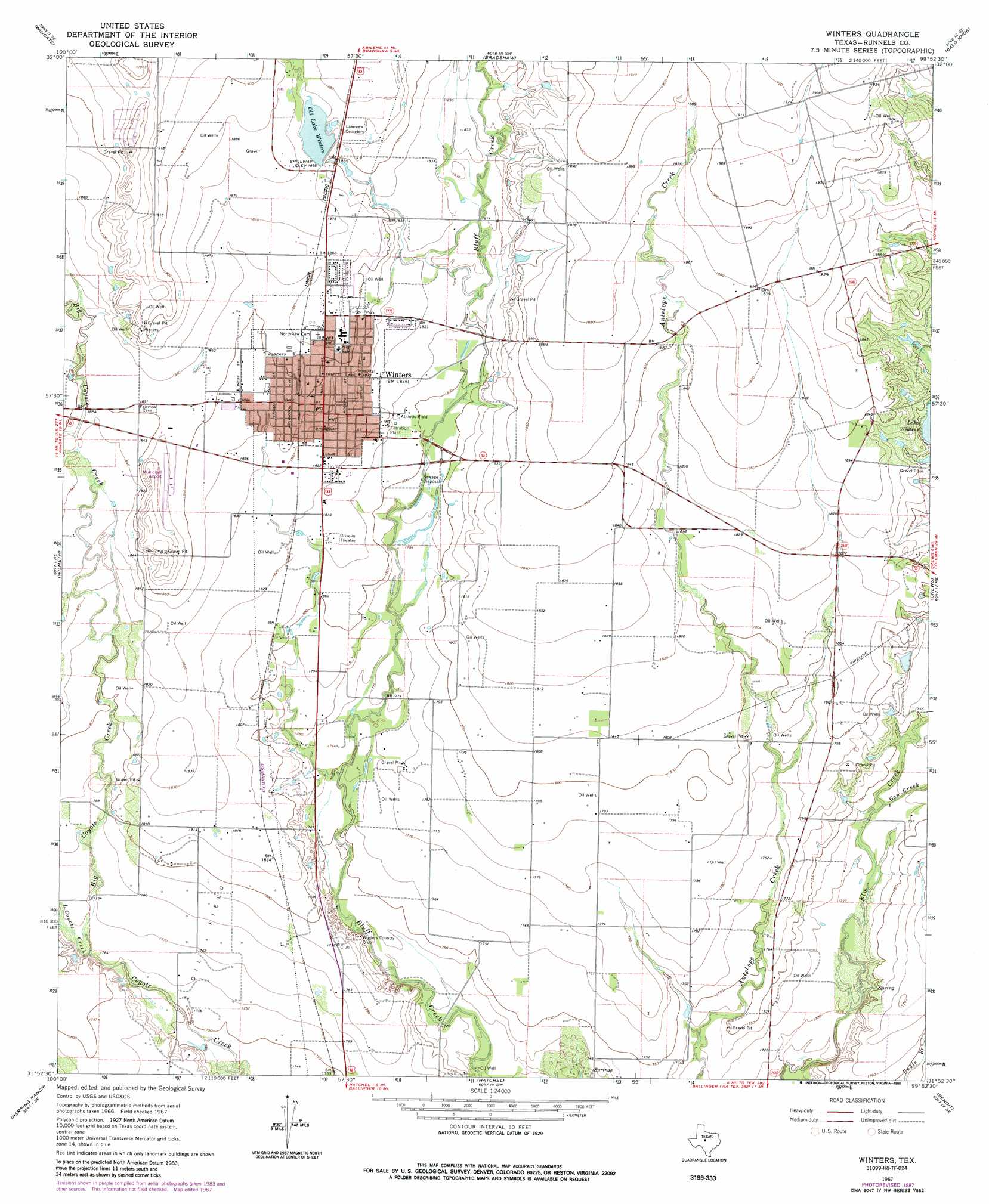
Winters Topo Map Texas
To zoom in, hover over the map of Winters
USGS Topo Quad 31099h8 - 1:24,000 scale
| Topo Map Name: | Winters |
| USGS Topo Quad ID: | 31099h8 |
| Print Size: | ca. 21 1/4" wide x 27" high |
| Southeast Coordinates: | 31.875° N latitude / 99.875° W longitude |
| Map Center Coordinates: | 31.9375° N latitude / 99.9375° W longitude |
| U.S. State: | TX |
| Filename: | o31099h8.jpg |
| Download Map JPG Image: | Winters topo map 1:24,000 scale |
| Map Type: | Topographic |
| Topo Series: | 7.5´ |
| Map Scale: | 1:24,000 |
| Source of Map Images: | United States Geological Survey (USGS) |
| Alternate Map Versions: |
Winters TX 1967, updated 1970 Download PDF Buy paper map Winters TX 1967, updated 1988 Download PDF Buy paper map Winters TX 2010 Download PDF Buy paper map Winters TX 2013 Download PDF Buy paper map Winters TX 2016 Download PDF Buy paper map |
1:24,000 Topo Quads surrounding Winters
Hylton |
Shep |
Lake Abilene |
Tuscola |
Lawn |
Church Peak |
Wingate |
Bradshaw |
Bald Knob |
Goldsboro |
Hog Mountain |
Wilmeth |
Winters |
Crews |
Novice West |
Maverick |
Herring Ranch |
Hatchel |
Benoit |
Talpa |
Miles Nw |
Rowena |
Ballinger |
Buffalo Bluff |
Little Grape Creek |
> Back to 31099e1 at 1:100,000 scale
> Back to 31098a1 at 1:250,000 scale
> Back to U.S. Topo Maps home
Winters topo map: Gazetteer
Winters: Airports
Winters Municipal Airport elevation 570m 1870′Winters: Dams
Old Lake Winters Dam elevation 570m 1870′Winters: Populated Places
Winters elevation 561m 1840′Winters: Reservoirs
Lake Old Winters elevation 566m 1856′Old Lake Winters elevation 570m 1870′
Winters: Streams
Big Coyote Creek elevation 537m 1761′Gap Creek elevation 527m 1729′
Little Coyote Creek elevation 537m 1761′
Winters digital topo map on disk
Buy this Winters topo map showing relief, roads, GPS coordinates and other geographical features, as a high-resolution digital map file on DVD: