Veribest Topo Map Texas
To zoom in, hover over the map of Veribest
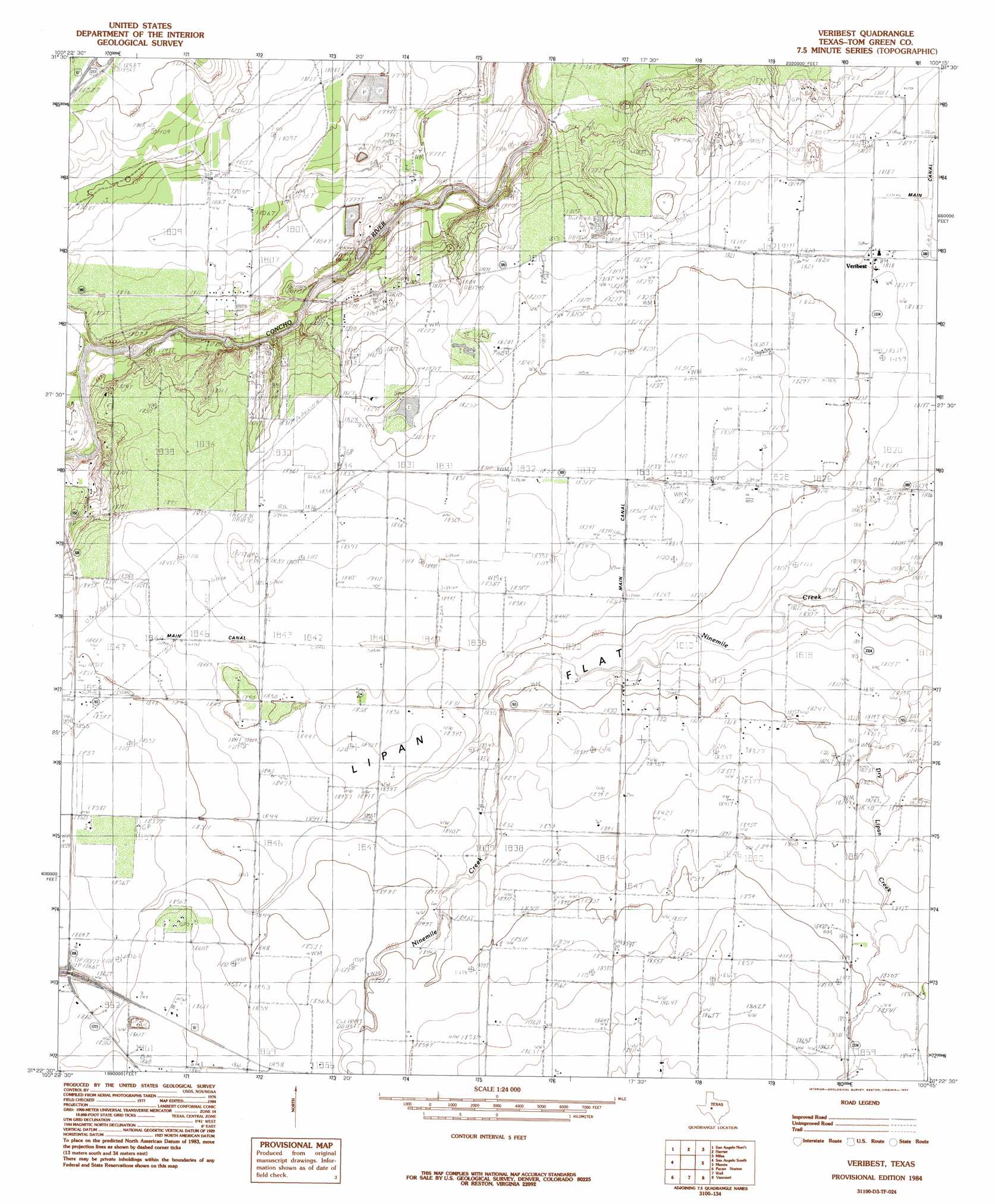
USGS Topo Quad 31100d3 - 1:24,000 scale
| Topo Map Name: | Veribest |
| USGS Topo Quad ID: | 31100d3 |
| Print Size: | ca. 21 1/4" wide x 27" high |
| Southeast Coordinates: | 31.375° N latitude / 100.25° W longitude |
| Map Center Coordinates: | 31.4375° N latitude / 100.3125° W longitude |
| U.S. State: | TX |
| Filename: | o31100d3.jpg |
| Download Map JPG Image: | Veribest topo map 1:24,000 scale |
| Map Type: | Topographic |
| Topo Series: | 7.5´ |
| Map Scale: | 1:24,000 |
| Source of Map Images: | United States Geological Survey (USGS) |
| Alternate Map Versions: |
Veribest TX 1984, updated 1984 Download PDF Buy paper map Veribest TX 2010 Download PDF Buy paper map Veribest TX 2012 Download PDF Buy paper map Veribest TX 2016 Download PDF Buy paper map |
1:24,000 Topo Quads surrounding Veribest
Murph Draw |
Pecan Mott |
Tennyson |
Miles Nw |
Rowena |
Mount Nebo |
San Angelo North |
Harriet |
Miles |
Lowake |
Twin Buttes |
San Angelo South |
Veribest |
Mereta |
Eola |
Knickerbocker |
Pecan Station |
Wall |
Vancourt |
Vick |
Cold Creek Spring |
Christoval |
Susan Peak |
Kickapoo Spring |
Burr Oak Creek |
> Back to 31100a1 at 1:100,000 scale
> Back to 31100a1 at 1:250,000 scale
> Back to U.S. Topo Maps home
Veribest topo map: Gazetteer
Veribest: Dams
City of San Angelo Sewage Ponds Dam elevation 551m 1807′Johnson Dam elevation 545m 1788′
Kaase Dam elevation 538m 1765′
Veribest: Flats
Lipan Flat elevation 557m 1827′Lipan Flat elevation 564m 1850′
Veribest: Populated Places
Sixmile Crossing elevation 534m 1751′Veribest elevation 555m 1820′
Veribest: Reservoirs
Johnson Lake elevation 545m 1788′Kaase Reservoir elevation 538m 1765′
San Angelo Sewage Ponds elevation 551m 1807′
Veribest digital topo map on disk
Buy this Veribest topo map showing relief, roads, GPS coordinates and other geographical features, as a high-resolution digital map file on DVD: