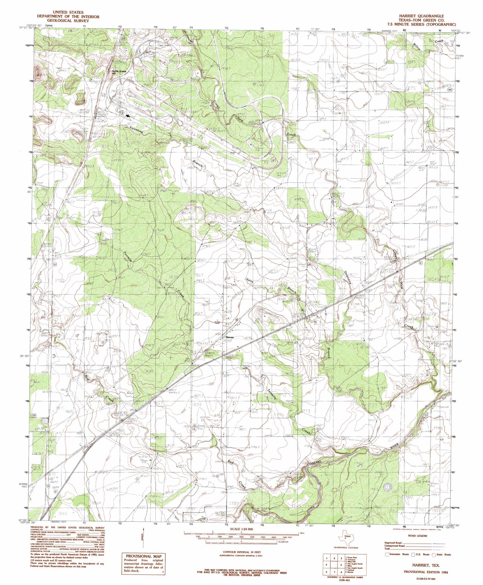
Harriet Topo Map Texas
To zoom in, hover over the map of Harriet
USGS Topo Quad 31100e3 - 1:24,000 scale
| Topo Map Name: | Harriet |
| USGS Topo Quad ID: | 31100e3 |
| Print Size: | ca. 21 1/4" wide x 27" high |
| Southeast Coordinates: | 31.5° N latitude / 100.25° W longitude |
| Map Center Coordinates: | 31.5625° N latitude / 100.3125° W longitude |
| U.S. State: | TX |
| Filename: | o31100e3.jpg |
| Download Map JPG Image: | Harriet topo map 1:24,000 scale |
| Map Type: | Topographic |
| Topo Series: | 7.5´ |
| Map Scale: | 1:24,000 |
| Source of Map Images: | United States Geological Survey (USGS) |
| Alternate Map Versions: |
Harriet TX 1984, updated 1984 Download PDF Buy paper map Harriet TX 2010 Download PDF Buy paper map Harriet TX 2013 Download PDF Buy paper map Harriet TX 2016 Download PDF Buy paper map |
1:24,000 Topo Quads surrounding Harriet
Millican Mountains |
Cement Mountain |
Shawville |
Maverick |
Herring Ranch |
Murph Draw |
Pecan Mott |
Tennyson |
Miles Nw |
Rowena |
Mount Nebo |
San Angelo North |
Harriet |
Miles |
Lowake |
Twin Buttes |
San Angelo South |
Veribest |
Mereta |
Eola |
Knickerbocker |
Pecan Station |
Wall |
Vancourt |
Vick |
> Back to 31100e1 at 1:100,000 scale
> Back to 31100a1 at 1:250,000 scale
> Back to U.S. Topo Maps home
Harriet topo map: Gazetteer
Harriet: Airports
Burner Farm Airport elevation 548m 1797′Harriet: Dams
Erwin-Jordan Dam elevation 534m 1751′Krall Dam elevation 552m 1811′
Harriet: Populated Places
Harriet elevation 559m 1833′Kiesling elevation 573m 1879′
Harriet: Reservoirs
Erwin-Jordan Reservoir elevation 534m 1751′Krall Reservoir elevation 552m 1811′
Harriet: Streams
Crows Nest Creek elevation 523m 1715′Little Crows Nest Creek elevation 589m 1932′
Red Creek elevation 527m 1729′
Sales Branch elevation 542m 1778′
Tenmile Creek elevation 528m 1732′
Valentine Branch elevation 528m 1732′
Harriet: Summits
Rattle Snake Hill elevation 623m 2043′Harriet digital topo map on disk
Buy this Harriet topo map showing relief, roads, GPS coordinates and other geographical features, as a high-resolution digital map file on DVD: