Dog Creek Ne Topo Map Texas
To zoom in, hover over the map of Dog Creek Ne
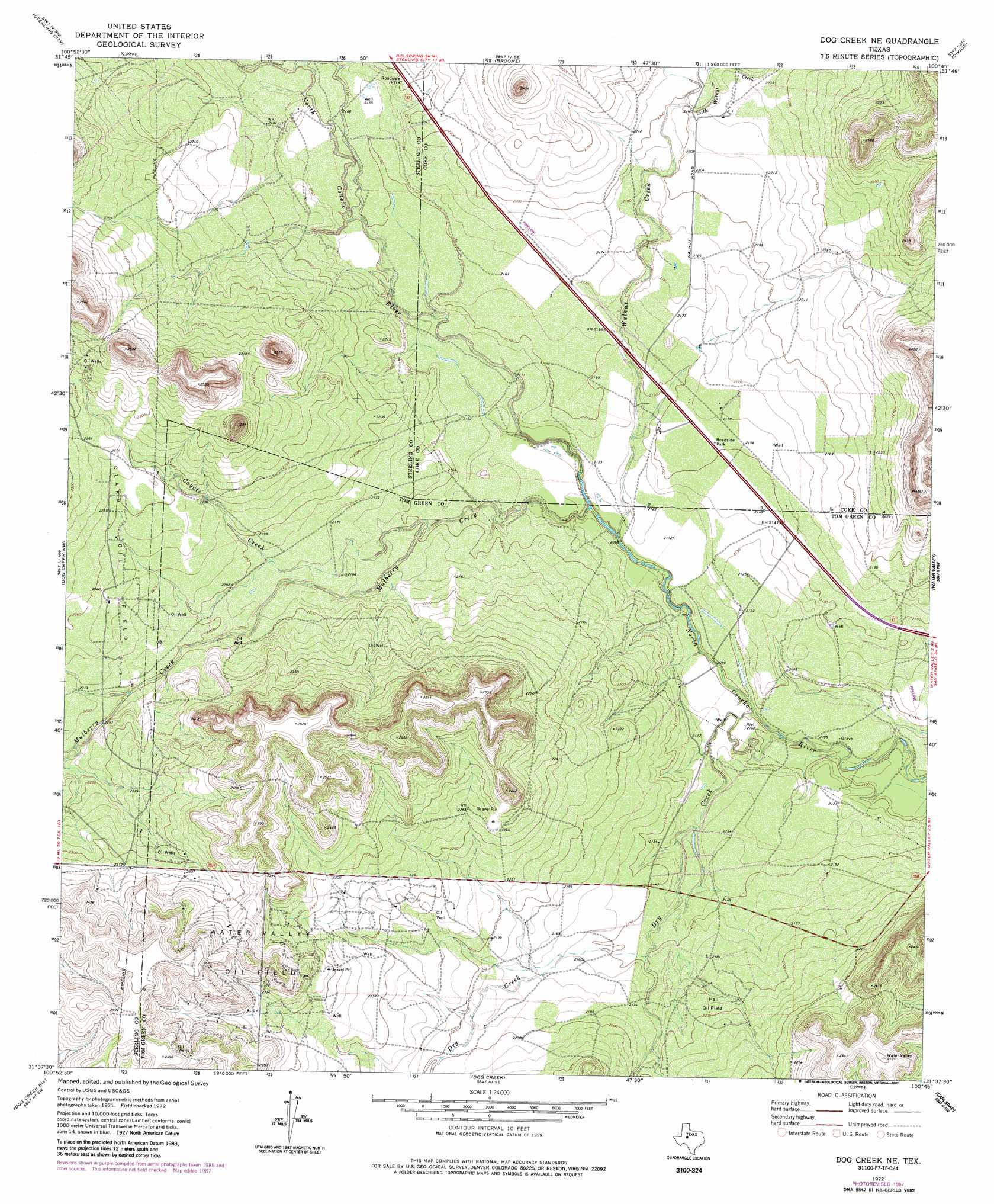
USGS Topo Quad 31100f7 - 1:24,000 scale
| Topo Map Name: | Dog Creek Ne |
| USGS Topo Quad ID: | 31100f7 |
| Print Size: | ca. 21 1/4" wide x 27" high |
| Southeast Coordinates: | 31.625° N latitude / 100.75° W longitude |
| Map Center Coordinates: | 31.6875° N latitude / 100.8125° W longitude |
| U.S. State: | TX |
| Filename: | o31100f7.jpg |
| Download Map JPG Image: | Dog Creek Ne topo map 1:24,000 scale |
| Map Type: | Topographic |
| Topo Series: | 7.5´ |
| Map Scale: | 1:24,000 |
| Source of Map Images: | United States Geological Survey (USGS) |
| Alternate Map Versions: |
Dog Creek NE TX 1972, updated 1974 Download PDF Buy paper map Dog Creek NE TX 1972, updated 1987 Download PDF Buy paper map Dog Creek NE TX 2010 Download PDF Buy paper map Dog Creek NE TX 2012 Download PDF Buy paper map Dog Creek NE TX 2016 Download PDF Buy paper map |
1:24,000 Topo Quads surrounding Dog Creek Ne
Cumbie Draw Ne |
Sterling City Nw |
Crawford Slide |
Green Mountain |
Edith |
Cumbie Draw |
Sterling City |
Broome |
Divide |
Millican Mountains |
Dripping Springs Draw |
Dog Creek Nw |
Dog Creek Ne |
Water Valley |
Murph Draw |
Coon Dive Draw |
Dog Creek Sw |
Dog Creek |
Carlsbad |
Mount Nebo |
Bradford Draw |
Wallace Draw |
Arden |
Knickerbocker Nw |
Twin Buttes |
> Back to 31100e1 at 1:100,000 scale
> Back to 31100a1 at 1:250,000 scale
> Back to U.S. Topo Maps home
Dog Creek Ne topo map: Gazetteer
Dog Creek Ne: Oilfields
Clark Oil Field elevation 684m 2244′Hall Oil Field elevation 668m 2191′
Water Valley Oil Field elevation 723m 2372′
Dog Creek Ne: Streams
Coyote Creek elevation 648m 2125′Dry Creek elevation 633m 2076′
Little Walnut Creek elevation 667m 2188′
Mulberry Creek elevation 638m 2093′
Walnut Creek elevation 638m 2093′
Dog Creek Ne digital topo map on disk
Buy this Dog Creek Ne topo map showing relief, roads, GPS coordinates and other geographical features, as a high-resolution digital map file on DVD: