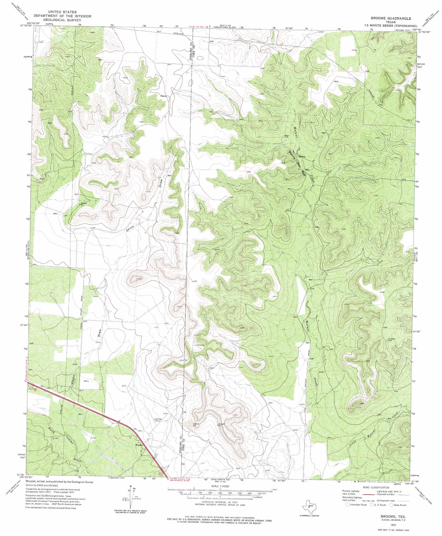
Broome Topo Map Texas
To zoom in, hover over the map of Broome
USGS Topo Quad 31100g7 - 1:24,000 scale
| Topo Map Name: | Broome |
| USGS Topo Quad ID: | 31100g7 |
| Print Size: | ca. 21 1/4" wide x 27" high |
| Southeast Coordinates: | 31.75° N latitude / 100.75° W longitude |
| Map Center Coordinates: | 31.8125° N latitude / 100.8125° W longitude |
| U.S. State: | TX |
| Filename: | o31100g7.jpg |
| Download Map JPG Image: | Broome topo map 1:24,000 scale |
| Map Type: | Topographic |
| Topo Series: | 7.5´ |
| Map Scale: | 1:24,000 |
| Source of Map Images: | United States Geological Survey (USGS) |
| Alternate Map Versions: |
Broome TX 1972, updated 1974 Download PDF Buy paper map Broome TX 2010 Download PDF Buy paper map Broome TX 2013 Download PDF Buy paper map Broome TX 2016 Download PDF Buy paper map |
1:24,000 Topo Quads surrounding Broome
Buffalo Draw |
Mcwhorter Mountain |
Dead Indian Mountain |
Silver |
Sanco |
Cumbie Draw Ne |
Sterling City Nw |
Crawford Slide |
Green Mountain |
Edith |
Cumbie Draw |
Sterling City |
Broome |
Divide |
Millican Mountains |
Dripping Springs Draw |
Dog Creek Nw |
Dog Creek Ne |
Water Valley |
Murph Draw |
Coon Dive Draw |
Dog Creek Sw |
Dog Creek |
Carlsbad |
Mount Nebo |
> Back to 31100e1 at 1:100,000 scale
> Back to 31100a1 at 1:250,000 scale
> Back to U.S. Topo Maps home
Broome topo map: Gazetteer
Broome: Cliffs
Shelving Rock Bluff elevation 734m 2408′Broome: Populated Places
Broome elevation 674m 2211′Broome: Valleys
China Draw elevation 668m 2191′Broome digital topo map on disk
Buy this Broome topo map showing relief, roads, GPS coordinates and other geographical features, as a high-resolution digital map file on DVD: