Hog Mountain Topo Map Texas
To zoom in, hover over the map of Hog Mountain
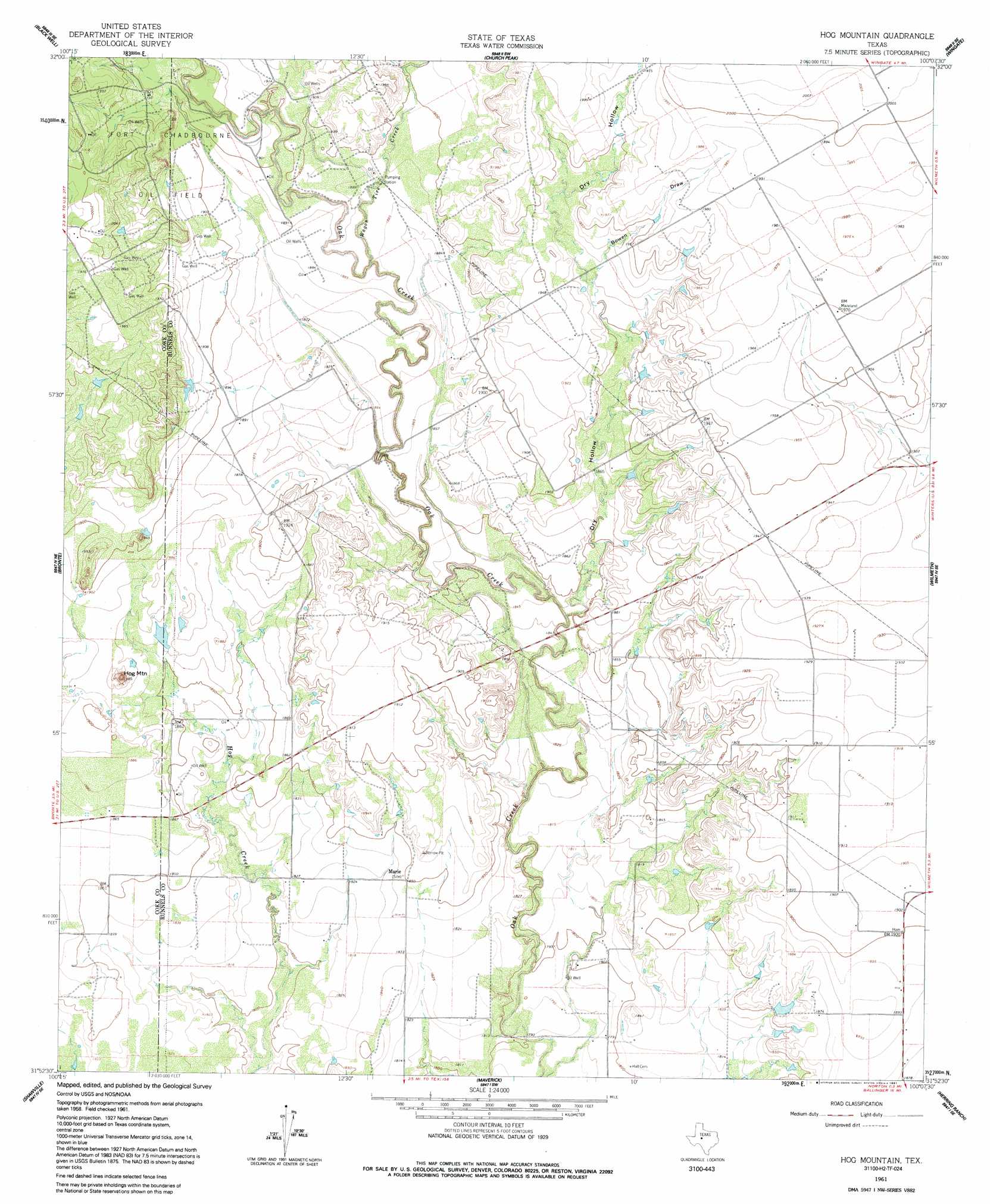
USGS Topo Quad 31100h2 - 1:24,000 scale
| Topo Map Name: | Hog Mountain |
| USGS Topo Quad ID: | 31100h2 |
| Print Size: | ca. 21 1/4" wide x 27" high |
| Southeast Coordinates: | 31.875° N latitude / 100.125° W longitude |
| Map Center Coordinates: | 31.9375° N latitude / 100.1875° W longitude |
| U.S. State: | TX |
| Filename: | o31100h2.jpg |
| Download Map JPG Image: | Hog Mountain topo map 1:24,000 scale |
| Map Type: | Topographic |
| Topo Series: | 7.5´ |
| Map Scale: | 1:24,000 |
| Source of Map Images: | United States Geological Survey (USGS) |
| Alternate Map Versions: |
Hog Mountain TX 1961, updated 1962 Download PDF Buy paper map Hog Mountain TX 1961, updated 1991 Download PDF Buy paper map Hog Mountain TX 2010 Download PDF Buy paper map Hog Mountain TX 2012 Download PDF Buy paper map Hog Mountain TX 2016 Download PDF Buy paper map |
1:24,000 Topo Quads surrounding Hog Mountain
Maryneal |
Blackwell Ne |
Hylton |
Shep |
Lake Abilene |
Blackwell Sw |
Blackwell |
Church Peak |
Wingate |
Bradshaw |
Robert Lee |
Bronte |
Hog Mountain |
Wilmeth |
Winters |
Cement Mountain |
Shawville |
Maverick |
Herring Ranch |
Hatchel |
Pecan Mott |
Tennyson |
Miles Nw |
Rowena |
Ballinger |
> Back to 31100e1 at 1:100,000 scale
> Back to 31100a1 at 1:250,000 scale
> Back to U.S. Topo Maps home
Hog Mountain topo map: Gazetteer
Hog Mountain: Populated Places
Marie elevation 555m 1820′Hog Mountain: Streams
Wagon Tire Creek elevation 566m 1856′Hog Mountain: Summits
Hog Mountain elevation 594m 1948′Hog Mountain: Valleys
Bowen Draw elevation 584m 1916′Dry Hollow elevation 558m 1830′
Hog Mountain digital topo map on disk
Buy this Hog Mountain topo map showing relief, roads, GPS coordinates and other geographical features, as a high-resolution digital map file on DVD: